Among the alternatives are a seasonal closure from January through June
The U.S. Forest Service will accept public comments through Nov. 30 regarding four alternatives for managing the scenic Cape Horn trail in the Columbia River Gorge National Scenic Area.
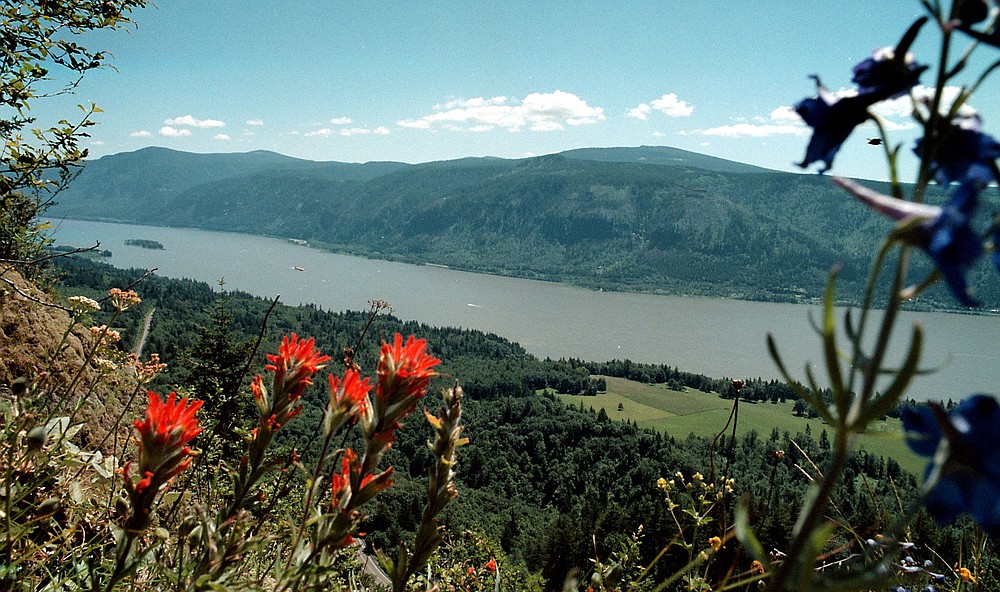
The agency released an environmental assessment on Oct. 30 containing four alternatives for the 5.5-mile route, which was created by hiking enthusiasts on federal land and private conservation trust lands in western Skamania County over the past decade.
Diana Ross of the scenic area office in Hood River said the Forest Service did not identify a preferred alternative.
The trail starts at the park-and-ride lot at the junction of state Highway 14 and Salmon Falls Road, climbs to Pioneer Point atop Cape Horn, drops to cross south of Highway 14 to spectacular buffs above the Columbia River, then passes underneath a waterfall before ending at the bottom of Cape Horn Road.
Hikers must walk 1.3 miles up the road to complete the loop.
But several problems exist with the current trail location, according the Forest Service.
Among the troubles are poorly designed trail tread in places, crossings of wet areas and talus slopes, two grade-level crossings of state Highway 14, and proximity to a peregrine falcon nesting site.
Here is a summary of the four alternatives drafted by the Forest Service:
No change — The trail pretty much stays the same, with restoration projects accomplished as needed over time.
Seasonal closure — Most of the existing trail is kept, with re-routes around talus slopes and wet areas. But, the stretch between the waterfall and west end of Cape Horn Road would be closed January through June to protect the falcons from disturbance.
The closure would eliminate hikers making a loop half of the year.
Underpasses would be built under Highway 14 at the west crossing and at Salmon Falls Road.
Temporary parking would be added at Strunk Road with a wheelchair-accessible route to a scenic overlook. Temporary parking would be added at Canyon Creek Road.
Cape Horn Road would continue as the connection needed to make a loop. Dogs would be required to be leashed.
No loop — South of Highway 14, the trail would go to the top of the waterfall, then head west and eventually dead-end. At some point, the western end would be extended to Washougal as part of a Washougal-to-Stevenson trail.
North of Highway 14, the trail would continue on to parking and a scenic overlook at Strunk Road. It would include Pioneer Point and end at a parking lot on Canyon Creek Road.
The trail mileage would be reduced from 5.5 miles to 3.7 miles. Dogs would be required to be on a leash.
Waterfall terminus — The portion south of state Highway 14 would end at the waterfall, thus not continuing to Cape Horn road and making a loop possible.
Temporary parking would be available at Strunk Road with a wheelchair-accesible trail to an overlook. Temporary parking would be available at Canyon Creek Road.
Trail mileage would shrink to 4.9 miles. Dogs would be required to be leashed.
There would be viewpoints at the top of the waterfalls, the bottom of the falls and looking east at Cigar Rock.