STEVENSON — A decision will be announced in mid-December on the fate of the popular Cape Horn trail in the Columbia River Gorge National Scenic Area.
The Forest Service released an environmental assessment on Oct. 30 containing four alternatives for the 5.5-mile route, which was created over the past decade by hiking enthusiasts on federal land and private conservation trust lands in western Skamania County.
The alternatives include a controversial seasonal closure or eliminating part of the route due to conflicts with sensitive lands and nesting peregrine falcons.
Dan Harkenrider, scenic area manager for the U.S. Forest Service, said the mid-December decision will be followed by a 45-day period when the public can appeal his decision.
Comments on those alternatives are being accepted through Nov. 30. Diana Ross, leader of the Forest Service team that prepared the environmental documents, said potential appellants need to comment on the alternatives to maintain their standing to challenge the decision.
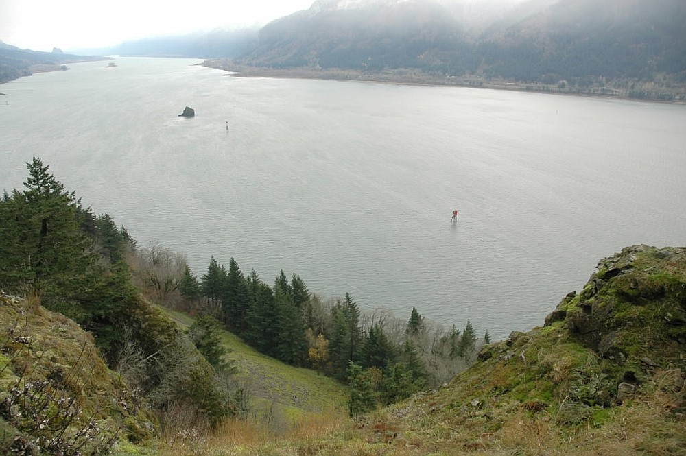
The trail starts at the park-and-ride lot at the junction of state Highway 14 and Salmon Falls Road, climbs to Pioneer Point atop Cape Horn, then drops to cross south of Highway 14 to spectacular bluffs above the Columbia River. It then passes underneath a waterfall before ending at the bottom of Cape Horn Road.
Hikers walk 1.3 miles up the road to complete the loop.
But several problems exist with the current trail location, according the Forest Service.
Among the troubles are poorly designed trail tread in places, crossings of wet areas and talus slopes, two grade-level crossings of state Highway 14 and proximity to a peregrine nesting site.
The Forest Service’s four alternatives are:
nA no-change plan.
nA loop trail but with a January-through-June seasonal closure from above the waterfall to the west end of Cape Horn Road.
nA plan that eliminates much of the trail on the bluffs above the Columbia River.
nA plan that ends the trail at the base of waterfall, thus not connecting to Cape Horn Road.
The seasonal closure idea got a cool reaction at a public meeting Thursday in Stevenson to get comment on the alternatives.
The Forest Service was asked why the closure to avoid disturbing the falcons needed to take half the year.
Robin Dobson, a Forest Service ecologist, said the birds need that much time for courtship, nesting and fledging. The standard closure is January through July, but the agency shaved off a month in the summer, he added.
Harkenrider said the cliffs, talus slopes and wet areas south of state Highway 14 are sensitive and it is the Forest Service’s responsibility to protect them.
“If we had a blank slate, we wouldn’t have a trail below Highway 14,’’ he said. “We’re trying to be responsible. There’s a compromise that’s required.’’
The no-action alternative is not acceptable to the Forest Service, he said.
Ross said the alternative that keeps the loop trail, but with the seasonal closure, barely meets the Forest Service’s responsibilities.
“I can’t give you everything you want,’’ Harkenrider said.
Greg Cox, scenic area assistant manager, said the state Department of Transportation has secured $3.5 million in federal highway money for a pair of pedestrian underpasses for state Highway 14.
Cox said Transportation officials need to know the sites of the underpasses by mid-February.
Allen Thomas: 360-735-4555 or al.thomas@columbian.com