<img height="1" width="1" style="display:none" src="https://www.facebook.com/tr?id=192888919167017&amp;ev=PageView&amp;noscript=1">
Thursday,  April 18 , 2024

Linkedin Pinterest
News / Sports / Outdoors

Summer hikes, family style

By Al Thomas, Columbian Outdoors Reporter
Published: July 22, 2010, 12:00am

My son, a senior-to-be next month at Washington State University in Pullman, occasionally gets asked how he likes fishing. His answer often is: “Well, it’s better than hiking.”

I felt like a disclaimer is necessary before writing this piece offering tips on hiking with children. This insight was learned through failures, not successes.

Lesson No. 1: Hike as far as the enjoyment of the children takes you. Be prepared to turn back far, far short of the goal. Ryan endured several forced marches, when I needed to complete the loop in order to write a story for the newspaper.

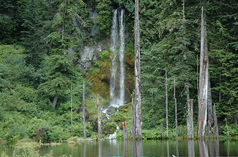
Making a 10-year-old hike seven miles in the shadeless, ashy, blowdown on the east side of Mount St. Helens, coupled with long car rides to the trailhead and back, killed his interest in the backcountry.

It’s all about a child’s sense of time and pace. Their highlight might be a swarm of Monarch butterflies, not a panoramic view.

Lesson No. 2: Provide water. Not just water to drink, but pick a location where there is shallow water to get all wet. Children love playing in the water. Our best hikes were at the coast, where there was the beach and surf to play in, plus at June Lake, with its shallow, sandy shore.

Lesson No. 3: Bring these items along on the hike:

A friend. They make it special, much more so than family.

Children’s sunscreen. This is obvious. Also needed is an age-appropriate bug repellent.

Snacks: Both solid and liquid.

Anti-bacterial wipes.

Patience. This is a repeat of Lesson 1 and can’t be overemphasized.

Here are three kid-friendly hikes to try this summer:

June Lake

THE BASICS: June Lake trail No. 216B leads 1.6 miles with 700 feet elevation gain from Road No. 83 on the south side of Mount St. Helens to the small lake.

GETTING THERE: From the junction of state Highway 503 and 503 spur at Yale, go east on Highway 503 spur for 5.2 miles to Cougar. Continue east on the main road (becomes Forest Service road No. 90) for 6.8 more miles to the junction with road No. 83. Turn left and follow road No. 83 for 7 miles to the June Lake trailhead.

Morning Briefing Newsletter envelope icon
Get a rundown of the latest local and regional news every Mon-Fri morning.

MISCELLANEOUS: The lake was formed by a 2,000-year-old lava flow blocking a tributary of Swift Creek. A waterfall pours over a basalt cliff replenishing the cold, clear water.

The shallow lake is great for wading with its sandy bottom. Flipflops or aquasox make splashing in June Lake easier on the feet.

Bring a towel along to wipe off feet and keep the grit out of shoes.

Falls Creek

THE BASICS: This is a 1.7-mile hike up Lower Falls Creek trail No. 152A from the trailhead parking lot to a viewpoint at the base of the falls.

GETTING THERE: From Carson, drive 14.5 miles to the junction with the Mineral Springs Road. Continue north another .8 mile on the Wind River Highway and turn right on road No. 3062. Drive two miles and at the fork, go right on road No. 3062057 another .4 mile to the trailhead parking lot.

MISCELLANEOUS: The trail starts on the south side of Falls Creek, and crosses on a suspension bridge about half way to the falls.

A side stream is crossed on a bridge a few minutes before reaching the falls. Here’s a spot to let youngsters dangle hands and feet in the water, seeing how long they can tolerate the cold.

While the falls are stunning, the viewpoint is not the most family friendly place. Parents will want to keep an eye open here. It’s not really dangerous, but also not a spot to yet the young run about unsupervised.

Council Bluff

THE BASICS: Hike up Boundary trail No. 1 for about a mile to the junction with Council Bluff trail No. 117, then 0.3 miles to summit of Council Bluff.

GETTING THERE: From the Chevron station in Trout Lake, take road No. 23 north for 21.5 miles to the junction with Lewis River road No. 90. Continue on road No. 23 for 3.1 miles to the junction with road No. 2334 that leads about a mile to Council Lake.

MISCELLANEOUS: This is the most strenous of the three suggested hikes here by a wide margin, but still manageable with children.

Boundary trail No. 1 starts at the site of the former Council Lake campground and heads west, crossing the Gifford Pinchot National Forest and ending at Johnston Ridge at Mount St. Helens.

The first mile or so heading west from Council Lake is an old road. There’s definitely some elevation gain here, but the road is wide enough for a family to plod up. The final push up Council Bluff trail No. 117 gains about 500 feet in elevation in 0.3 mile, so it’s steep.

The view atop Council Bluff is superb. Council Lake shimmers below and Mount Adams commands the eastern horizon. There are plenty of wildflowers on the sunny summit of Council Bluff. In 1932, the Forest Service built a fire lookout here, then removed the structure in the 1960s.

Besides just this hike, there is lots to do on the west side of Mount Adams.

Council Lake camground has been abandoned by the Forest Service, thus there are no camping fees.

Council Lake is stocked annually with trout by the state Department of Fish and Wildlife. The lake is 40 to 50 feet deep in spots.

Nearby is Takhlakh Lake, the most scenic campground in the Gifford Pinchot. There’s a trail around Takhlakh and another trail to TakhTakh Meadows.

Several other trails are in in the area.

Loading...
Columbian Outdoors Reporter