HOOD RIVER — Taking your eyes off the trail for even one moment could be disastrous along portions of the Surveyor’s Ridge Trail.
The views of Mount Hood and the orchard-covered Hood River valley below are spectacular, but one miscalculation and there is nothing but sagebrush and jagged rock awaiting along the sheer cliff side.
Getting there: From Government Camp, take state Highway 35 north for about 10 miles then make a right on to Forest Service road No. 44. Continue for about 3.5 miles to the Surveyor’s Ridge trailhead on the left.
Rating: Aerobically strenuous and technically intermediate to advanced.
But perhaps that is precisely what makes Surveyor’s Ridge such a draw for mountain bikers and hikers: the challenge of negotiating the narrow ribbon of dirt while taking in the dramatic vistas.
While Hood River is famous for windsurfing and kiteboarding, as a mountain biking destination the area sometimes takes a back seat to Central Oregon.
Surveyor’s Ridge is a vast ridge on the east side of Mount Hood that runs from the mountain north toward the Columbia River .
Just off state Highway 35 near the entrance to Mt. Hood Meadows Ski Resort, the trailhead is about a 90-minute drive from Clark County.
The top half of the mountain was obscured by thick white clouds recently, but that did not take away from the thrill of the ride.
Many options exist in the area. I chose to do an out-and-back ride along the Surveyor’s Ridge Trail.
The south trailhead is just off Forest Service road 44. From there, the trail runs parallel along Road 44 through thick greenery, then loops to the left through Cook’s Meadow.
This portion of the trail is mainly doubletrack before it connects to the ridge top and becomes singletrack running parallel to Forest Service road 17.
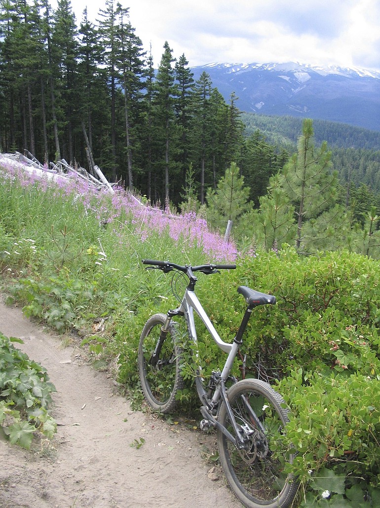
At that point along the ride, I emerged from the forest into the open ridgeline, where pink wildflowers speckled the hillside and the snowy slopes of Mount Hood ascended into the clouds in the distance.
From there, the trail weaves back into the mixed-conifer forest and then back out along the exposed ridgeline.
One half-mile section is particularly scary, as it winds along a precipitous drop, the orchards surrounding the tiny town of Parkdale visible far below.
The relatively flat trail mixes in steep uphill and downhill sections.
While the view to the east is the most stunning, to the west up the ridge are several unique rock formations and geologic deposits along the way.
The Surveyor’s Ridge Trail runs for about 12 miles, maintaining an elevation of a little more than 4,000 feet for most of the route.
The south section of the trail is intermediate, while the last few miles on the north end become more technical.
Knowing this, I chose to turn around shortly past the Gibson Prairie Horse Camp and head back toward the south trailhead. This made for a ride of about 18 miles.
The rolling terrain of the ridge provided a solid workout, but nothing too demanding.
The trail ridden entirely out and back results in a ride of about 25 miles.
Several access points are located along Road 17 for those looking for shorter outings.
For a longer option, mountain bikers can ride the Surveyor’s Ridge Trail to its north end, then loop back to the south trailhead along Road 17.
An even more demanding ride is the Surveyor’s Ridge/Dog River Loop, a 25-mile excursion that features a long climb up the Dog River Trail and a technical descent of the Oak Ridge Trail.
Mountain bikers in the Surveyor’s Ridge area must yield to hikers and horseback riders, though traffic is usually light.
The trail remains ridable through late fall, but bikers and hikers should be cautious of big-game hunters during autumn.
Yet no matter when you go, Surveyor’s Ridge is the type of trail that is hard to forget: Perfect singletrack trail conditions, with great views of Oregon’s highest peak and one of its most picturesque valleys.
But while you’re riding, remember to keep your eyes on the trail.