What a difference a month makes.
On the heels of a rain-soaked November, Mother Nature abruptly turned off the faucet when the calendar turned to December. What had been a strong start to the rainy season has become a dry, cold pattern — stuck on repeat.
Through Thursday, Vancouver had only recorded a paltry 0.14 inch of rain in December. That’s nearly 3 inches off the normal total for the first half of the month, according to Steve Pierce, president of the Oregon chapter of the American Meteorological Society. The Portland International Airport had seen only 0.06 inch in the same period — 2.74 inches below normal to that point in December.
Read Steve Pierce’s weather blog at http://www.columbian.com/weblogs/weather
“Rainfall amounts like this are unprecedented in the month of December,” Pierce said. “This is more like something we would see in the first half of August, not December.”
The reason? A stubborn upper-level ridge of high pressure sending storms well north of Portland and Southwest Washington, said National Weather Service meteorologist Jeremiah Pyle.
That doesn’t mean La Niña — the weather pattern typically characterized by wet, cool winters — has disappeared. The cool ocean water that fuels it is still there, Pyle said, but the second such phenomenon in as many years is not a particularly strong one. La Niña years don’t always follow the same blueprint all season long, he said.
“It’s just one of those strange patterns that you’ll sometimes see,” Pyle said.
While La Niña hasn’t produced huge rain or mountain snow this month, cold days and nights haven’t been hard to come by. Vancouver’s average high temperature has landed below 44 degrees so far in December, according to the National Weather Service. Overnight lows had dropped below freezing 12 times in 15 nights through Thursday, dipping as low as 21 degrees on Dec. 13.
Cooler-than-average weather continues a yearlong trend for Southwest Washington and the Portland area. The region waited until well into August to record its first 90-degree day of 2011. And Portland has only seen 169 days of 60 degrees or more this year, well off the norm of about 200 days.
This years’s total of 60-degree days is the lowest since Portland record-keeping moved to the airport after 1940, Pyle said. Before that, you’d have to go all the way back to 1909 to find a year with fewer 60-degree days than 2011, Pierce said.
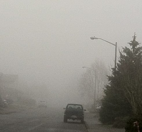
The Northwest’s current run of cold and dry weather won’t end anytime soon. Next week’s forecast calls for only a few weak systems rolling through with a slight chance of rain Sunday, Tuesday and Wednesday. Other than that, it’s intermittent fog, sun and cold.
The lowest rainfall total ever recorded at the Portland airport for the entire month of December is 1.38 inches, Pyle said. If the current pattern doesn’t budge, that record might be in jeopardy.
Of course, one good storm could dash that notion in a hurry. Just last month, Vancouver recorded 2.38 inches of rain in a single day. But nothing like that looms on the radar yet.
“We may be looking at a record-setting December,” Pyle said. “We’ll at least make a run at it.”
Eric Florip: 360-735-4541; http://twitter.com/col_enviro; eric.florip@columbian.com.