For much more detail on local trails, go online to www.cityofvancouver.us/parks-recreation/parks_trails/trails/index.asp
• East Fork Lewis: Take state Highway 503 north of Battle Ground and turn right on Northeast Rock Creek Road, which morphs into Northeast Lucia Falls Road. Follow Lucia Falls Road for 5.4 miles to the junction with Hantwick Road. Turn right and proceed 0.6 mile to the parking lot at the trailhead.
• Washougal River Greenway: The west parking lot is at Baz Riverfront Park on Northeast Third Loop in Camas. The larger east parking lot is at the junction of East Second Avenue and Yale Street in Camas.
• Gibbons Creek Wildlife Art Trail: The parking lot is on the south side of state Highway 14 just east of milepost 18.
Despite its suburban sprawl, Clark County still has hiking spots with a hint of backcountry flavor.
There are other places to walk — the Columbia River Renaissance Trail, Evergreen Trail at Columbia Springs, Burnt Bridge Creek Greenway Trail or Vancouver Lake-Frenchmen’s Bar trail — close to the Vancouver’s urban core.
But here are three trails selected for their semi-solitude or wildlife values:
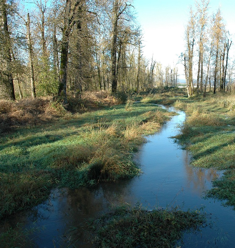
• East Fork Lewis River trail
A 2.4-mile trail extends from a trailhead on Hantwick Road east to Moulton Falls County Park.
The western half-mile or so of the trail is paved and leads to a large pond featuring a bench for taking a break. The remainder of the trail is gravel to the bridge crossing the East Fork of the Lewis River at Moulton Falls Park.
The eastern end of the trail parallels Clark County’s premier stream and several tributaries cascade down from the steep hillside to the south.
Bells Mountain trail, which leads 7.5 miles to Cold Creek campground, junctions with the Hantwick-Moulton Falls Trail about a half-mile west of Moulton Falls Park.
• Washougal River Greenway Trail
In Camas, the 1.05-mile paved trail wanders past a series of ponds, along the Washougal River, then crosses the river on a scenic wooden bridge.
The ponds along the way offer a chance to get close to a few mallards. Canada geese are frequent visitors.
From the west end of the trail at Baz Riverfront Park on Northeast Third Loop, it is only a 0.2-mile walk west to connect with Lacamas Park trailhead just off Northeast Third Avenue, opposite the intersection with East First Avenue.
From this trailhead, hikers can access the network of trails in Lacamas Park, plus the loop around Round Lake and the Heritage Trail along Lacamas Lake and upper Lacamas Creek.
• Gibbons Creek Wildlife Art Trail
This 1.12-mile gravel path goes through the west end of Steigerwald Lake National Wildlife Refuge east of Washougal.
It starts near state Highway 14 and parallels Gibbons Creek to end at the Dike Trail along the Columbia River.
No dogs, running or bicycles are allowed. The trail crosses Gibbons Creek at 0.62 mile and passes a viewpoint of Redtail Lake at 0.96 mile. Once on the dike trail, walkers can head west toward Steamboat Landing or east for more views of the refuge.
The trail offers a way to reach the east end of the Dike Trail without passing through the Port of Camas-Washougal Industrial Park.
There’s an additional 0.6 mile of trail that is open May 1 through Sept. 30 that allows for a partial loop hike.