
The rainstorm that clobbered Mount Hood, causing landslides and flooding, also raked Washington’s south Cascades.
However, officials with the Gifford Pinchot National Forest reported Tuesday that damage appeared to be relatively minor on the 1.3 million-acre forest.
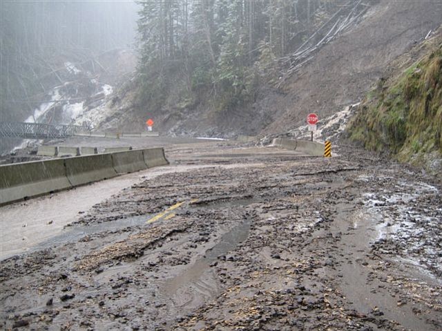
One recurring slide did prompt forest officials to close Forest Road 25 at Benham Creek, 13½ miles south of the road’s junction with state Highway 12 in Randle. A recurring landslide has bedeviled forest officials at that location since 1996, when a massive landslide wiped out a culvert five miles north of the road’s junction to the Windy Ridge viewpoint on the east side of Mount St. Helens. At that time, the forest spent $1 million on a two-lane bridge.
Then, over the winter of 2008-09, a landslide wiped it out.
Forest officials replaced it with a temporary one-lane bridge, but the latest mudslide has covered the road on both sides. The Cowlitz Valley Ranger District on Tuesday closed the road from the north, cutting off access to the Wakepish Sno Park. The forest had already imposed its normal wintertime closure from the south with a gate near the Muddy River viewpoint north of Swift Reservoir.
