Salmon Creek Greenway swamped by Columbia’s overflow.
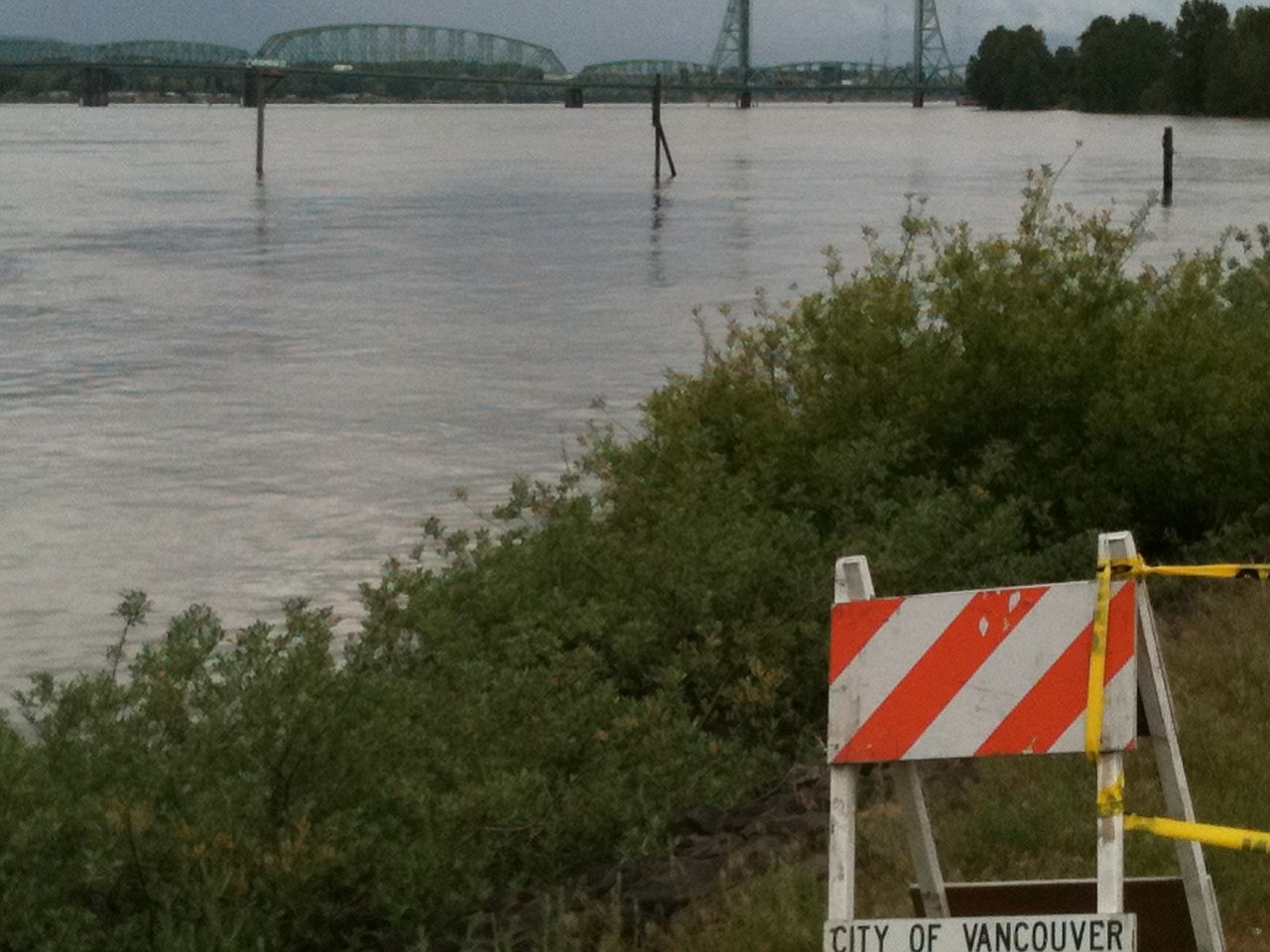
Already-high water levels on the Columbia River are expected to climb higher today, pushing past the 16-foot flood stage in Vancouver.
As a result, this week there is a possibility of flooding in low-lying areas near the river’s bank, according to the National Weather Service.
About 3:45 p.m. Monday, the weather service issued a flood watch for the Columbia, saying it would affect some areas in Clark and Multnomah counties.
“The river level in the Columbia River system will rise slowly over the next few days as increased snowmelt water from east of the Cascades reaches the lower Columbia River system,” the bulletin said. “Wet weather anticipated midweek may result in additional river rises late in the week.”
Forecasts predict the river at Vancouver will surpass 16 feet and hover near or above that mark the rest of the week. If predicted showers materialize, high river flows could flood access roads and some low-lying properties. Rain figures into the forecast through at least Friday.
The water levels will fluctuate about six inches during the high to low tide cycle. The river spent much of Monday about 15.7 feet above sea level, according to the weather service. Other local streams feeding into the Columbia are also high.
The Columbia River is experiencing its highest water runoff levels since 1997 because of high precipitation levels this year and late-melting snow. The preserved snowpacks making their way into the Columbia River Basin are 180 percent as deep as normal. In a normal year, the water would have released into the river at a more gradual pace, but this year’s harsh winter and cool spring are releasing it in a rush.
The levels forecasted for this week have been reached only a few times in the past 20 years, according to the weather service.
Storage dams such as the John Day Dam, east of The Dalles, Ore., and the Grand Coulee and Dworshak dams in Idaho, are capturing the majority of the excess water. For instance, John Day is accepting 100,000 cubic feet per second, according to the Army Corps of Engineers.
The beach near Vancouver Lake is covered in water, as is a large portion of the Salmon Creek Trail. The majority of the Burnt Bridge Creek Trail was built above the 200-year flood mark, making it unlikely the water will rise to a level that impacts that trail.
Flooding has been observed near Vancouver’s Waterfront Renaissance Trail between the Interstate 5 Bridge and Beaches Restaurant & Bar. On Monday evening, the trail was flooded for about a 60-foot-long section near Columbia Shores Condominiums. Signs erected by Vancouver-Clark Parks and Recreation reminded passersby of a persistent concern about flooding. Residents of the condominiums are asking people not to try to complete the trail by trespassing into their hillside gardens and trampling the plants.
Larry Altose of the Washington Department of Ecology said by phone that flooding poses environmental threats when swift-moving waters carry off containers holding hazardous materials left unsecured outside homes and businesses, and when the water makes contact with sewage and septic systems. Of particular concern is the water sweeping hazardous materials from low-lying farm properties.
“They need to be not just closed but in a place where they’re safe from being dislodged by floodwaters,” Altose said of containers of paints, primers and gasoline.
He said images of emergency workers responding to floods always show respondents in waders and other protective clothing.
“If sewers or septic tanks become flooded, floodwater can become contaminated by sewage,” Altose said. “The water should not be contacted directly.”
Additionally, officials have expressed concerns heading into the holiday weekend people will take to water for play without recognizing new currents created by the water’s rise. The water is very cold and dangerous, and officials say people should avoid it.
Here is a quick look at some parks and trails that are affected by rising streams:
o At Washougal’s Captain William Clark Regional Park at Cottonwood Beach, flooding has covered the area where shelters are used. Parks official Brian Potter said a birthday party reservation had to be canceled.
o Although Vancouver Lake Park has water well above the beach area, folks have continued using it for boating. The Frenchman’s Bar Trail is safe to use as it runs 2.5 miles from the lake up to Frenchman’s Bar Park. There, fishing enthusiasts have moved to higher ground and kept casting.
o Salmon Creek Trail is not officially closed but is 20 to 25 percent underwater, so folks are advised to find drier sections or trails, Potter said.
o In the greater Battle Ground area, the East Fork Lewis River isn’t affected by water rising in the Columbia, Potter said. As a result, Lewisville Park and Daybreak Regional Park & Boat Launch are in good shape. But the La Center Bottoms Stewardship Site trail, which is known for fabulous wildlife viewing, has some flooding problems.
On Monday afternoon, Potter said he wasn’t aware of flooding problems in the county’s many other parks and trails.