A helicopter, trailing an instrument that a scientist said resembles “a big orange Hula Hoop,” is opening a new research chapter on Mount St. Helens.
The U.S. Geological Survey is using a low-flying helicopter to collect water-saturation data that will help identify potential hazards.
Carol Finn, a USGS geophysicist based in Denver, said the project will help scientists better understand landslide potential on the volcano.
Helicopter pilots specially trained for low-level flying can use “see and avoid” techniques to minimize their interference with people and animals encountered during the survey.
The actual testing began Friday following Thursday’s calibration flights.
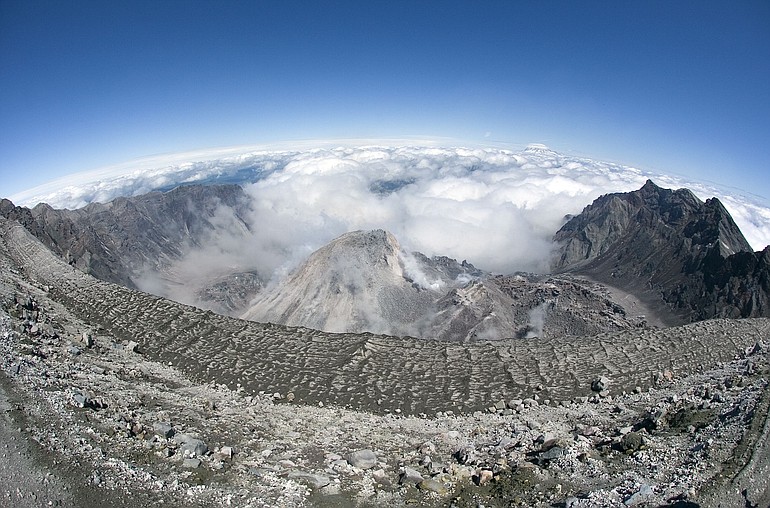
The USGS issued a news release a few days ago so climbers and hikers would not be alarmed by the low-flying helicopter trailing equipment on a 100-foot-long cable, making repeated passes over the crater and the volcano’s flanks.
Finn said the survey measures the rocks’ resistance to electricity, because “electricity goes through water easier,” telling scientists the amount of water in the volcano.
The measurements are made with a time-domain electromagnetic and magnetic survey instrument.
“It’s like a big orange Hula Hoop,” Finn said.
It does its job about 100 feet over the ground — midway between the terrain and the helicopter, which flies at about 200 feet.
“The current goes through the hoop, creating a magnetic field,” she said. “The magnetic field creates a secondary electrical field that goes into the earth and comes back and gets recovered in the hoop. The timing of the return tells you about the resistivity.”
The helicopter flies at a ground speed of 50 to 60 mph, back and forth across the entire volcano along equally spaced lines.
Finn said the Mount St. Helens survey was inspired by similar research on Mount Rainier, Mount Adams and Mount Baker.
“We’re finding new ways of looking at volcanoes,” Finn said.
On those peaks, the survey was looking for what she called “rotten rock.” Volcanic eruptions produce gases that can mix with water from glaciers.
“That makes sulfuric acid, which eats rocks, and makes things more unstable in case of a landslide,” she said.
“We also discovered water in the rocks,” she said. “It’s fairly wet. That was a surprise. We could see it even in places that were not rotten.”
That’s when, “We wondered about seeing (water) at Mount St. Helens,” she said.
Whether it’s rotten rock or saturated terrain, “It makes things more unstable in case of a landslide,” she said.
Slide opened eruption
Landslides have played a significant role in the history of Mount St. Helens.
On the morning of May 18, 1980, a 5.1-magnitude earthquake under the volcano triggered the biggest landslide in recorded history.
The slide uncorked a gas-charged reservoir of magma that flattened 230 square miles of forest, snapping old-growth firs like matchsticks; jetted a 15-mile-high plume of ash that eventually circled the globe; and buried the Toutle River valley beneath 150 to 200 feet of eviscerated mountaintop.
Tom Vogt: 360-735-4558 or tom.vogt@columbian.com.