It was just a bit hazy atop Silver Star Mountain, but Robert Nobile of Chicago still was savoring the view.
“I’d rate it a nine (out of 10),” Nobile said after hiking Ed’s trail No. 180A and Silver Star trail No. 180 to reach the summit.
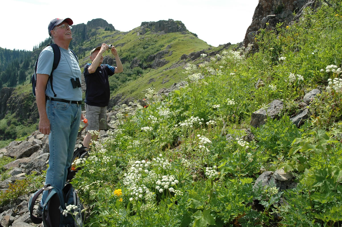
“It’s got wildflowers and great views coming up,” Nobile said. “You get to see four mountains, plus part of the mountain range. It’s not too long, not too strenuous. It’s just a great mix of plants, trees and meadows.”
GETTING THERE: From Sunset campground northeast of Battle Ground, follow Gifford Pinchot road No. 41 for four miles to the junction with No. 4109. Pay attention, this just is easy to miss when driving east. Make a hard right turn at the junction and a sign identifying the road as No. 4109 is visible.
GETTING THERE: From Sunset campground northeast of Battle Ground, follow Gifford Pinchot road No. 41 for four miles to the junction with No. 4109. Pay attention, this just is easy to miss when driving east. Make a hard right turn at the junction and a sign identifying the road as No. 4109 is visible.
Road No. 4109 drops to cross Copper Creek then climbs four miles to the trailhead at road's end.
WARNING: Road Nos. 41 and 4109 are passable for cars, but a truck or anything with a higher clearance is recommended due to the number of ruts and potholes.
TRAIL MILEAGES
Location Mileage Elevation
Trailhead 0.0 3,159
jct with Ed's trail 0.3 3,349
rock arch 1.4 4,012
viewpoint 1.7 4,089
jct with trail No. 172 2.0 4,084
road to summit 2.2 4,170
Silver Star summit 2.5 4,382
Road No. 4109 drops to cross Copper Creek then climbs four miles to the trailhead at road’s end.
WARNING: Road Nos. 41 and 4109 are passable for cars, but a truck or anything with a higher clearance is recommended due to the number of ruts and potholes.
TRAIL MILEAGES
Location Mileage Elevation
Trailhead 0.0 3,159
jct with Ed’s trail 0.3 3,349
rock arch 1.4 4,012
viewpoint 1.7 4,089
jct with trail No. 172 2.0 4,084
road to summit 2.2 4,170
Silver Star summit 2.5 4,382
Another Midwesterner, Tom Borneman of Oconomowoc, Wis., rated the hike an eight.
“The scenery is very good,” Borneman said. “It’s not very difficult with some good promontories to look from. The wildflowers are spectacular, at least I think they are.”
No stranger to mountains, Larry Rogers of Park City, Utah, also sat on the summit and rated the hike an eight.
Silver Star Mountain offers hikers a good alternative this month while waiting the high country of Mount Adams and the Goat Rocks finally to shed last winter’s deep snowpack.
Nestled in the southwest corner of the Gifford Pinchot National Forest, Silver Star Mountain is very unlike most of the backcountry on the west side of the Cascades.
Burned by the Yacolt fire of 1902, plus a later fire, the 4,382-foot peak and its surrounding terrain is mostly treeless.
Instead, Silver Star is a wonderful mix of steep ridges, cliffs, talus slopes, upland meadows and an amazing diversity of wildflowers.
“The variety and profusion of tiger lilies, penstemon, phlox, avalanche lilies and columbine present a tapestry of color equal to and found in the national parks of the Pacific Northwest,” according to Nicholas Dodge in his 1987 “Silver Star Mountain A Short History and Plant List.”
Add to Dodge’s flowers lots of lupine, paintbrush and beargrass.
The late Russ Jolley used to say Silver Star Mountain reminded him of eastern Oregon or northern California.
“The views are unexcelled,” Jolley wrote in his 1976 book “Hiking the Gifford Pinchot Backcountry.”
The easiest route to the summit of Silver Star Mountain is from the trailhead on Gifford Pinchot road No. 4109. It’s about 1,200 feet of elevation gain using the Silver Star and Ed’s trails.
Silver Star trail No. 180 is what’s left of the former road to the summit. Skamania County had a radio repeater on top of Silver Star decades ago.
Ed’s trail No. 180A parallels the Silver Star trail, but takes a much more scenic route through hanging meadows, under rocky bluffs and through a rock arch high on the side of the Star Creek drainage.
From trailhead to summit is 2.5 miles.
The steepness of the terrain and the windy nature of the ridges make it a relatively bugfree hike.
Richard Borneman of Vancouver said the only trail in southwest Washington he’d rate higher than Silver Star Mountain is the Loowit No. 216 loop around Mount St. Helens.
“But this is pretty nice,” he said. “It’s next best.”