Monitoring equipment boosted to tell a fuller story about volcano
By Eric Florip, Columbian
Transportation & Environment Reporter
Published: August 20, 2012, 5:00pm
Share:
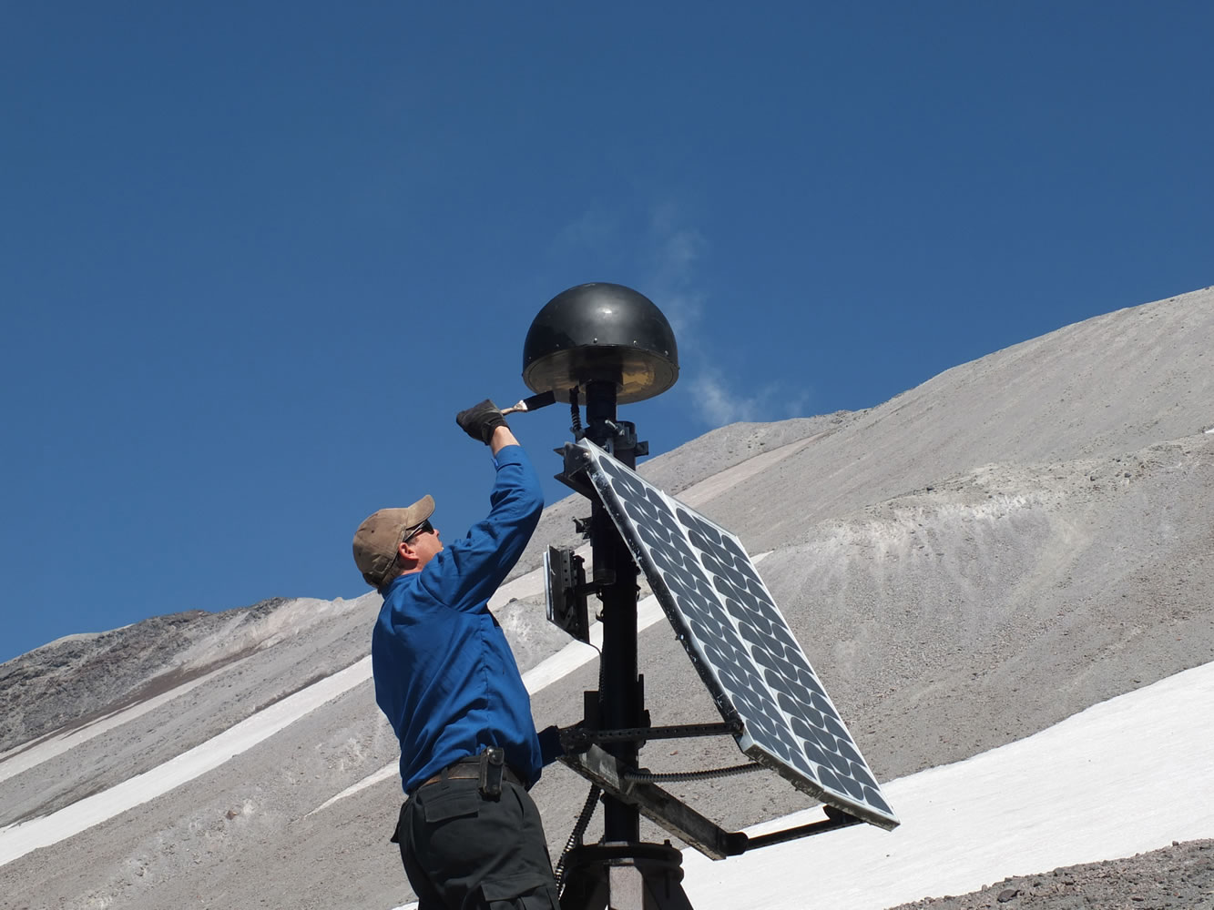
Cascades Volcano Observatory scientist Ben Pauk applies protective paint to a GPS antenna on Mount St. Helens. Researchers have spent recent weeks upgrading the monitoring equipment used to collect data from the volcano.
A series of monitoring equipment upgrades on Mount St. Helens aims to give scientists a better pulse on the action below the volcano’s crater — and better protection from the elements above it.
Researchers at the Vancouver-based Cascades Volcano Observatory rely on sophisticated equipment to watch the mountain’s every move. That includes seismometers transmitting information in real time, and GPS devices marking the precise shape of Mount St. Helens as it changes.
Scientists have spent recent weeks modifying antennae and completing other upgrades designed to boost the data capacity of the GPS system, said Ben Pauk, a geophysicist helping with the work. They’ve also moved some electronic equipment inside a new fiberglass hut within the crater. The extra shelter will shield the equipment from snow and ice that has caused problems in the past.
The small hut — “it kind of reminds me of a doghouse,” Pauk said — sits on the spot known as September Lobe, on the northwest side of the mountain’s crater.
“The site was completely buried by snow this last winter,” Pauk said, noting an antenna was “sheared off” at that time.
The CVO operates seven GPS units at Mount St. Helens, capable of measuring the smallest of movements. Researchers watch the devices’ positions in relation to each other, so they can detect any change in St. Helens’ shape. Magma stirring under the surface can cause the mountain to shift, however slightly, as if breathing in and out.
“Ultimately what we’re looking for is inflation and deflation of the volcano as magma moves into the system,” Pauk said.
The upgrades came with the help of federal stimulus money, which paid for more than $500,000 in monitoring and communication investments on Washington, Oregon and Northern California volcanoes, Pauk said. Much of the new equipment was purchased before this year, according to CVO scientist Carolyn Driedger.
GPS upgrades are far from the only work happening at Mount St. Helens this summer, typically a busy time for maintenance and field work. One study recently used a gravimeter to measure the gravitational force at various spots in the crater.
Those figures are mostly the same. But an increased gravity reading at one location, for example, would indicate more material beneath the surface where the measurement was taken.
“The idea is to try to detect gravity anomalies at different locations,” Pauk said.
Data from the most recent work hasn’t been analyzed, Pauk said. It will eventually be compared with an earlier, similar study, he said.
Ending an untold story
Richard Waitt returned to Mount St. Helens this month to finish piecing together a story he started three decades ago. The CVO geologist is studying deposits and sediment in the ground, hoping to determine what happened during the massive landslides that came with the mountain’s catastrophic 1980 eruption.
Waitt is focusing much of his attention on Spirit Lake at first. The earth itself, layer by layer, tells the story, he said.
“It’s like reading a book from page one to 99 and figuring out what happened, in order,” Waitt said.
Waitt started the work immediately after the eruption, but later deferred to avoid overlapping with another researcher at the time, he said. Waitt soon became committed to other work and other projects. He last worked on the Spirit Lake study in the early 1980s, but never came back to it.
The destruction of Spirit Lake is a story that hasn’t been fully told, Waitt said, lost in the shadow of the larger eruption and the broad damage it caused. It’s believed that the slides from Mount St. Helens slammed into the lake, blasting water some 800 feet above its original level, Waitt said. A layer of dead trees still sits on Spirit Lake’s surface, many pulled down from surrounding slopes during the eruption.
By digging into the geologic evidence around the lake, Waitt hopes to tell that story in greater detail. But the clues are harder to find today, he said — much of the area has been altered by vegetation and animals in the years since the eruption.
Waitt first resumed his field work Aug. 1. He expects the full study to be a multiyear effort. Eventually, Waitt plans to publish the lake’s story as completely as possible.
“I think the landslides had a much greater effect on Spirit Lake than we’ve known,” Waitt said.
Morning Briefing Newsletter
Get a rundown of the latest local and regional news every Mon-Fri morning.