For more information on life in Clark County, visit www.columbian.com/portrait.
GRASSY KNOLL TRAIL NO. 146: From the stoplight in Carson, follow the Wind River Highway for 3.2 miles to Bear Creek Road. Turn right. In 3.8 miles, the road becomes Gifford Pinchot National Forest road No. 6808. Follow road No. 6808 for another 7.4 miles to Triangle Pass. Go left on to road No. 68 for 2.2 miles to the trailhead. No parking pass is needed.
RACETRACK TRAIL NO. 171: From the stoplight in Carson, follow the Wind River Highway north for 5 miles to the junction with Old State Road. Turn right, then left almost immediately on to Panther Creek road. Stay on Panther Creek road for 11.4 miles to Four Corners (the junction of roads Nos. 60 and 65.) Continue north another 5 miles to Falls Creek Horse Camp. The trailhead for trail No. 171 is on the right, just north of the camp. A National Forest Day Pass ($5) or a Northwest Forest Pass ($30 annually) is needed at the trailhead.
Paintbrush, penstemon, phlox, balsamroot, lupine, columbine, glacier lilies … these colorful, showy wildflowers are the delights of the high country.
Combine them with meadows, waterfalls, glacial peaks, sprawling forests, sparkling lakes, rocky outcrops and panoramic views, and it’s no wonder that bookstore shelves are lined with dozens of hiking guidebooks.
The 1.3-million-acre Gifford Pinchot National Forest has hundreds of miles of trails through the high country of Southwest Washington.
Straddling the crest of the Cascade Mountains from Mount Rainier south to the Columbia River, the Pinchot forest has six wilderness areas and a chunk of a seventh.
There’s an active volcano in Mount St. Helens, a sleeping volcano in Mount Adams and the remnants of an ancient volcano in the Goat Rocks. There’s majestic old growth in Trapper Creek Wilderness and grand meadows in Indian Heaven Wilderness.
There’s so many trails to tell about. As a sampler, here are two in the southern end of the Gifford Pinchot to explore once the snow melts in summer:
• Grassy Knoll No. 146 — Come mid- to late June, the ridgeline at Grassy Knoll should be called Floral Knob or Wildflower Crest.
While it’s not the best overall wildflower display in the Pinchot, Grassy Knoll puts on its display at a time when the higher-elevation flowers and meadows still have snow not yet melted.
The trail climbs steeply for the first mile to several rocky outcrops with views of the Big Lava Bed below and Mount Adams on the eastern horizon. The path then drops before climbing to the former lookout site atop Grassy Knoll at 2.1 miles.
While this can be a logical turnaround spot, trail No. 146 continues for another 1.3 miles through open hillsides studded with wildflowers and views of Mount Hood, Mount Adams, Mount Defiance and lesser peaks.
At 3.44 miles, the trail enters the trees again. It will soon pass Cold Springs before ending at the junction with the Pacific Crest National Scenic Trail.
Just before the trail enters the forest again is a good spot to enjoy lunch and head back.
The elevation in those 3.4 miles is just less than 1,000 feet.
Andrea Ruchty, a botanist for the Gifford Pinchot National Forest in Trout Lake, said Grassy Knoll is designated a special botanical interest area.
GRASSY KNOLL TRAIL NO. 146: From the stoplight in Carson, follow the Wind River Highway for 3.2 miles to Bear Creek Road. Turn right. In 3.8 miles, the road becomes Gifford Pinchot National Forest road No. 6808. Follow road No. 6808 for another 7.4 miles to Triangle Pass. Go left on to road No. 68 for 2.2 miles to the trailhead. No parking pass is needed.
RACETRACK TRAIL NO. 171: From the stoplight in Carson, follow the Wind River Highway north for 5 miles to the junction with Old State Road. Turn right, then left almost immediately on to Panther Creek road. Stay on Panther Creek road for 11.4 miles to Four Corners (the junction of roads Nos. 60 and 65.) Continue north another 5 miles to Falls Creek Horse Camp. The trailhead for trail No. 171 is on the right, just north of the camp. A National Forest Day Pass ($5) or a Northwest Forest Pass ($30 annually) is needed at the trailhead.
Several plants including yellow bells, Columbia kittentails and big-headed clover are at the limit of their range at Grassy Knoll.
Plants from both sides of the Cascades are found on Grassy Knoll, due to its combination of weather and microclimate, Ruchty said.
Wildflowers start blooming near the Grassy Knoll trailhead as early in the year at the start of May, she added.
• Indian Racetrack-Red Mountain — Racetrack trail No. 171 from Panther Creek road No. 65 to the summit of Red Mountain is 3.87 miles (one way) and gains 1,400 feet in elevation.
There’s a lot packed into those almost 4 miles.
The trail climbs through the forest of Indian Heaven Wilderness for 2.5 miles before reaching the lake and meadow country at the site of a large tarn.
In another .25 mile, the trail arrives at Indian Racetrack.
The meadow is large and bisected by the historic Kalam’T Indian Racetrack. Once several feet wide, the former horse-racing track now is basically a trail through the meadow.
The racetrack was a gathering spot for Indians from as far east as Roosevelt in Klickitat County to the Willamette Valley on the west. The bands camped in the trees around the edge of the meadow and participated in social and religious ceremonies at the end of the huckleberry picking season.
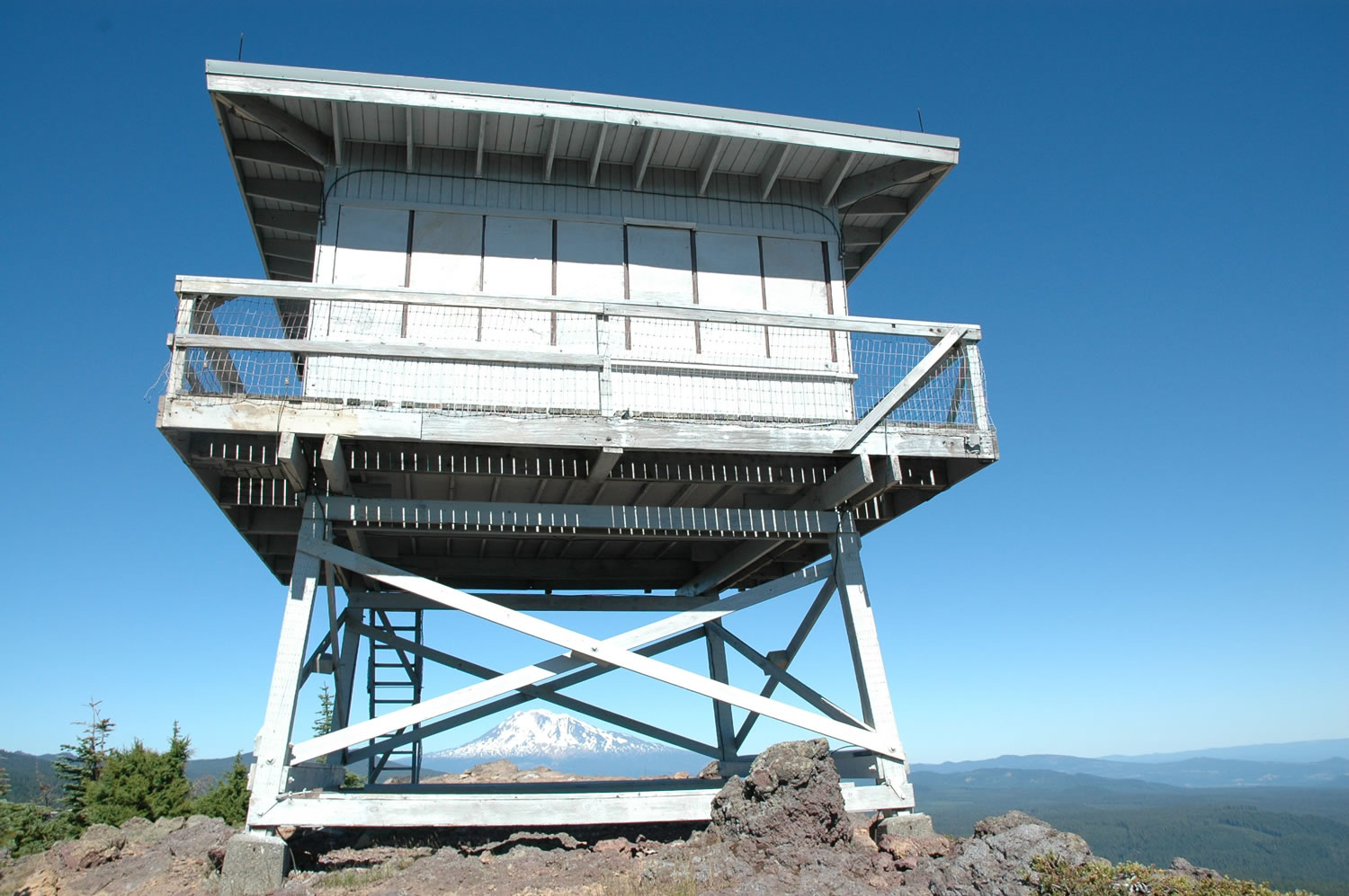
From the meadow at the racetrack, the trail climbs 0.9 mile and 540 feet in elevation to road No. 6048. Continue heading up the road another 0.2 mile to Red Mountain Lookout.
Red Mountain was the first fire lookout on the Gifford Pinchot.
The earliest lookout on Red Mountain was built in 1910. It was replaced with a standard cabin in 1935, which was replaced by a lookout tower in 1959.
A windstorm in December 2006 blew the lookout apart.
In summer 2007, a volunteer effort began to restore the damaged lookout. Volunteers donated labor in 2007 and 2008. Forest Service employees continued the work in 2009 and restoration was completed in 2010.
The lookout is locked and its windows boarded, but visitors can climb the stairs and experience a splendid view, including Mounts St. Helens, Hood, Adams and Rainier.