<img height="1" width="1" style="display:none" src="https://www.facebook.com/tr?id=192888919167017&amp;ev=PageView&amp;noscript=1">
Thursday,  April 18 , 2024

Linkedin Pinterest
News / Clark County News

Less lightning, more rain for Vancouver in encore thunderstorm

Rain totals of 0.86 inches at airport, 1.4 inches in Vancouver Heights

By Mark Bowder, Columbian Metro Editor
Published: May 26, 2012, 5:00pm

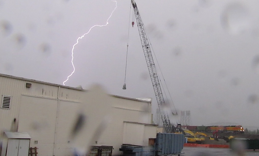
Stormy weather made an encore performance Saturday, with less lightning but more rain in a path from Yale Lake through Vancouver.

The storm developed in the foothills of the Cascade Range north of Clark County early Saturday evening and moved southwest across Yale Lake, Amboy, Battle Ground and Hockinson before moving into the Vancouver area at about 7:25 p.m.

By the time the storm moved through into Oregon, it had dropped 0.83 of an inch of rain at Pearson Field in Vancouver and 1.4 inches at a weather-spotter’s home in Vancouver Heights, said Colby Neuman, a meteorologist with the National Weather Service in Portland. He said the spotter also reported dime- to penny-sized hail.

“The worst was over Vancouver and the Portland airport,” Neuman said.

The weather service detected about 10 sky-to-ground lightning strikes in Saturday’s storm in the Portland-Vancouver metro area, far fewer than on Friday, which saw “several dozen” ground strikes, Neuman said. Friday’s storm had brought about 0.26 of an inch of rain at Pearson Field.

No damage was reported from lightning strikes Saturday, though heavy rainfall caused street flooding in many locations, according to the Clark Regional Emergency Services Agency. Much of the street flooding was on state Highway 503, Padden Parkway east of Highway 503 and the freeways.

In downtown Vancouver, fire crews temporarily blocked access to Columbia Street at the BNSF Railway underpass, which was impassable with more than a foot of storm runoff.

Such storms are unusual in Western Washington, but they developed Friday and Saturday because of a low-pressure system over the Great Basin that brought weather out of the north and northeast.

“They were two very similar days,” Neuman said. “Things lined up to where we were under the gun for both days.”

Don’t expect a third day of meteorological fireworks, though. Neuman said Sunday will bring increasing clouds as the evening progresses and an increasing chance of more traditional Northwest-style rain.

Mark Bowder: 360-735-4512; http://twitter.com/col_cops; mark.bowder@columbian.com.

Loading...
Columbian Metro Editor