DENVER — A storm that toppled trees, whipped up blinding dust storms and may have spawned some tornadoes closed highways in Wyoming Tuesday and was slowing flights at Denver International Airport.
In Wyoming, a 100-mile stretch of Interstate 25 between Cheyenne and Douglas was closed as well as a 125-mile section of I-80 between Laramie and Rawlins. More than a foot of snow had fallen as of midmorning in Lander. In Pine Bluffs, near the Nebraska border, wind has created 1- to 2- foot drifts out of the snow that has fallen there.
Wind gusts up to 71 mph damaged a marina and windows in Sweetwater County.
The storm has so far proved less potent than originally predicted in Colorado because the cold front lingered in Wyoming.
Up to around 10 inches of snow had fallen in Colorado’s mountains by dawn Tuesday. Another 5 to 10 inches was possible in some locations but final snowfall amounts would vary quite a bit, National Weather Service forecaster Jim Daniels said.
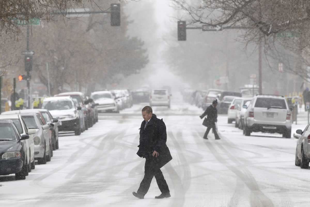
Up to a foot had been in expected in Denver but forecasters are now calling for around 5 inches.
The storm has canceled 465 flights at Denver International Airport and deicing was causing departing flights to be delayed by as much as a half hour.
Blizzard warnings are also in effect from south of Denver to the New Mexico line and in northwestern Colorado. Winds gusting up to 50 mph were expected there.
As the storm moved in Monday night, spotters reported two tornadoes near Akron in eastern Colorado.
Northern California was first to feel the lashing blasts of the storm Monday, which spread to the Sacramento and San Joaquin valleys.
At least a dozen trees came down in San Francisco, police officer John Tozzini told KGO-TV, which reported that more than 20,000 utility customers lost power in the region. A swath of outages occurred across the Sacramento Municipal Utility District, the Sacramento Bee reported.
A tree smashed into a Sacramento home where four friends were playing bridge, but they didn’t stop playing their game Monday, according to KCRA.
Gusts topped 80 mph at some places in Southern California. The blustery system was being fueled by a cold front.
“It’s just a cold, really strong upper low,” said Carol Smith, a meteorologist with the National Weather Service in Oxnard, Calif.
Whitecaps flecked the Pacific Ocean along the California coast, where gale warnings and small craft advisories were posted. Recreational boaters were warned to stay in port. Wind-driven swells slapped over the tops of breakwaters and turned waves into a churning froth under piers at points such as Redondo Beach and Manhattan Beach on the Los Angeles County coast.
The wind turned small wildfires into big problems in some areas, including a blaze in Fillmore about 50 miles northwest of Los Angeles that burned two homes and forced the evacuation of 84 homes.
Blowing dust forced the closure of state Route 14 in the high desert Antelope Valley north of Los Angeles due to low visibility. Officer Michael Farrell said motorists who stopped on the road were hit from behind by other cars, but no major injuries were reported.
The power went out for more than 13,000 Southern Californians because of the winds and the weather.
The rush of air had an upside: California’s main power grid manager, the Independent System Operator, reported that turbines spinning within the ISO grid produced a record of 4,196 megawatts Sunday. The previous record was 3,944 megawatts on March 3.
In Arizona, gusty winds produced by a cold front enveloped Phoenix in a dusty haze and closed 34 miles of Interstate 40 in the northern part of the state for several hours Monday. At least four people were injured in a pileup when two semi-trucks jackknifed in a dust storm on I-10 in southern Arizona. The injuries were not life-threatening.