BEND, Ore. — Envy isn’t healthy, but it probably best describes the feeling I used to get whenever I left Bend to recreate along Cascades Lakes Highway. As I drove along, I’d take in the houses of the lucky few who lived in developments along Bend’s southwest edge, resentful of their quick access to fun.
However, once I added running, mountain biking and writing these outing stories to my life a few years back, my thinking began to shift — to the east, to be specific.
Come winter and spring, the opportunities for fun migrate east, and that’s when I thank my stars I live a mile from China Hat Road.
At some point over the long Thanksgiving weekend — during which I hiked, ran and explored caves in the China Hat area four times in three days — it dawned on me that China Hat and its offerings are sort of like a mini Cascade Lakes Highway, or maybe a fun-house mirror version of it.
Their high-use seasons are flipped — summer and fall are busiest along the Cascade Lakes Highway, winter and spring along China Hat Road.
Summer along the Cascade Lakes means people swimming in lakes, loudly dressed cyclists grinding their way up toward Mount Bachelor, preternaturally fit ultra-racers running trails. The warm months also mean South Sister summiters, couples tandem kayaking, horseback riding, mountain biking, etc.
Of course, there are people who continue using both areas year-round, but winter and spring in the Cascades winnows usage down to snow enthusiasts heading to the hills for snowmobiling, sledding, skiing and boarding.
Winter activity
For those who want to keep trail running, mountain biking and horseback riding once snow descends west of Bend, winter means heading to places like the Badlands, Horse Ridge and the China Hat Road area.
Out east, cold temperatures and moisture combine to firm up the otherwise dusty singletrack of Swamp Wells, Boyd Cave and Coyote Loop trails. On a busy weekend, you’ll see at least one Subaru or SUV parked along every forest road, presumably people out strolling with their dogs or otherwise exploring new pathways to fun. All the while, gun enthusiasts provide a soundtrack at nearby Coyote Butte.
On Thanksgiving Day, I parked along Forest Road 1815 and took a 6-mile run on trail 3962 toward Boyd Cave, sharing the singletrack with my dog, Kaloo and the occasional mountain biker, but not many others. A quarter mile out from where I parked, the pine and junipers thin out, giving way to an old burn area that provides ample sun for its fans.
Sunshine was abundant, so much so that I began losing layers, literally; if anyone finds a black glove out there, it’s mine.
On the drive home that warm and windless afternoon, I made a mental note of Bessie Butte. Located in another area that’s been marred by forest fire, Bessie is an easy-to-reach alternative to crowded Pilot Butte.
“I know,” I thought to myself. “I’ll get everyone to hike up Bessie after dinner.”
Our kids are sudden but resolved vegetarians, so after we ate veggie lasagna in place of our traditional fare, I suggested that hike to watch the sun set.
It was already pushing 4 p.m. as we drove to Bessie Butte, the trailhead and much of the trail already in deep shadow. After maybe 15 minutes ascending the 3/4-mile trail, we were afforded views of mountains from Bachelor to Hood, lit by the setting sun.
There were ripples of complaint on the way up, sure, but also thoughts of the far easier walk down and a warm apple pie waiting at home.
Here’s the sad twist: On the drive back, just west of Knott Road, we hit and killed a deer. After the immediate relief of feeling a bump under the wheels instead of giant mammal through the windshield, it all became a blur of hysterics and shouting.
My wife pulled over and I trotted down the sidewalk in twilight, only to confirm we’d killed what we hit.
Some readers will roll their eyes or say that’s the risk of night driving in Oregon in November; trust me that knowing the time of day and year didn’t quell the sadness in that van. We reported the accident to Bend Police, and, life rolling on, my daughter Lucy and I set out the next morning for Boyd and Hidden Forest caves.
En route, we drove past the deer, still sitting where we’d left it in the bike lane. Lucy pledged she’d give every penny she had for the deer to be alive.
A bit of the surreal
As we drove up to the Boyd Cave parking area, a family was descending the steep staircase that provides access to the cave, a somewhat surreal sight, though not as surreal as the lingering scent of perfume as we explored the cave behind them.
The staircase into the 1,900-foot-long lava tube is heavily dented, presumably from rocks falling on it, and there’s graffiti around the mouth of the cave.
We should all be better stewards of the few caves that are open year-round. Many out here are restricted for bat habitat and resource protection. Nearby Skeleton Cave is open only to commercial tours, and Wind Cave is closed year-round.
As Scott Cook notes in “Bend, Overall,” the first five minutes of Boyd Cave are good for a quick look that doesn’t require crawling, and that was our plan. Even a quick jaunt leads you by rock pileups, across smooth, sandy stretches and other sights for the eyes — provided you remember a flashlight or headlamp. The temperature is chilly, too, so also plan on wearing a coat and gloves. Sturdy footwear is also recommended, as there are spots where you’ll scramble from one lava gutter to another as you search for the easiest path.
Just over three miles away is the trail to Hidden Forest Cave. Though we’d been here before, we relied on Cook’s accuracy to lead us down the correct forest road, 300, located 3.1 miles from where the Boyd Cave turnoff. Do not be fooled by the more prominent Forest Road 1820, which you’ll see at the three-mile mark. You’ve been warned.
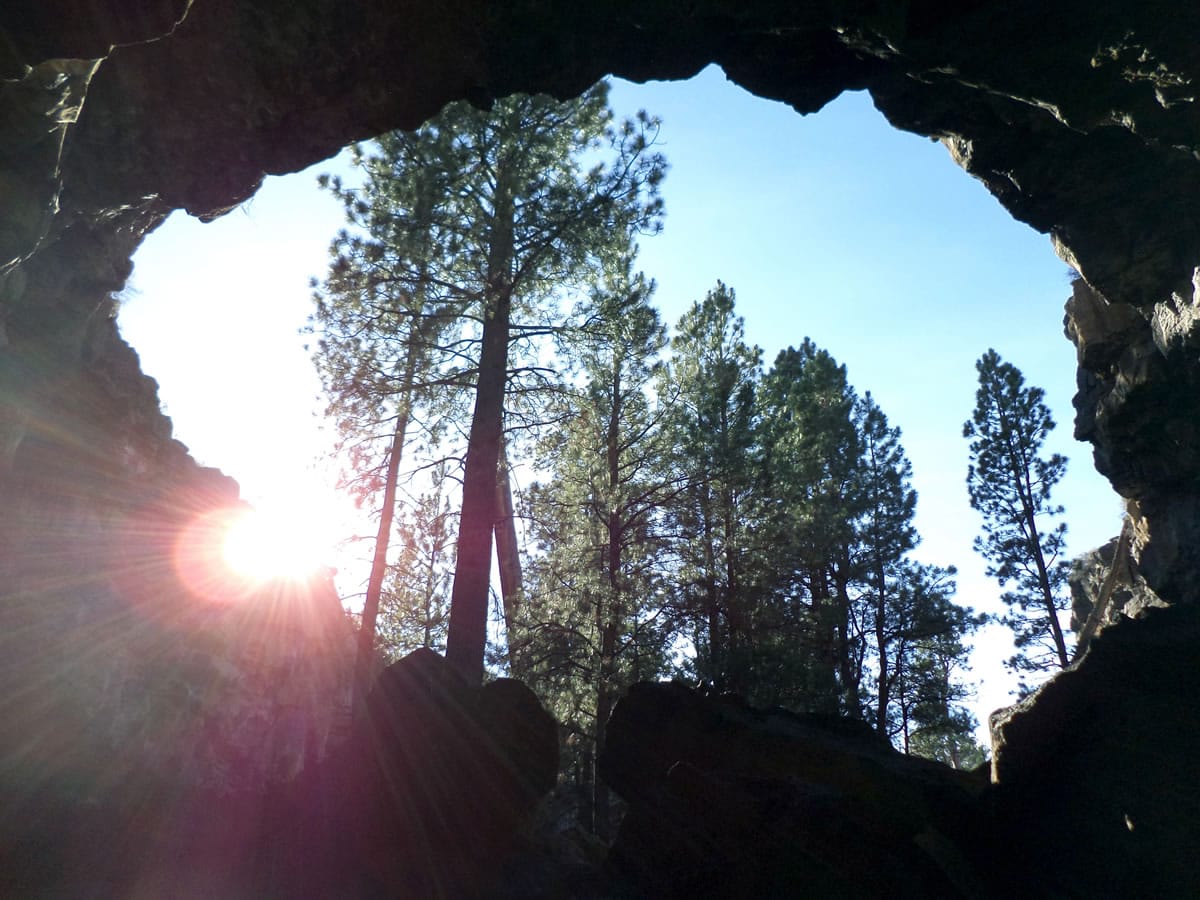
Hidden Forest gets its name, I’m going to guess, from the large ponderosas growing out of its floor about 30 feet below the surrounding forest. Last time we were here, about a year and a half ago, we’d seen the graffiti that recently made headlines again, after its cleanup.
This time we skipped bringing headlamps down into the cave. A beam of sunlight warmed us as we stood in the rocky clearing before making our way up, out and back to the car.
On Saturday, I made still another trip out China Hat way, returning to trail 3962 in search of my lost glove. I didn’t find it, but it was mostly just an excuse to get back to run on a sunny stretch of trail.