TROUT LAKE — It’s a substantial drive — about two hours — from Clark County to the cross-country ski and snowshoe trails on the south side of Mount Adams.
So, that’s the down side.
But here are the benefits:
o Often it’s sunny with blue skies this far east when the west side of the Cascades Mountains are locked in low clouds, fog and drizzle.
o The snow is better. While not the powder of central Oregon, the drier snow of the Trout Lake area is an improvement over the Cascade concrete found at places like Mount St. Helens. Skis actually perform more like designed.
o The crowds are smaller. Well, compared to Mount Hood standards, there are no crowds. It’s likely on weekends you’ll meet a few other skiers or snowshoers, but probably not a weekday.
o The terrain is better. Pineside and SnowKing sno-parks, a few miles northeast of here, offer six connected loops. Two of the loops are rated easiest, two are intermediate and two are difficult.
Justin Ewer of the Mount Adams Ranger District said the trails are groomed on about a weekly basis. More skiers than snowshoers use the trails, he added.
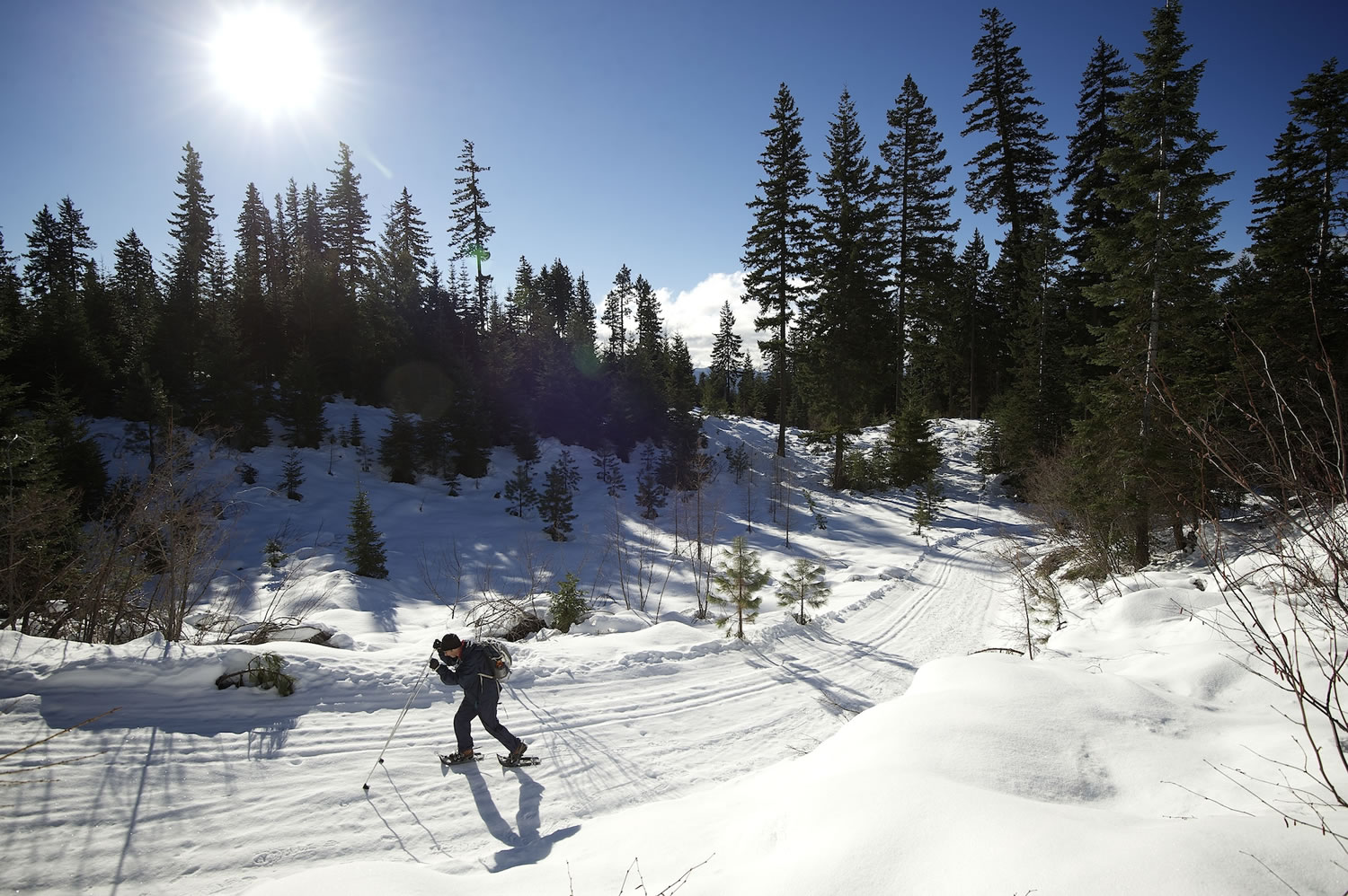
Alexe Colson of Portland spent New Year’s Day cross-country skiing on the 4.7-mile Lava Loop out of SnowKing Sno-Park.
Colson said she would rate Lava Loop an eight on a one-to-10 scale.
“We loved Lava trail, it was a great workout,” she said. “We started with a good bit of downhill and ended with some steady uphill, which really got our cardiovascular system working. We were looking for a workout, nice trail and a place to run the dog.”
Colson added the trail is not easy and lacks a panoramic view of Mount Adams.
On low-snow years, road No. 82 is plowed several additional miles to a parking lot at the junction with road No. 190 or Smith Butte Sno-Park at the junction with road No. 200.
Ewer said plowing road No. 82, the main access route, to the Smith Butte would be too expensive on a typical snow year.
“It’s cost driven,” he said. “It could use up the plowing budget.”
When asked about the possibilities for future trail expansion in the area, Ewer said there may be a chance to consider improvements.
“Any future expansion would need to be ecologically and financially sustainable,” he said.
Trail guide
Here’s a look at the trails available on the south side of Mount Adams:
Pineside Sno-Park
(elevation 2,770 feet, parking for 20 vehicles, vault toilet)
Big Tree Loop — This 3.7-mile loop is great for beginners. In fact, each year the Trout Lake Cabin Fever Festival uses the Big Tree Loop for a nordic ski race.
There is less than 100 feet total elevation change on Big Tree Loop. It has two gradual downhill stretches, just right for a new skier to get the feel of going down on cross-country skis yet not so fast as to fall.
The loop is best skied clockwise. To access this loop requires using a piece of Eagle Loop. The round trip is 4.9 miles.
Eagle Loop — Not a long loop at 3.3 miles, Eagle has some steep enough grades and tight turns (particularly on the northwest leg) to earn its difficult rating.
Hole in the Ground Loop — The Forest Service rates Hole in the Ground as a “most difficult” loop, an accurate assessment. Except for well-skilled cross-country skiers, this loop is best enjoyed on snowshoes. As a snowshoe trip, Hole in the Group Loop is no problem.
Hole in the Ground Loop overlaps part of Big Tree Loop. Hole in the Ground Loop, per se, is 4.5 miles. Adding in the approach mileage to and from Pineside, the round trip is 6.4 miles.
Hole in the Ground Loop is the one of the few spots in the Pineside-SnowKing trail network where a skier or snowshoer gets partial views of Mount Adams.
SnowKing Sno-Park
(elevation 3,375 feet, parking for 25 vehicles, vault toilet)
Pipeline Loop — Another beginner, or perhaps easy intermediate, loop.
Pipeline Loop is 2.2 miles. But it is accessed by skiing 0.9 mile from SnowKing on road No. 101 via the Lava Loop. So, the round trip is 4 miles.
The Pipeline Loop is best skied counterclockwise, thus heading uphill on road No. 744 and down on road No. 110.
Lava Loop — This is a 4.7-mile intermediate loop. It does have some portions that boost the rating to most difficult if the snow is icy. It is best skied counterclockwise.
The initial 1.4 miles are easy, then it drops gently at first then more steeply to a crossing of road No. 82. Lava Loop continues with ups and downs for two miles before returning to SnowKing Sno-Park.
By skiing this counterclockwise, the steepest of the grades south of road No. 82 are uphill stretches.
Princess Loop — An easy 1.5-mile loop that mostly circles through a former clearcut on the south side of Road No. 82 opposite SnowKing parking lot.