o Lacamas Creek in Camas
o East Fork Lewis-Hantwick Road to Moulton Falls
o Washougal Dike (east end)
Website: http://www.vanclarkparks-rec.org
Some days, there just isn’t enough time to drive to the wilds for a hike.
Some days, the weather is too dicey to even want to drive to the wilds for a hike.
Fortunately, despite its suburban spread, Clark County has a handful of hiking and walking routes distributed fairly well.
Water is like a magnet to hikers, and the local trail system keys in on the county’s lakes and streams.
Here’s a look — organized by water body size — at some of the better hiking opportunities in Clark County:
BIG RIVER — The Columbia River is our big water, and there are routes along the river in both east and west Clark County.
The Columbia River Renaissance Trail is a 14-foot-wide concrete route stretching on-street and off-street for about five miles from the downtown area to the east along the Columbia shoreline. It passes Vancouver Landing, the Water Resources Education Center, Marine Park and ends at Wintler Park.
To get there from Interstate 5, take the Mill Plain exit and head west, turn south on Columbia Street, travel under the I-5 Bridge and park in one of the public parking lots. It can be accessed at the east end via Wintler Park.
• The Washougal Dike trail starts at Steamboat Landing in Washougal and heads east along the river for more than three miles.
Along the way, hikers walk past Capt. William Clark Park at Cottonwood Beach. Continuing east, the dike trail eventually leaves the Port of Camas-Washougal Industrial Park and is bracketed by Steigerwald Lake National Wildlife Refuge on the north and the Columbia River and Reed Island on the south.
Gibbons Creek passes under the dike via a fish ladder. The route goes another half-mile east to a fence, where hikers must turn around and retrace their route.
To get to Steamboat Landing, follow state Highway 14 east to Washougal. Turn south into the parking lot at the 15th Street intersection.
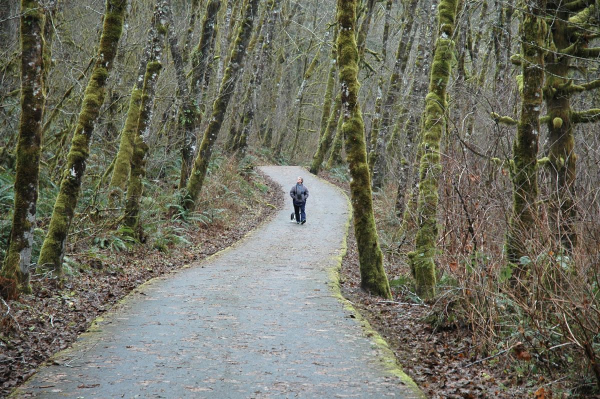
MEDIUM WATER — A 2.4-mile trail extends from a trailhead on Hantwick Road east to Moulton Falls County Park along the East Fork of the Lewis River.
The western half-mile or so of the trail is paved and leads to a large pond, including a bench for taking a break. The remainder of the trail is gravel to a bridge crossing the East Fork at Moulton Falls park.
The eastern end of the trail parallels the river and several tributaries cascade down from the steep hillside to the south.
To get there, take state Highway 503 north of Battle Ground and turn right on Northeast Rock Creek Road, which morphs into Northeast Lucia Falls Road. Follow Lucia Falls Road for 5.4 miles to the junction with Hantwick Road. Turn right at proceed .6 mile to the parking lot at the trailhead.
SMALL STREAMS — Salmon Creek Greenway is a three-mile paved path along lower Salmon Creek between Salmon Creek Park and Northwest 36th Avenue-Northwest Seward Road.
Mallards, mergansers and other ducks can be seen in the wetlands. At one point, there’s a view of Mount Hood on clear days.
Trailheads are available at Salmon Creek Park on the east or where Northwest 36th Avenue becomes Northwest Seward Road in Felida.
• The Lacamas Creek trail starts in Camas and follows the stream for a mile upstream to the dam on Round Lake and Clark County’s Lacamas Park.
Slightly beyond the half-mile point, the trail crosses Lacamas Creek at Lower Falls. Immediately upon crossing the bridge, the trail forks. Take the hard left and climb to a crossing of Woodburn Creek.
The trail ends at the junction with Round Lake Loop trail. Veer to the left and visit the dam that creates Round and Lacamas lakes.
The flow in Lacamas Creek is greatest in the winter and makes the falls and cascades more scenic. This trail also connects to the Round Lake Loop, encircling Round Lake and adding 1.2 miles.
The lower trailhead is just off Northeast Third Avenue in Camas opposite the intersection with East First Avenue. Turn in to a small parking lot on the west side of Lacamas Creek. The trail starts about 30 yards to the north at a signed gate.
By adding the Round Lake Loop, this trip can be stretched to 2.8 miles. Lacamas Park also has several fire roads which can be hiked, adding options and distance.
LAKES — There’s a plethora of short hiker and equestrian trails in 276-acre park Battle Ground Lake State Park.
The hilly trails wander through a forested setting. It takes about 20 minutes to stroll around the lake.
To get to the park, go to the corner of Northwest Grace Avenue and Main Street in downtown Battle Ground and follow the signs on Northeast 229th Street, Northeast Heisson Road, Northeast 244th Street and Northeast Palmer Road for three miles to the park entrance.
• Lacamas Lake Heritage Trail is a 3.25-mile gravel path paralleling the south shore of the lake. Mostly flat, the trail is popular with runners and mountain biker riders as well as walkers.
The route passes beneath Lacamas Shores development and along Camas Meadows Golf Club.
The downstream trailhead is on Northwest Lake Road in Camas, while the upper trailhead is on Goodwin Road.