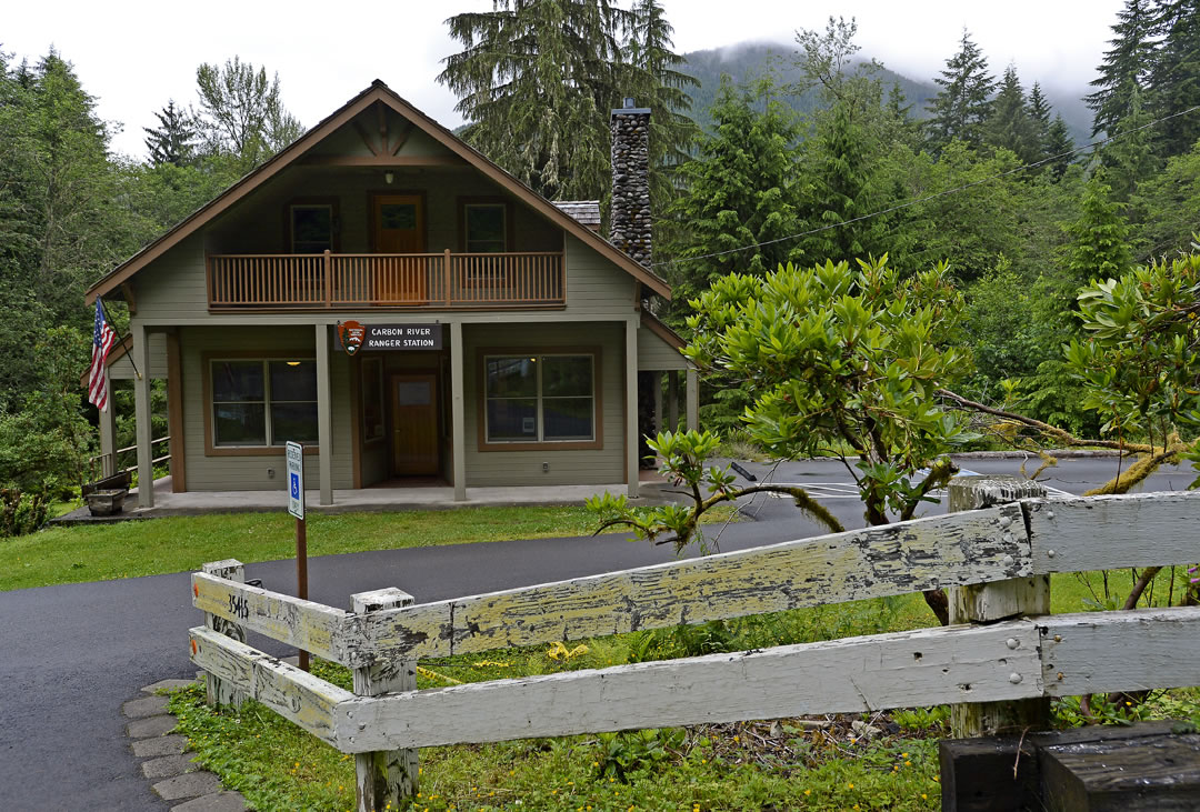
The overhauled house on the north side of the Carbon River Road is more than just a new Mount Rainier National Park ranger station.
It’s an improvement over the treacherously located old ranger station that will likely be lost one day to a river notorious for spilling over its banks. And it might prove to be a step toward the reimagining of the approach to Rainier’s back door.
The public dedication of the $600,000 Carbon River Ranger Station is scheduled for 10 a.m. Saturday, July 6.
“This is going to be much more user-friendly,” Chuck Young, Rainier’s chief ranger, said of the new primary public contact point for the northwest corner of the park. “The old building was basically a windowless box.”
The new ranger station opened last month and serves as a place for visitors to get trail information, maps, permits and, Young says, “use the restroom, the most common request so far.”
While the vast majority of the more than 1.5 million visitors to Mount Rainier each year head for tourist hot spots such as Paradise and Sunrise, the Northwest corner (including Mowich Lake) attracts about 58,000 visitors annually.
Most are local residents, Young said. The Carbon River Entrance is the closest park access point to Buckley (18 miles), Puyallup (32) and Tacoma (40).
While views of Mount Rainier aren’t available from the Carbon and Mowich Lake parking lots, the area has an abundance of hiking options. Small lakes, waterfalls, the Tolmie Peak fire lookout, the snout of the Carbon Glacier, and the 93-mile Wonderland Trail are accessible here.
“It’s a great part of the park that a lot of people enjoy,” Young said.
The Ranger Station
In 2004, Congress approved the expansion of the northwest boundary of the park, allowing the purchase of 755 acres. Among that land was a 100-acre ranch purchased in 2010.
The ranch belonged to John and Yolanda Thompson, and their home was identified as an ideal structure for the new ranger station.
The building includes storage, offices and sleeping quarters for rangers. It will also have a security system, something the frequently burgled old station didn’t have.
It won’t be packed with amenities for visitors. It will just serve as a base for collecting information, permits and, perhaps, water before setting out on a hike. “I don’t think it’s a place visitors will linger too long,” Young said.
Just as important, it’s a safe distance from the Carbon River, which park geologists say will some day wash away the old ranger station and its parking lot.
Camping comeback
Before the 2006 flood that ravaged Rainier’s infrastructure, visitors had two options for year-round drive-in camping at Rainier: Sunshine Point near the Nisqually Entrance, and Ipsut Creek at the end of the Carbon River Road.
But the flood eliminated both options. The Nisqually River washed away most of Sunshine Point. The Carbon River’s destruction forced the park to permanently prohibit vehicle traffic on the road to Ipsut Creek, which was converted to a backcountry camp that requires a 5.1-mile hike or bike trip.
“The lack of year-round camping – that’s a complaint we hear quite a bit,” Young said.
If year-round camping is going to return to Rainier, the Carbon River area might be the best location.
But where? Park officials aren’t sure yet. The 755-acre patch of land that’s home to the new ranger station has a few possibilities, Young said.
However, Pierce County owns the nearby land where the old coal-mining town of Fairfax once stood. A partnership to put a campground on the county land could be discussed in the future, Young said.
“It may not be that important to people that they are actually camping inside a national park,” Young said. “They just might want a nice place to camp in the area.”
Historical future
The road to Rainier’s Carbon River Entrance has a rich history and, park community planner Bryan Bowden believes, the potential for a bright future.
Reminders of the area’s mining history still dot the corridor as visitors approach the park through towns such as Burnett, Wilkeson and Carbonado. There are signs of the old rail bed that once serviced the area, coke ovens remain in Wilkeson, and a cemetery in Carbonado includes a monument honoring more than 100 men who died in the mines.
“And there were a number of expeditions to the mountain that came through here,” Bowden said.
The history packaged with recreation opportunities make the area a fascinating place to visit, Bowden said. And there are ideas to accentuate these assets.
In addition to adding a campground, there are efforts to push the county’s Foothills Trail all the way to the park boundary. Pierce County and the Foothills Rails-to-Trails Coalition have worked for decades to build a paved path on old rail beds from Rainier to Tacoma. The longest paved section currently stretches 15 miles from Puyallup to South Prairie.
“You could ride a bike almost all the way to the Wonderland Trail (when the Foothills Trail is complete),” Bowden said. Bikes now are allowed in the park only as far as Ipsut Creek Campground, 0.3 miles short of the Wonderland Trail.
The park also partnered with the Town of Wilkeson to draft a development concept for Coke Oven Park, an 11 1/2 -acre park with a half-mile trail running past the remaining ovens.
Bowden is a member of the Coke Oven Park planning team. “When you start dreaming about the things that could happen in that area, it’s enough to make you start salivating,” he said.
The forum
As exciting as the ideas might be, Bowden says if they’re ever going to become reality, there needs to be more coordination between the towns, the park and the property owners along the Carbon River corridor.
Bowden is working to get 20 of these stakeholders to sign a memorandum of understating that would form the Carbon River Forum.
While the park is convening the forum, Bowden said it has no agenda for the meetings other than creating an atmosphere for discussing ideas for the future of the area. He envisions topics such as the Foothills Trail, county parks planning, and signage and fish passage in the river.
Bowden expects all stakeholders to sign the memorandum within a month.
“It’s purely about collaboration,” Bowden said of the forum. “It’s through the power of collaboration that you make things happen.”