<img height="1" width="1" style="display:none" src="https://www.facebook.com/tr?id=192888919167017&amp;ev=PageView&amp;noscript=1">
Wednesday,  April 24 , 2024

Linkedin Pinterest
News / Clark County News

Stretch of Lower River Road steadily eroding

New gate in place to shorten farthest dead-end stretch of state highway

By Scott Hewitt, Columbian staff writer
Published: February 12, 2014, 4:00pm
3 Photos
This new gate at Milepost 10 of Lower River Road is still open, but some day officials with the Washington Department of Transportation will deem the road unsafe and close the gate permanently.
This new gate at Milepost 10 of Lower River Road is still open, but some day officials with the Washington Department of Transportation will deem the road unsafe and close the gate permanently. Photo Gallery

The future of Lower River Road just got shorter by about a mile and a third.

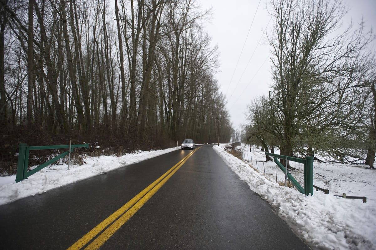
Erosion of a Columbia River dike that was built decades ago to protect farmland has spurred the installation of a new roadway gate at milepost 10, just below Round Lake, northwest of Vancouver. There’s already a small parking area here where folks can get out and stroll into the state-owned countryside to the east. Now the Washington Department of Transportation will add another small parking area to the west, according to maintenance superintendent Bob Kofstad.

That’s in anticipation of the day that this farthest leg of Lower River Road, or state Highway 501, which climbs past Frenchman’s Bar Park and keeps heading north to a dead end, needs to be closed to public traffic. Right now, the new gate remains open. But someday, the decision that the road is too dangerous will officially be made, and it will be closed permanently.

Lower River Road doesn’t get much traffic north of Frenchman’s Bar, transportation department spokeswoman Abbi Russell said, but it does get hikers, cyclists and birdwatchers. Nothing much is situated north of the new gate, except one small rental house that’s owned by Fazio Brothers Sand Co. The commercial operations of Fazio Brothers and Andersen Dairy are both south of the gate, so they won’t be affected.

Anybody who does require access to the road north will get a key when that gate is finally locked, according to Kofstad. But the general public won’t be able to wander up there by car or bike anymore, he said.

On Tuesday, Kofstad and Russell drove a reporter north past the new gate and along the road as it narrows to a single lane that hugs the river. The water level was low, but Kofstad said in spring when things get really

wet, the river rises to the point where it’s just about sloshing over the road. Every time a big ship goes by, Kofstad said, its wake batters the bank. Chain-link fencing and concrete barricades have been added as safety measures along the road.

“The river has been reclaiming the highway and the dike for years,” Russell said. “The reason we’ve gotten to this point is, we’re concerned that the next flood event washes it all away.”

“It’s not a question of if, it’s a question of when,” Kofstad said.

The road ends in a small, trashy parking area with concrete barricades; from there it’s about 400 feet along an old dike trail to a spot where the river is dramatically eating away at the land.

The state has no plans to fortify the road or the dike, Russell said. “It’s not a high priority. There are lots of needs out there,” she said.

Loading...
Tags