Jurgen Hess knew the Mount Adams area had experienced its share of retreating forestland in recent years. The local advocate has seen it first-hand in the form of wildfires, logging and development.
But seeing the full scope of forest loss through a new interactive map offered a different view entirely.
“The thing that to me was shocking was the visual picture of it,” said Hess, a board member of the nonprofit Friends of Mount Adams. “You can see it in abstract form when you read about it … but to see these patterns, wow.”
A group of researchers and the University of Maryland’s Department of Geographical Sciences recently developed a high-resolution online map charting forest gain and loss across the entire world from 2000 to 2012. The project, which drew from satellite data, was published in the journal Science in November.
The study found that 2.3 million square kilometers of forest cover were lost globally during those 12 years, against 0.8 million square kilometers gained. Tropical areas saw both the biggest losses and the biggest gains.
In the Northwest, results were mixed. The majority of federal and state forests remained untouched, while other areas saw a combination of gain and loss, or both.
Many of those changes aren’t permanent, said Anthony Chavez, a spokesman for Weyerhaeuser, one of the region’s largest private owners of timberlands. The map reflects a snapshot of forest cover over a relatively short time period, he said, which doesn’t necessarily mean irreversible loss.
One of the largest areas of forest gain in the region, for example, shows up on replanted Weyerhaeuser-owned land in northeast Clark County. Other areas lost to logging will be replanted just the same, Chavez said. State officials say the same is true of state forests harvested for timber.
“Nothing has changed for us in the last several decades in terms of how we manage forests,” Chavez said of Weyerhaeuser’s approach. “We are committed to a sustainable forestry practice.”
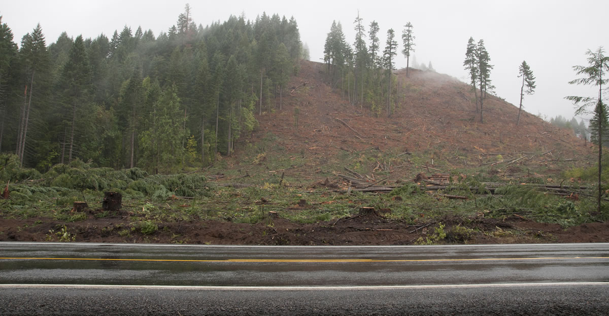
Among the most significant areas of loss on the map in Southwest Washington are lands south and east of Mount Adams. Hess attributed much of that to two wildfires: the Cold Springs Fire in 2008 and the Cascade Creek Fire in 2012.
But Hess said he’s also noticed an uptick in private-land logging in recent years, with some cuts extending right to the edge of major roadways. Too much of that, he said, and the cumulative effect on the area could become more evident.
“I worry and wonder about the impact to wildlife, to watersheds, to soil and those kinds of things,” Hess said.
‘Disturbing trend’
While forestland ebbs and flows to some extent in a given decade, the long-term trend in Washington remains decidedly negative, according to the state Department of Natural Resources. A 2013 DNR study found that Washington lost 650,000 acres of forestland use from 1976 to 2006. In Western Washington, the rate of decline equated to losing an area of forest the size of a football field every 42 minutes — for 30 years.
“It’s a really disturbing trend,” said DNR State Forester Aaron Everett. “There’s a lot at stake with the current rate of losses that we see.”
Most of that is due to development as new growth encroaches on natural areas, Everett said. The state faces an ongoing balancing act as it creates places for people to live while trying to protect the environment, he said.
When timberland falls out of forest use, reasons vary, Everett said. A landowner might sell because of economic reasons, a death in the family or an inter-generational transfer, he said.
Often, the result is new construction or housing on land that once supported natural forest cover.
“That’s a permanent loss,” Hess said. “We’ll never gain that.”