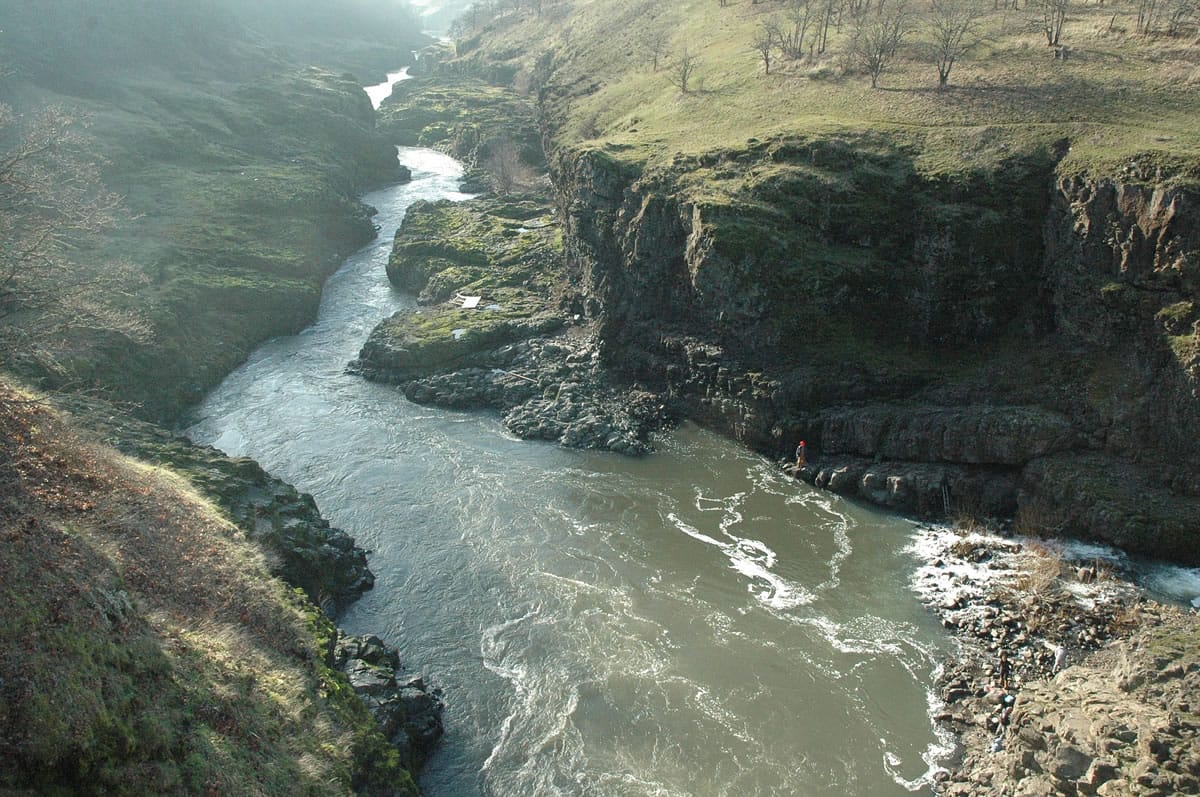
LYLE, Wash. — The lower two miles are the least scenic — perhaps least appealing — of the otherwise splendid Klickitat Trail.
Unless you like bald eagles.
“It’s prime bald eagle season,” said Andy Kallinen, assistant area manager for the Washington State Parks and Recreation Commission in the central portion of the Columbia River Gorge. “The bald eagles are out big time in these first two miles to the trestle.”
Indeed they were.
Ten of America’s national symbol could be counted in just a small area along the west side of the Klickitat River about 0.3 mile upstream of the Lyle Trailhead.
Kallinen said he’s heard reports of as many as 60 eagles being spotted some days along the lower Klickitat.
In winter, eagles migrate from many areas to the Northwest, said David Anderson, district wildlife biologist for the state Department of Fish and Wildlife.
“They come from Alaska, Canada, the interior Rocky Mountains, California, etc.,” Anderson said. “They start to show up in December and are generally gone in March. They focus on salmon as well as waterfowl that concentrate in the Northwest this time of year. They like the mouth of rivers that have gravel or sand bars where spawned out salmon wash up and are easily available.”
Jim Buckland of Mill A in eastern Skamania County wasn’t looking for eagles on the Klickitat Trail. He just wanted a nice spot in the middle of winter.
“We we’re just looking for sunshine,” Buckland said. “We were going to go to the Deschutes River trail, but it got foggier the farther east we went.”
As what has been largely a non-winter winds down, places like the Klickitat Trail offer a great opportunity to jumpstart the hiking and outdoor season.
The Klickitat Trail is the 31-mile former railroad right-of-way from Lyle to Goldendale in Klickitat County. It follows the Klickitat River upstream to Wahkiacus, then heads up Swale Canyon to the Goldendale Plateau.
It has two particularly special sections — the eight-mile stretch between Fisher Hill Bridge and the community of Pitt and the 13-mile stretch through Swale Canyon.
But both of those are a considerable outing for the still cool and short days of winter.
An easier outing begins at the Lyle Trailhead just off state Highway 14 and is sandwiched between the Klickitat River and state Highway 142 for 1.7 miles to the Fisher Hill trestle and trailhead.
The old railroad route is flat, gaining only 70 feet in elevation in that 1.7 miles.
While the lower stretch of the trail is simple to access and easy on the lungs, it’s not long on solitude. A handful of residences abut the lower end of the trail and the traffic from the highway is not far away.
To find the Lyle Trailhead, follow Highway 14 east to the bridge across the Klickitat River and turn left.
Here are two other early-season hiking opportunities in the central end of the Gorge, where the wildflowers and sunshine return much sooner than farther west:
Catherine Creek — The Catherine Creek area is part of a large piece of federal ownership on the Washington side of the Columbia Gorge between Bingen and Lyle.
To reach the Catherine Creek parking lot, follow state Highway 14 to just west of milepost 71 and follow Old Highway 8 for 1.3 miles to the parking lot on the north side of the road.
A variety of trails meander through the open hillside and also connect to the Coyote Wall area to the west. Catherine Creek and Coyote Wall have specular displays of balsamroot in late April and May.
Deschutes River State Recreation Area — A former railroad grade on the east side of Oregon’s Deschutes River has been converted into a 17-mile bike trail, although hikers and some horsemen use it too.
To get to the park, follow Interstate 84 east to exit 97, then follow Oregon 206 east until you cross the mouth of the Deschutes River. Turn right after the right and enter the park.