This really is the end of the road. You’ve probably got this year’s lack of precipitation to thank for keeping it open so long.
The Washington Department of Transportation has decided to close, permanently, that troublesome gate at Milepost 10 on Lower River Road. That’s because of safety worries as the shoreline beyond the gate erodes into the Columbia River, according to maintenance superintendent Bob Kofstad.
Sometime on Tuesday, Transportation spokesman Bart Treece said, the state will lock the gate it installed and left open in early 2014. Motor traffic will be able to proceed no farther — losing about a mile and third of river-hugging roadway in all.
Cyclists and birdwatchers who love this remote end of Lower River Road will still be able to enjoy most of what it has to offer, Treece added. The state has added a little paved bypass around one end of the gate that’s just wide enough for a bike or walker to use. Cyclists and pedestrians still may go around the gate and proceed for about another mile — just past the last house on the east side of the road.
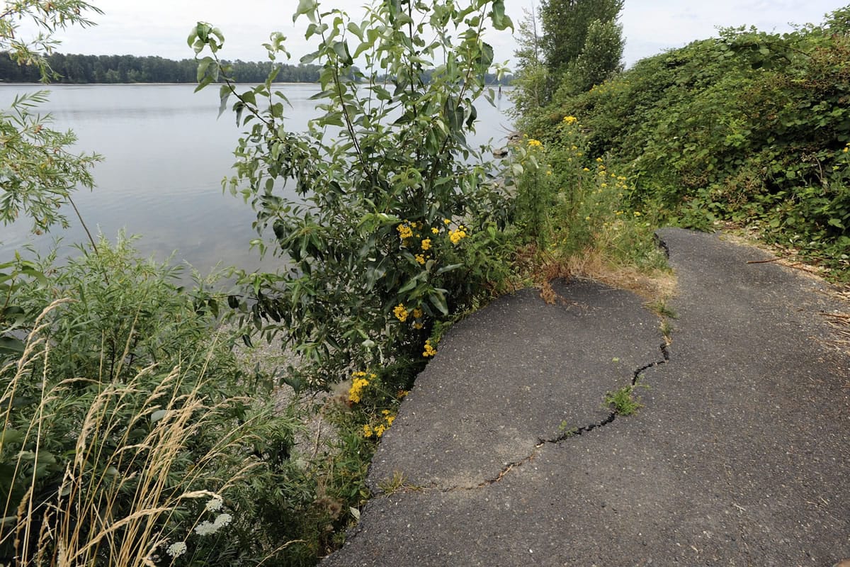
That’s where the state will totally block off access to the last one-third of a mile, which is getting truly dangerous, Kofstad said. The concrete barriers that mark the current dead end of the road will be picked up and moved closer in, he said. They’ll be placed all the way across the road and across about an equal width of adjacent ground, over to a big thicket of trees — preventing anybody from just strolling around them, he said.
The road itself is public property, but all the surrounding land past the gate is private, and the state transportation department — which isn’t in the law enforcement business — wants to discourage trespassing, Kofstad said.
More to the point, the state wants to prevent anybody from edging up to that sheer dropoff and accidentally tumbling about 15 or 20 feet down — either onto scrubby lower shoreline that’s already littered with crumbling asphalt and sagging vegetation, or into the water itself, Kofstad said.
“We just don’t know if the ground would give way right under your feet” in a number of spots in that last segment, Kofstad said. So it will be off-limits to everybody, including pedestrians and bikes.
Kofstad agreed that waves generated by river traffic contribute to the bank’s erosion. “I don’t know how you stop it. That is commerce,” he said. If it hadn’t been for this year’s drought and the low level of the river, he said, the state probably would have taken this step sooner.
Treece said he’s been in touch with two clubs that are keenly interested in this remote stretch of road — the Vancouver Audubon Society and Bike Clark County — and they have been understanding about the road’s underlying problem and the need to close the last segment.
“They’ll still have a certain amount of access,” he said.
The gate became troublesome — and controversial for those groups — earlier this year when it was repeatedly closed by unauthorized parties who reportedly drank, littered, fired weapons and made mischief behind it. Cyclists thought the gate had been closed permanently, to all traffic, with no warning.