The Atlantic hurricane season officially begins June 1, but nature often ignores humanity’s best attempts to corral it with the calendar.
There’s a 30 percent chance the Atlantic may churn out the season’s first storm along the U.S. East Coast by Thursday or Friday, the earliest that’s happened since 2007, according to the National Hurricane Center in Miami. If a storm forms, it will likely be a subtropical system, a sort of hybrid between a regular storm and a true tropical one.
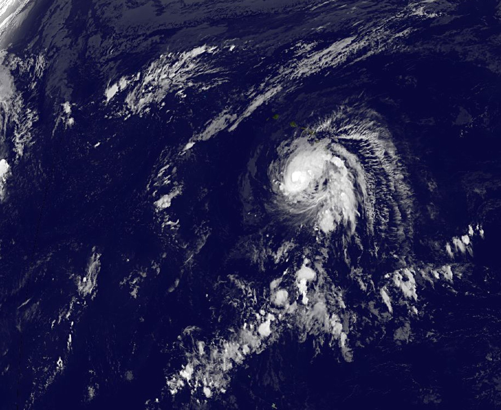
An area of low pressure is moving off North America into the warm ocean waters, and the combination of the two may provide the building blocks for what would be named Ana.
“This is pretty prime example of how they might form early in the season,” said Alan Reppert, a senior meteorologist with AccuWeather Inc. in State College, Pennsylvania.
There’s a pattern to a normal Atlantic hurricane season. In the first few months, storms often form along the U.S. coast from the Gulf of Mexico to North Carolina when a weather front moves into the ocean. Reppert said these storms tend to be weak because they develop close to land and don’t have a lot of time to strengthen.
Later in the season, the main formation area shifts to the coast of Africa near the Cape Verde Islands. This is where some of history’s most deadly hurricanes have begun. At the end of the season, in late October and November, activity is often focused in the Caribbean Sea.
Subtropical Storm Andrea formed on May 6 off the mid- Atlantic coast in 2007, the eighth-earliest in records going back to 1851 and the first May cyclone since 1981, according to the hurricane center.
On May 18, 2013, Tropical Storm Alberto grew out of a system off the coast of the Carolinas, in much the same way that Ana could form.
Right now, the water in the area of the Gulf Stream is about 79 degrees Fahrenheit (26 Celsius), or “just barely warm enough for tropical storm formation,” said Bob Henson, a meteorologist with Weather Underground in Ann Arbor, Michigan.
The current system is forecast to move “generally northward,” the hurricane center said, no threat to oil and gas operations in the Gulf of Mexico. The Gulf accounts for about 4 percent of U.S. natural gas production and 17 percent of oil output.
The hurricane center hasn’t predicted a track for the system. Forecasting models are designed to work with actual storms, and before a system has truly developed a certain amount of fudging has to go into the calculations.
Until then it’s time to sit and wait, and ponder that while the official start of the Atlantic hurricane season is three weeks away, nature isn’t in a waiting mood.