Repairs to the Spirit Lake drainage tunnel are complete, and the conduit is lowering the lake after it rose about 13 feet during a two-month shutdown, federal officials said.
“We’re very happy that the tunnel has reopened,” U.S. Forest Service spokeswoman Sue Ripp said Tuesday.
The agency will now turn its attention to studying an alternative way to keep the lake safe.
Among the many questions that analysis will ask is whether the lake can be safely raised on a permanent basis, or whether it should be lowered further, and what other geological hazards lurk in the area. The National Academy of Sciences will lead the effort, which is scheduled to develop a recommendation by June 2017.
The tunnel normally keeps the lake at elevation 3,440 feet; but it had rose to 3,458 feet since the Jan. 7 shutdown, according to the U.S. Geological Survey. Geologists back in the 1980s considered the lake safe up to 3,475 feet.
Federal officials monitored the lake daily during the shutdown and had plans in place to open the tunnel if needed, but that did not become necessary despite exceptionally wet weather, said Chris Strebig, a spokesman for the Forest Service.
If allowed to rise, the lake would breach a mass of volcanic debris that dammed its old outlet into the North Fork of the Toutle River during the eruption of Mount St. Helens on May 18, 1980. The resulting flood could be catastrophic for the Toutle and Cowlitz valleys.
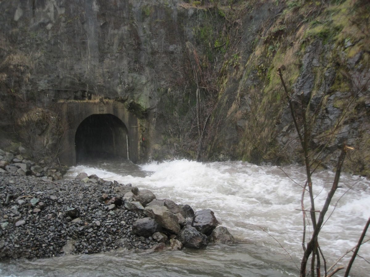
The tunnel, 11 feet wide and about 8,500 feet long, drains the lake into South Coldwater Creek, from where it eventually joins the Toutle’s north fork.
The shutdown enabled a contractor to dig out a portion of the tunnel floor that was rising and restricting the flow. Under a $3 million contract, Catworks, LLC of Battle Ground, also installed steel “ribs” to stabilize that troubled section of the tunnel.
The tunnel has needed about $7 million in repairs since the U.S. Army Corps of Engineers completed it in 1985. The Forest Service now will study whether there are alternative ways to control the lake level.
“I am very appreciative of the U.S. Army Corps of Engineers and Catworks’ efforts to complete these repairs,” Gina Owens, forest supervisor for the Gifford Pinchot National Forest, said in a press release. “With these important repairs completed, we can focus on work with our partners to explore long-term sustainable options in this geologically active landscape.”
In the early 1980s, the Corps evaluated a range of options for controlling the lake, including cutting an outlet across the debris damming the lake. It backed off that plan when local officials howled about putting a channel right beneath the volcano, which was then very active.
The volcano has settled down, but geologists say it will erupt again. And there are other hazards in the area, including earthquakes and flash floods that can break out of the volcano’s crater.
Nevertheless, members of the Northwest congressional delegation now want the Forest Service to re-evaluate alternatives to the tunnel. So the agency has asked the National Academy of Sciences to assemble an independent scientific committee to look at long-term options. The committee will consult interested groups and individuals, hold meetings and publish a report.
Spirit Lake is at the north foot of the volcano in the Gifford Pinchot National Forest. The giant eruption raised the lake surface more than 200 feet, and the new lake bottom is about 100 feet higher than the lake’s pre-eruption lake surface.