Noah would feel right at home in Southwest Washington this spring — severely soggy.
And while rain and snow literally power the Northwest, the wet conditions certainly have put a damper on lots of outdoor activities, hiking among them.
All this moisture has left most of the region’s trails muddy, with boggy pools and rivulets in places, and occasional snow patches.
Significant snow remains even at mid-elevation.
The National Resources Conservation Service reports 13 feet of snow at June Lake, which is only 3,440 feet elevation. The U.S. Forest Service reports 24 inches still at Cougar Sno-Park, lower yet at 2,220 feet elevation.
Even the reliable early-season hiking and cycling places like Coyote Wall and Catherine Creek in western Klickitat County are soaked and muddy.
But it is April, the days are much longer, and it’s time to wait no longer to put on the hiking boots or get the bike out.
So here are a few suggestions for an outing:
Clark County
Moulton Falls — A 2.4-mile trail extends from a trailhead on Hantwick Road east to Moulton Falls County Park along the East Fork of the Lewis River.
The western half-mile or so of the trail is paved and leads to a large pond, including a bench for taking a break. The remainder of the trail is gravel to a bridge crossing the East Fork at Moulton Falls park.
The eastern end of the trail parallels the river and several tributaries cascade down from the steep hillside to the south.
To get there, take state Highway 503 north of Battle Ground and turn right on Northeast Rock Creek Road, which morphs into Northeast Lucia Falls Road. Follow Lucia Falls Road for 5.4 miles to the junction with Hantwick Road. Turn right at proceed .6 mile to the parking lot at the trailhead.
Lacamas Creek — The Lacamas Creek trail starts in Camas and follows the stream for a mile upstream to the dam on Round Lake and Clark County’s Lacamas Park.
Slightly beyond the half-mile point, the trail crosses Lacamas Creek at Lower Falls. Immediately upon crossing the bridge, the trail forks. Take the hard left and climb to a crossing of Woodburn Creek.
The trail ends at the junction with Round Lake Loop trail. Veer to the left and visit the dam that creates Round and Lacamas lakes.
This trail also connects to the Round Lake Loop, encircling Round Lake and adding 1.2 miles.
The lower trailhead is just off Northeast Third Avenue in Camas opposite the intersection with East First Avenue.
Turn in to a small parking lot on the west side of Lacamas Creek. The trail starts about 30 yards to the north at a signed gate.
By adding the Round Lake Loop, this trip can be stretched to 2.8 miles.
Lacamas Park also has several fire roads which can be hiked, adding options and distance.
Columbia Gorge
Historic Columbia River Highway — Whether it is to hike or cycle, the 4.5 miles of Historic Columbia River Highway between Hood River and Mosier on the Oregon side of the Gorge are hard to beat.
It’s paved, wide (10 to 18 feet), scenic and passes through the Mosier Twin Tunnels. There’s only about 330 feet of elevation gain, good parking lots at each end and the cost is only $5 for an Oregon Parks day-use permit.
The twin tunnels, which are 1 mile west of the Mosier trailhead parking lot, are the highlight of the route, which gets as much use by pedestrians as cyclists.
The tunnels were constructed in 1919 and 1920. The west tunnel is 81 feet long. The east tunnel is 288 feet.
The easiest access is the Mosier trailhead, exit 69 off Interstate 84.
Klickitat County
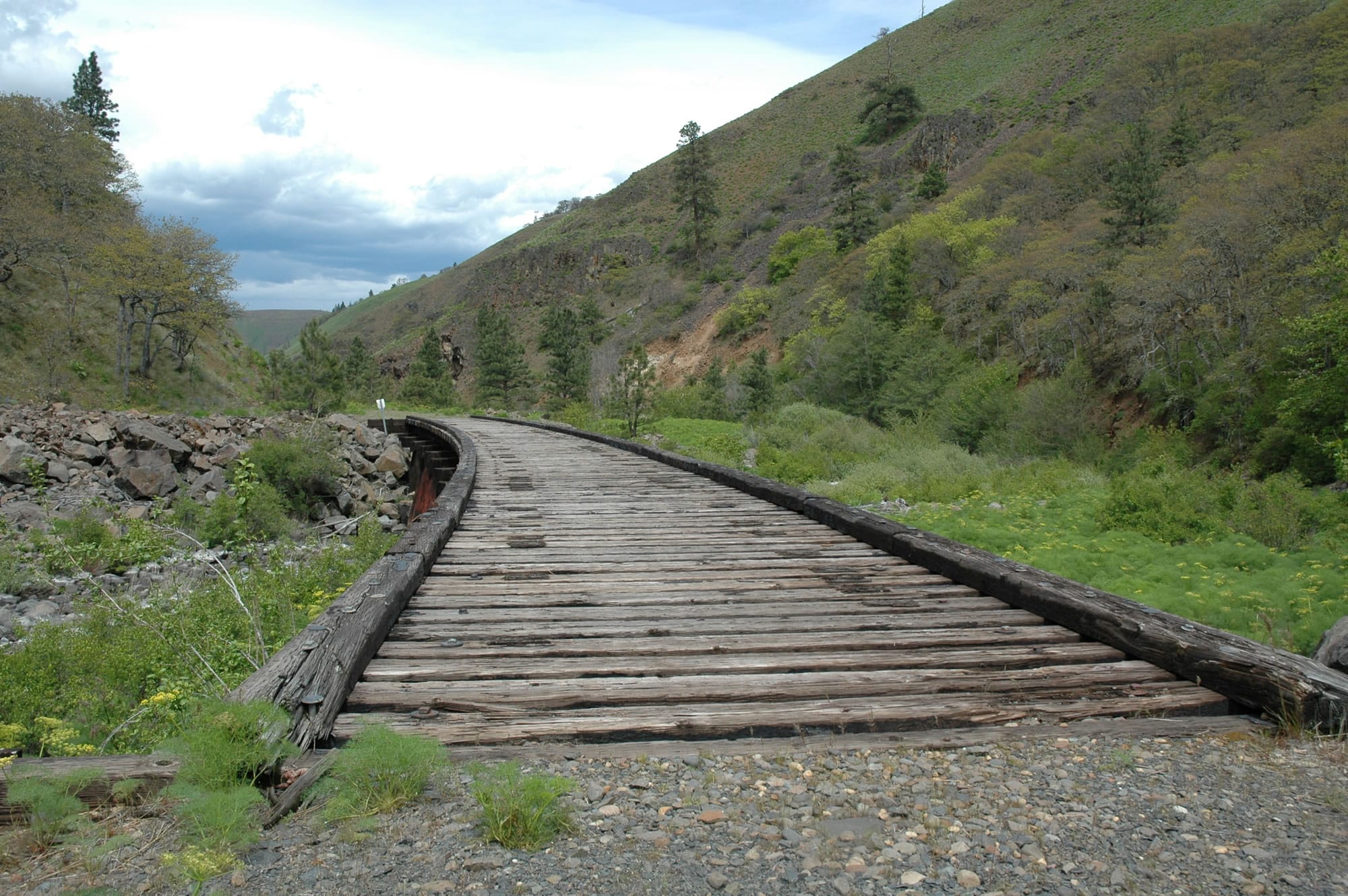
Swale Canyon — Once a railroad route, the Klickitat Trail stretches 31 miles from Lyle on the Columbia River along the banks of the Klickitat River to Wahkiacus, then up scenic Swale Canon ending west of Centerville.
The Swale Canyon portion of the Klickitat Trail is 12 miles, stretching between trailheads at Harms Road near Centerville and Schilling Road at Wahkiacus.
It is used by mountain bikers and hikers alike. The canyon has a remote feel. Eight trestles add interest to the route.
Swale Canyon is good in April and even better in early May, when yellow-colored parsley and balsamroot are everywhere, balanced by the blues and purples of lupine, combining in a showy wildflower display.
To reach the Schilling Road trailhead, follow state Highway 142 from Lyle up the Klickitat River for 16.5 miles to Horseshoe Bend road. Turn right on Horseshoe Bend Road and then turn right again on Schilling Road and the parking lot is obvious.
To reach the Harms Road trailhead, take the Centerville Highway out of Lyle.
Turn north off state Highway 14 between the gas station and cafe in Lyle to get on the Centerville Highway. Follow the highway north and east for 15 miles, then turn left on Harms Road and go north for a half-mile to the bridge crossing Swale Creek.
If not wanting to take two cars, start at Harms Road and hike to trestle 3 at 1.78 miles or trestle 4 at 5.78 miles. But remember, the hike back is all uphill.