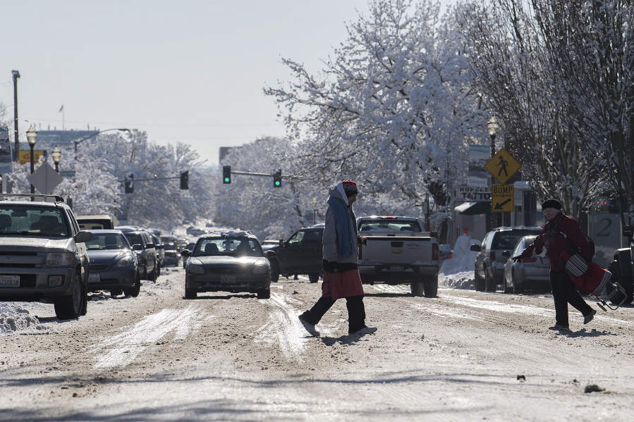
Forecasted heavy precipitation and freezing rain threaten to exacerbate difficult driving conditions in Southwest Washington, according to the National Weather Service.
The weather service issued a freezing rain advisory from 4 a.m. to 6 p.m. Tuesday in Vancouver and the Portland metro area. Temperatures will hover around or dip below freezing in valleys this morning. Freezing rain will likely accumulate for several hours, although temperatures were expected to rise this afternoon.
The weather service predicts a “major ice storm” will hit the Columbia River Gorge, Hood River, Ore., and Wind River valleys and many others in the Gifford Pinchot National Forest Tuesday and Wednesday morning.
However, there is a lot of uncertainty of how Clark County and the rest of Southwest Washington will be affected, Andy Bryant, a hydrologist with the weather service, said Monday.
The area may get between one-tenth and one-fifth of an inch of freezing rain, with as much as a half-inch near the Gorge, forecasters said.
“It could be a real bear for trying to get around,” Bryant said of the freezing rain.
Temperatures are expected to climb above freezing early Tuesday afternoon for west Clark County. But areas east of Interstate 205 likely won’t climb above freezing until the late afternoon or early evening. Areas in the Gorge may stay below freezing through Wednesday afternoon.
A flood watch has also been issued for Vancouver and the Portland metro area and the central and western Columbia River Gorge through Wednesday night due to the rising temperatures, low-elevation snow and ice accumulations, and anticipated rain.
Between 1 to 2 inches of rain could fall on the Vancouver area through Thursday. Temperatures are expected to remain above freezing through the week. The warmest day will be Wednesday, with an expected high of 48 degrees.
The weather service cautions people to expect standing water in some streets where snow and ice block storm drains, potentially swollen creeks and general slushy conditions
Several school districts, including Vancouver Public Schools, announced Monday evening that they will start two hours late Tuesday. Battle Ground Public Schools will start 2½ hours late. Washougal and La Center school districts will be closed. Parents and students are encouraged to watch for potential updates Tuesday morning.
The Vancouver Public Works Department said it will have crews out early Tuesday morning trying to break through the large chunks of ice and snow on the roads.
Public works has also set up two self-serve sand-bag sites for residents concerned about possible flooding expected to follow Tuesday’s rainfall. Sand and sand bags will be available in front of the fence and near the sign at the old Golden Skate building, 4915 E. Fourth Plain Blvd.; and at the public works site at 912 N.E. 192nd Ave. Residents should bring their own shovels.
The city of Battle Ground announced its Public Works Department is going to clear storm drains in the city. But with more than 1,800 catch basins and inlets, they’re asking residents and businesses to help. If it is safe to do so, residents should clear neighborhood storm drains so rain water can flow into them.