BOISE, Idaho (AP) — A conservation group has created maps identifying key landscapes in three Western states most likely to sustain native species amid climate change and is distributing money to protect private lands in those areas through use-limiting easements or outright purchases.
The Nature Conservancy says it has $6 million from the Doris Duke Charitable Foundation that it’s now distributing among land trusts that must come up with five times the amount in matching funds for approved easements or acquisitions.
“We’re protecting lands in the three states that are identified as being resilient,” said Ken Popper, senior conservation planner with The Nature Conservancy. “In the short term, we’re looking at wildlife movements and in the long term movements of habitats. Certainly, the species present will change in the future, and habitat could even shift from forestland to grassland.”
The maps and associated information, called the Terrestrial Resilience and Regional Connectivity reports and maps, cover some 355,000 square miles in Idaho, Oregon, Washington and parts of Montana, Nevada, California and Utah.
Popper said the information is the result of dozens of data sets that include soil maps, vegetation maps, species distribution, moisture, elevation and the locations of roads, power lines, cities and towns. He said the maps, available to the public, took four years to create at a cost of $350,000.
The idea behind the project is for local land trusts to use the information to identify private lands that could be strongholds for species threatened by climate change.
“Those refugia areas will allow plants and animals to adapt to climate change as it occurs,” Popper said.
So far, The Nature Conservancy says, about $4.5 million in grants have been identified to conserve about 70 square miles of private land.
One of the recipients is the Columbia Land Trust that works to conserve land in the lower Columbia River Basin.
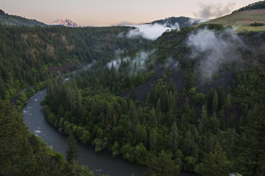
The group is receiving $700,000 to preserve 3,200 acres of the Klickitat Canyon Forest in south-central Washington state along the Klickitat River, which is designated as a Wild and Scenic River. The land is about 38 river miles upstream from where the Klickitat enters the Columbia River.
Cherie Kearney, the group’s forest conservation director, said the land trust was aware of how unique and beautiful the area is with its Douglas firs and ponderosa pines, eagles and falcons and other wildlife, but didn’t have a true understanding of its significance until looking at The Nature Conservancy maps.
“I began to see the Klickitat Canyon as almost a storm cellar,” Kearney said. “This will stay relatively consistent.”
The 3,200 acres contains elevation variations and is also considered a pinch point that connects with federal public land and tribal land to the north. The land is being purchased from the Hancock Timber Resource Group. Kearney said the land trust intends to keep the area open to the public and also continue to pay property tax on that land that’s in a rural area.
The Nature Conservancy has also created a resiliency map for the East Coast, and expects to have a resiliency map for California completed sometime this year, Popper said. Resiliency maps for the Great Plains and Great Lakes area are also in the works, with the ultimate goal of creating maps for the entire U.S.
“Resiliency science is probably the best science related to biodiversity in terms of protecting refugia in the face of climate change that we have,” said Erin Heskett of the Land Trust Alliance, which has about 1,100 land trust members. “To remain relevant over the next 50 to 100 years, we need to employ this kind of science.”