ST. PETERSBURG, Fla. — Florida, Alabama and Mississippi launched emergency preparations Saturday ahead of the arrival of Subtropical Storm Alberto, a slow-moving system expected to cause wet misery across the eastern U.S. Gulf Coast over the holiday weekend.
Cuba was being pounded by rain along its western coast, raising the threat of flash floods and mudslides. The National Hurricane Center in Miami said the island’s rain totals could reach 10 to 15 inches — and even 25 inches in isolated areas.
Heavy downpours were expected to begin lashing parts of Florida, Louisiana, Mississippi and Alabama on Sunday. Tropical storm warnings have been issued for parts of Florida and Alabama, saying tropical storm conditions are possible there by early Monday.
The governors of Florida, Alabama and Mississippi all declared states of emergency ahead of the storm Saturday.
About 5 to 10 inches of rain are possible along affected areas in eastern Louisiana, Mississippi, Alabama, western Tennessee and the western Florida Panhandle. Isolated areas could see as much as 15 inches.
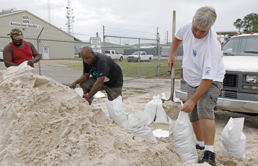
Under overcast skies and occasional drizzle, several Gulfport, Miss., residents lined up to fill 10- and 20-pound bags with sand they will use to block any encroaching floodwater expected as a result of Alberto.
Tommy Whitlock said sandbagging has become a usual event in his life since he lives next to a creek.
“I’m doing this because every time we have a hard rain, it floods at my house,” Whitlock said. “We get water from other neighborhoods, and water can get up to a foot deep in some places.”
Eddy Warner, a retired consultant for a construction company, filled bags while waiting for his nephew to come help transport them home to protect his garage.
“I’m 65 years old and too old to be doing this,” he said, laughing.
Alberto — the first named storm of the 2018 hurricane season that officially starts June 1 — is expected to strengthen until it reaches the northern Gulf Coast, likely on Monday night.
The NWS said waves as high as 18 feet could pound the popular Gulf beaches in Baldwin County, Ala., and northwestern Florida on Monday. A high surf warning was in effect through 7 p.m. Tuesday local time.