COUGAR — The Cougar-to-Beaver Bay trail is too new and perhaps too short to be on regional maps and in guide books.
But the 1.7-mile route adjacent to Yale Reservoir in southern Cowlitz County does have one feature in abundance — stairs.
The trail linking two PacifiCorp parks along the North Lewis River has 290 stair steps scattered along its length.
The trail was finished in September, said Jessica Kimmick, recreation manager for PacifiCorp.
Beaver Bay and Cougar parks will not open until spring, but the trail is available for hikers who are willing to walk in from the extension of state Highway 503.
The trail still needs signs, but will get them in time for the opening of the parks, said Tom Gauntt, media spokesman for PacifiCorp.
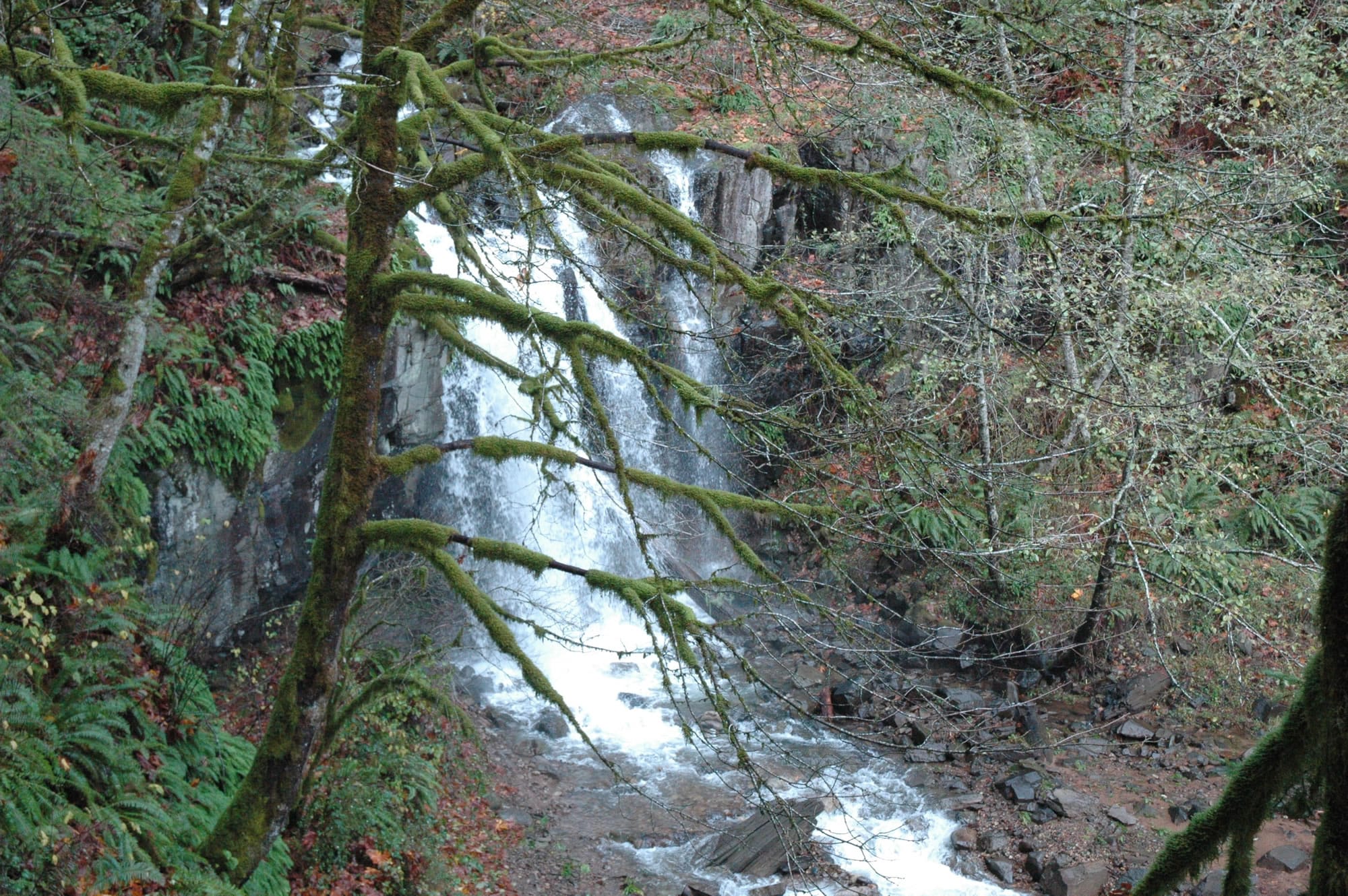
It passes through trees, underneath a power line easement and skirts 35-acre Beaver Bay wetland. The trail has five bridges and crosses several small creeks.
And while the trail has only about 50 feet of elevation change between Cougar and Beaver Bay, there are lots of small climbs and drops, thus the bridges.
“We will be performing maintenance on the trail and hazard tree removal during the off-season, so people should be aware of this and stay out of area where people are working,’’ Gauntt said.
The trail is open only for hiking and is not an Americans With Disabilities Act-accessible trail. Dogs must remain on a leash.
While there are views of Yale Reservoir, there is no lake access.
The Cougar-to Beaver Bay route is one of three hiking opportunities in the reach of the North Fork of the Lewis River including Merwin, Yale and Swift reservoirs.
The two other include:
Marble Creek trail — This is 0.44-mile path along the northern shore of Merwin Reservoir. It begins at Merwin Park and wanders out to a waterfall on Marble Creek.
The trail is ADA-accessible. It is for pedestrian and bicycle use. Dog are to be on a leash.
IP road — The former International Paper Co. road along the east side of Yale Reservoir is a trail in waiting.
PacifiCorp plans a 3.5-mile hiking-biking trail along the former logging truck road from near its bridge across the North Fork of the Lewis River to about the mid-point of Yale Reservoir.
Trailhead directionsCougar Park to Beaver Bay Park trail — Cougar trailhead: Park along state Highway 503 (only room for a couple of vehicles) and walk down the main entrance road into Cougar Park, crossing Cougar Creek and continuing through the park and toward the reservoir.At 0.59-mile from Highway 503 there is a steel rod on the left marking the start of the trail.
Beaver Bar trailhead: Park near the closed gate on the Beaver Bay Park access road (room for a half dozen or so vehicles) and walk down the main road to the campground host site.
Just beyond the host site, turn right into Section A. Walk a short distance and a green sign indicating the trailhead is on the right. Total distance from the parking area to the trailhead is about 0.2 mile.
Marble Creek trail — Park in the Merwin Park lot. The trail starts at a sign along the north shore of Merwin Reservoir.
IP road — The former International Paper Co. road that is destined to become a trail junctions with the main road No. 90 about mid-way along the Swift Power Canal.
The trail will end at a spot informally called Canyon Washout, where several hundred feet of the road was removed in a debris flow during a January 2009 storm.
Storms have destroyed multiple sections of the road and there are slumps, rockfall and other debris on the old pavement.
The road has been closed since 2008, but is open for walking.
Plans call for paving the route, providing parking, a trailhead toilet and an informational kiosk.
The trail will be closed to motorized use.
Todd Olson, director of compliance for PacifiCorp, said the utility is working with the Washington Department of Natural Resources to identify a trailhead location.
Olson said PacifiCorp hopes to have construction under way in 2017.