<img height="1" width="1" style="display:none" src="https://www.facebook.com/tr?id=192888919167017&amp;ev=PageView&amp;noscript=1">
Tuesday,  April 23 , 2024

Linkedin Pinterest
News / Sports / Outdoors

A walk on the wild west side of Mount St. Helens blast zone

Just getting to Castle Lake is frustrating and rewarding

By Matt Coffey, For The Columbian
Published: August 16, 2017, 11:30pm
7 Photos
Castle Lake and Ridge, a view north.
Castle Lake and Ridge, a view north. (Matt Coffey/Rambling Raven Designs) Photo Gallery

As we attempted to decipher a foot path out of the spiderweb of elk trails that sprawled across the slope, I reflected on the term “un-maintained.”

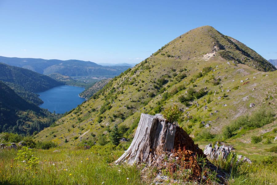
The Forest Service provided that simple warning in its description of the 221 Trail to Castle Lake: “Area Status: Unknown.” We stood on a grassy ridge along the western edge of Mount St. Helens’ blast zone after concluding a fruitless search for the trail. Trail or no, a slowly settling sun and the need for water pushed us to move on.

Far to our right, Coldwater Peak, Mount Margaret and Mount Whittier defined the backcountry that absorbed the 1980 blast. In the distance, the summit of Mount Adams rose above Studebaker Ridge’s sloping shoulder.

Just off to the west, the sound of a hidden waterfall drifted out from a bowl at the apex of the ridge we stood on. A gentle wind bounced brown grasses and Indian paintbrush around our feet as the declining sunlight bent the scene’s hues toward red. On that 4,000-foot ridge it was difficult to summon any frustration for the disappearing trail and the thirst.

We had started our walk earlier that day on the 238 trail from Blue Lake. More than once since the eruption Mount St. Helens has sent a blast of meltwater past Blue Lake. One recent blast cut the Forest Service 8123 road near the lake, and brought an end to the easy access to the west side once provided by the northern Sheep Canyon trailhead. A later blast in 2006 made a mess of the 238 trail, and swirled the lake into chalky turbidity.

Because of these two blasts, the trail can be a bit tricky to navigate. The old trail ran in a straightforward manner from the end of the 8123 trail, across Coldspring Creek on a standard foot bridge, and followed the creek to the lake. Today, the footbridge lies on its side where the storm threw it, halfway to Goat Marsh, and the short walk from road to lake can be a fun scamper over small creeklets.

I was pleasantly surprised to find that the lake has returned to its picturesque emerald blue in the years since I last visited. Ringed by trees right down to its banks, the lake is an ideal picnic spot. A sunny, gravelly bank on the southeast corner sits near a nice view of Mount St. Helens and the Domes. All is just a short walk from the trailhead.

From Blue Lake, the Toutle Trail spends two miles winding its way uphill through the shady, green dense forests so common on the western slopes of the Cascades. By the end of the second mile, the forest on the right side of the trail briefly gives way to a grassy meadow sloping away from the trail.

At this intersection with the 237 trail, two meadows appear along the 238 as it follows the base of a ridge and begins to descend into Sheep Canyon. After such a big snow year, both meadows shown a vibrant green between retreating patches of July snow.

Sheep Canyon is a short lava chute that directs a Toutle River tributary on its way west. Unlike the Toutle River Valley a few minutes farther on, Sheep Canyon has a well maintained bridge to cross its small gorge. The 238 drops again soon after the bridge, meeting the Loowit Trail 216 as both descend into the Toutle River Valley.

Crossing the Toutle is a mini-adventure in itself. The trail climbs down into and back out of the valley, the only places along the circumnavigational Loowit Trail where ropes are advisable.

The 1980 eruption threw massive mud flows down the Toutle River. Thirty-seven years after the eruption, the effects of these mudflow are something you can physically experience hiking the Loowit.

Passing the river, we plod our way up a mile of sweeping switchbacks into the blast zone. Large fields of grass and scattered, diminutive trees increasingly give way to rock as the eye drifts east into the devastated pumice plain. Tracing the Toutle’s course high up a looming Mount St. Helens, I feel small. Forming the headwaters of the Toutle River, the Talus and Toutle Glaciers sit sandwiched between Studebaker and Crescent ridges near the crater rim. The rocky, expansive views and matchsticks of blown down trees sharply contrasts the dense, strong forest covering the distant ridge behind us to the southwest.

It is a little less than a mile between our dusty viewpoint and that healthy forest. These two spots are nearly identical in elevation, temperature, and rainfall, and yet so radically different.

A spur of the Loowit trail, the 216G, departs west from a switchback corner. A weathered grey wood post identifies both trails. The 216G traces a short, western path through scrubby trees before disappearing into old logging roads on the top of the ridge. Periodic grey posts promise to guide us along the trail to Castle Lake, but instead peter out within a half mile, leaving us to pick our own path. The map maintains that the 221 trail descends the eastern slope of the ridge through the grassy benches below us. Eventually, it should meet the eastern fork of Castle Creek, following it to the lake three miles away.

We shuffle slowly down a likely path, choosing our steps and trying to not spook a herd of cow elk eyeing us just a few hundred yards away. Within a few minutes, the crumbling trail, alder-choked drainages, and increasing slope convince us to find a new way.

Regaining the ridge top, I find myself curiously unperturbed by our navigational dilemma. If not for a lack of water and a goal to reach the lake, I could sit for days on the ridge, absorbing this scene. Strawberry vines crisscross the ground here and there, an approaching sunset percolates to the left, the entirety of the blast zone unfolds on our right. We take a break, consult the map, and decide to stay high. The contour lines promise a reasonable descent down the back side of the ridge, and we can see an old road bed disappearing around a fold of the main hill.

Our gamble pays off, and we enjoy an hour-long saunter along the road bed, picking around trees and small washouts. The old road continues around the west side of the ridge, eventually depositing us back on the main spine, now north of the steep summit hill. As we progress, the Mount Margaret backcountry, pumice plain, and Mount St. Helens progressively come into view again, adding themselves to the scene of Castle Lake and a setting sun.

Fallen trees and occasional elk slow our progress as we drop further toward the lake. Periodic stands of deciduous trees grow into thickly vegetated forest as the lake shore draws close. The campsite proves somewhat disappointing, no views of the blast zone and difficult shore access.

The next morning, we begin the hike back, resuming the quest to find the 221 trail. After two hours of slow progress, bug-filled marshes, faint footpaths, and teasingly intermittent wood posts, we gave up on the 221 for the second time. Hot and thirsty again, we gladly splashed across Castle Creek and began a straightforward walk up a pumice ridge back to the Loowit Trail.

Morning Briefing Newsletter envelope icon
Get a rundown of the latest local and regional news every Mon-Fri morning.

The two mile, 1,200-foot climb up to the Loowit turned out to be a pleasant stroll through trees, mountain views, more strawberries, and elk herds. Another welcome water break at the 216, another crossing of the Toutle, and we were on our way home.

Castle Ridge was worth the work. Although Castle Lake and the 221 trail proved frustrating and a bit disappointing, discovering the ridge was worth the effort. The ability to experience open ridges, solitude, expansive views, and the transition between robust ecology and volcanic devastation will bring me back to the ridge in the years to come.

Loading...