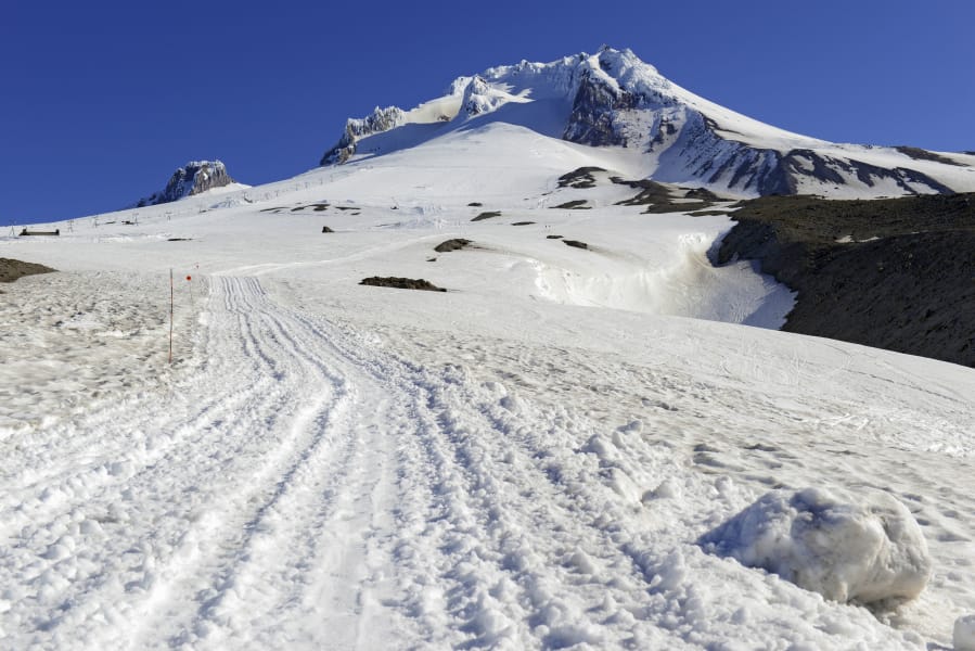
BEND, Ore. — A hefty early season snowpack in the Central Oregon Cascades has many skiers and snowboarders eager to explore the backcountry this winter.
And due to the COVID-19 pandemic and increased parking restrictions at ski resorts like Mt. Bachelor, more and more folks are expected to seek the solitude, freedom and fresh powder that the backcountry provides.
“Anecdotally, numbers have been increasing exponentially,” says Bend’s Kevin Grove, a board member for the Central Oregon Avalanche Center. “And we’re really anticipating a lot of backcountry users this winter, because the ski resort is a little more restricted, you need a parking pass, and also just the overall growth in population of Bend. When there’s no indoor sports, more and more people are recreating outside. And potentially more people who don’t have a lot of experience in the backcountry.”
Just in time for this surge in backcountry use, the Central Oregon Avalanche Center (COAC) is transitioning to a Type 1 avalanche center, with the goal of eventually providing an avalanche danger rating seven days per week for the Central Oregon Cascade Range.
The nonprofit COAC, founded in 2009, was officially recognized as a Type 2 avalanche center in 2017 and has been issuing two weekly observations over the past five years or so on its website coavalanche.org.
This season the center plans to provide an avalanche danger rating four days a week, Friday through Monday.
The COAC will use the North American Danger Scale which runs from 1 to 5, 1 being Low and 5 being Extreme. The center pays four professionals (two forecasters and two observers) to analyze and report the conditions at select areas in the Central Oregon backcountry. Skiers, snowboarders, snowmobilers and climbers can then use that information to make decisions about if, when or where to go.
“It’s really giving our users a better story and understanding of what’s happening in the mountains, and to help them make better-educated decisions as to where they might be thinking about going, or if they probably shouldn’t be going, and whether the avalanche hazard is increasing or decreasing over time,” Grove says.
Grove, an engineering professor at Central Oregon Community College, says the goal of the COAC has always been to become a Type 1 center, like the Northwest Avalanche Center, which serves the Washington Cascades, the Olympic Mountains and Mount Hood.
The forecasting zone for COAC runs from Mt. Bachelor north to Tam McArthur Rim, the Three Sisters and Santiam Pass. Grove says the center would like to eventually offer reports for the Mount Jefferson and Three Fingered Jack areas, as well as Paulina Peak, located east of La Pine in the Newberry National Volcanic Monument.
“That’s definitely a hot zone,” Grove says of Paulina Peak, where a number of avalanche fatalities have occurred over the last decade.
But the COAC does not yet have a sufficient weather station at Paulina to offer avalanche forecasts.
Bend’s Aaron Hartz is a backcountry ski guide and one of the professional forecasters for COAC, as well as a board member. When Hartz goes into the backcountry as a forecaster, he analyzes the snowpack, looking for weakness in the layers and how the wind has redistributed the snow that could lead to unstable slabs.
He combines that information with weather forecasts to offer an avalanche forecast and a danger rating for the next day on the website, along with other descriptions of the avalanche problem such as the type, likelihood and size.
“Statistics have shown that when the rating is right in the middle (3: considerable) that’s when backcountry users get into trouble,” Hartz says. “They’re not scared by it, and the skiing is probably good. But even on high-danger days, you can still go out into the backcountry as long as you stay out of avalanche terrain, which is slopes that are 30 degrees or steeper. You can find low-angle terrain, like the trees on Tumalo Mountain that come down to Dutchman Flat Sno-park.”
Hartz says there are nine different types of avalanche problems, two of which are the most frequent in Central Oregon winters: wind slabs, in which the wind redistributes the snow, and storm slabs, in which a fresh layer of snow sticks together but is not well-bonded.
In the springtime, the most common avalanches are caused by loose, wet snow, or cornice breaks, according to Hartz.
Hartz says the four-person COAC team tries to cover as much terrain as it can in the Central Oregon Cascades, and often where the observers and forecasters go depends on the weather conditions.
“A lot of times the observers just go where they can,” Hartz says. “If it’s really stormy, maybe we’ll just go to Tumalo Mountain or Todd Lake. If the weather’s better, we’ll go to Broken Top or the Three Sisters. This winter we’ll try to get out more to the Santiam Pass area.
“We’re a lower-budget avalanche center right now. We don’t have the funding to do this every day, but we are slowly increasing our fundraising.”
COAC is a community-funded nonprofit, and much of its funds come from the $40 annual fee from its members, according to Zoe Roy, development director for COAC.
“We provide and offer a service to members and nonmembers alike, but we’d love to see everyone who utilizes COAC contributing,” Roy says. “We may be offering a forecast four out of seven days of the week this year, but it is going to take a group effort on behalf of our whole backcountry community to keep this up and enable us to make the jump to offering a forecast seven days a week.”