With gyms closed, maybe you’ve found a love of walking during the coronavirus pandemic.
Maybe you’ve walked the Burnt Bridge Creek Trail, Salmon Creek Trail or the Columbia River Dike Trail more times than you can count.
Maybe you’re in the mood for a new trek — something with solitude and beauty but without uneven footing or big elevation gains.
The Yale Reservoir Logging Road Trail might be what you’re looking for.
Known also as the Old International Paper Road, the decommissioned paved logging road hugs the south shore of Yale Reservoir east and south of Cougar. It’s a flat, scenic and sparsely traveled route for walkers or mountain bikers looking for solitude without working hard to get there.
It has been more than a decade since logging trucks trundled along the road now managed by PacifiCorp. From an unmarked gate near the reservoir’s upper end, the route heads downriver for 3.75 miles until it ends at a large washout.
The first half mile of the trail is a gentle descent through the forest to the reservoir.
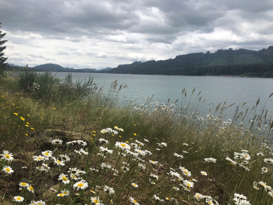
From there on, the route provides frequent water views from Yale Reservoir’s south bank. Scotch broom and wildflowers are common along the way, especially pink and lavender foxgloves growing more than six feet high.
While water views dominate one side of the trail, the other direction offers memorable scenes as well. On three occasions, creeks cascade through narrow, heavily forested gorges before passing through culverts under the trail.
Though mostly paved, the trail requires walkers to navigate some small debris slides. This is accomplished with little difficulty, however.
The trail ends where a washout in 2009 carved a 100-foot gash in the road. A creek babbles through the washout and into Yale Reservoir, making a nice setting for a mid-hike lunch.
Getting there
Drive east along Highway 503 to Cougar, which is about 40 miles from Woodland. Continue another two miles past Beaver Bay Park and the power station on the North Fork of the Lewis River.
After crossing the river, take the first right onto an unmarked gravel road and cross a long one-lane bridge. After the bridge, veer right and drive to an unmarked gate blocking vehicle traffic. Park on the side of the road, but don’t block the gate.