BEND, Ore. — Cyclists willing to brave cold temperatures can still find premium mountain biking trails in Central Oregon, even in the depths of winter.
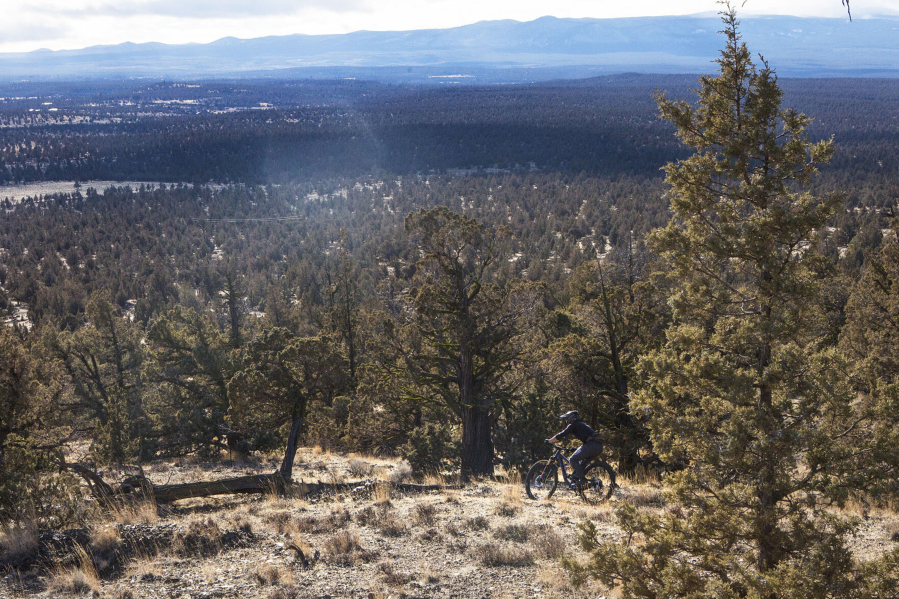
Sprawling High Desert views, thrilling terrain and quality wintertime dirt make Cline Buttes west of Redmond a popular destination for mountain bikers. Miles and miles of user-built trails line the juniper-filled slopes in the area.
The myriad trails on Cline Buttes, including a narrow singletrack path that wraps around the buttes and a few downhill trails that start from the top of the highest butte, are part of the Bureau of Land Management’s 32,000-acre Cline Buttes Recreation Area.
The singletrack that circles around the buttes for a 10-mile out-and-back ride is my favorite route in the area.
The trailhead on the south side of Cline Buttes is located just off Cline Falls Highway between Tumalo and Eagle Crest Resort and across the highway from the Maston trail system, also part of the recreation area.
Last Tuesday, I started out rolling through juniper trees and sagebrush as the singletrack trail became steeper along the south butte. The trail was completely frozen, and parts of the trail were blanketed in frost. It was 28 degrees when I started out, but my body warmed quickly as I climbed.
I turned left onto a rocky road, then picked up the singletrack again to the right after climbing a few hundred yards.
The singletrack narrowed to almost 10 inches in spots, and to my right was a fairly treacherous drop-off. Redmond, Smith Rock State Park and the snow-covered Ochoco Mountains sprawled out to the east, and soon I turned west as I wrapped around the north butte.
The trail transitioned downhill as a I headed to the west side of the buttes, where a cluster of enormous homes have been constructed on the hillside to provide a staggering view of snow-covered mountain peaks.
Much of the Cascade Range of Oregon was visible on the clear day with minimal clouds, all the way from Mount Hood to the Three Sisters.
The singletrack on the west side of Cline Buttes is special, not only because of the view of the Cascades towering over an endless expanse of juniper trees, but also because of the rolling, side-hill character of the trail.
The trail continued around and eventually connected to a gravel road that leads to the summit. I pedaled hard up the steep road, determined to reach the top.
Surrounding the summit of the butte, at 4,067 feet, is a barbed-wire fence that protects a radio facility, and three extremely technical downhill trails can be found after riding for a bit to the right of the fence.
The downhill trails are for advanced riders only, and riding the original singletrack as an out-and-back route is an option for those who want to avoid the challenging downhill.
I headed back down the way I had come along the gravel road and then onto the pristine singletrack.
The ride back was fast and tricky, as I had to negotiate the narrow singletrack and the steep drop-off to my left. I made it back to my car about two hours and 11 miles after starting, fairly tired but wanting to add more miles. So I crossed the highway and headed to the Maston area — a mostly flat network of singletrack — for another three miles of riding to make for a 14-mile outing.
All in all, the ride required 2 hours, 15 minutes and included nearly 1,500 feet of elevation gain — and some of the most dramatic views and dynamic terrain on the High Desert of Central Oregon.