SPOKANE — Spring, and all its showers, is here.
Which means it’s the perfect time to hike in Washington’s shrub lands — a unique ecosystem west of Spokane that, despite its seemingly drab appearance, features a smorgasbord of life: wildflowers, golden eagles, mule deer, burrowing owls, too many grasses to count and, of course, shrubs.
All together, more than 200 species of birds, 30 species of mammals and numerous reptiles, amphibians and insects live in and depend on Washington’s shrub-steppe habitat, according to the Washington Department of Fish and Wildlife.
The shrub lands are also geologically impressive, the glaciated coulees and channels testaments to the power and breadth of ice age floods.
There is no better place to get a taste of this ecological and geologic diversity than Northrup Canyon, near Grand Coulee Dam.
The hike starts at a Washington State Parks trailhead and gently winds its way up the canyon. There are 3-, 6- and 8-mile variations.
Hiking to the old Northrup homestead (more on that later) is three miles roundtrip, but continuing another 1.5 miles to Northrup Lake is well worth the effort.
The canyon itself is a geologic marvel. The steep basalt cliffs were carved during the ice age floods and the entire depression was likely once a glacial lake. Smaller granite bedrock hills dot the canyon floor. Known as roche moutonnees, these outcroppings are generally rounded on the uphill side and have steeper cliffs on the downhill side, a vestige of a moving glacier yanking away blocks of granite bedrock.
According to research done by Andrea Balbas, a professor at California State University, the granite bedrock was exposed by ice age floods about 15,600 years ago.
More recently men building the nearby Grand Coulee Dam camped in the canyon. You will pass a large pile of trash, rusted cans among other things. This is historic trash, remnants from the workers, which is why State Parks has left it there.
After 1.5 miles you will come to the Northrup Homestead. The oldest of these buildings was built in the 1890s by the Northrup family. The Northrups raised livestock and farmed a variety of crops, including fruit trees which are still around today. Northrup Creek is just one of a handful of perennial creeks in the Columbia Plateau. At the same time the canyon walls protect the entire area from the coldest winter winds and the hottest summer sun. The soil is rich, possibly a remnant of the glacial lake sediment that collected here.
All of which made it a relatively habitable place to live. The Northrups lived in the canyon until 1926.
Past the homestead, Douglas firs and Ponderosa pines appear, the only forest in Grant County. From the homestead, it’s possible to continue hiking to Northrup Lake, an additional 1.5 miles. This small lake offers decent rainbow trout fishing and is popular with fly fisherman. The lake is beautiful and reminiscent of an alpine lake, surrounded as it is by steep cliffs.
From here it’s a 3 mile hike back to the car.
However, about a mile past the homestead look for a less distinct trail on the left.
A key landmark? A large round fence post wrapped in barbwire. This single track trail heads slightly up hill and will take you toward the southern canyon cliff which looms over the parking lot. The trail cuts toward the cliffs and then gains elevation, eventually bisecting the Old Wagon Trail. It’s also possible to hike up the Old Wagon Trail directly from the trailhead.
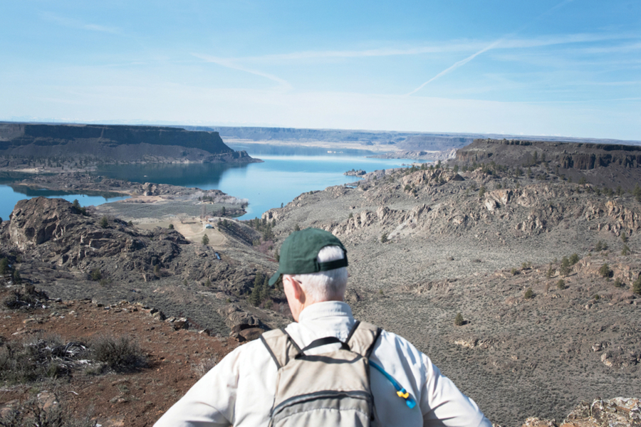
Either way, this trail takes you to the top of the canyon rim and provides beautiful views of Banks Lake. The trail, as the name suggests, is an old wagon road and was used to transport fruit and food from the farms in the canyon to people living in the Hartline and Almira areas. The road is also know as the Scheibner Grade after another family that lived in the canyon.