BEND, Ore. — The volunteers with the Central Oregon Trail Alliance have done it yet again: They’ve built new trails that further enhance the mountain biking mecca here on the High Desert.
Redmond has previously been an underserved area for premium singletrack, but that is changing. The latest new trails in the area include 12 miles of singletrack just west of Eagle Crest Resort, accessible from the Cascade View Trailhead.
I made the half-hour drive from Bend to the area earlier this month, not really knowing what to expect. I was pleasantly surprised with an intricate trail design of various loops that mixes flowing singletrack with technical rock areas, and just the right amount of climbing.
Add in the sprawling views of snow-covered Cascade peaks, and these trails are worth the trip.
The Cascade View Trailhead is located off Eagle Crest Boulevard, which is accessed from Highway 126. The trail system is open to non-motorized users and includes about 7 miles of trails open to horseback riders, hikers and runners in addition to the bike trails. The pedestrian and equestrian trails are separate from the mountain biking trails to reduce conflicts.
A map of the area is available at bendtrails.org.
I started out on the Blue-Belly Stem trail, which is a green (easy) trail, and enjoyed smooth, rolling singletrack through the hilly, juniper-laden area.
After about half a mile, I passed through a gate used by local ranchers who graze cattle in the area. Gates must be closed securely after passing through.
After the Blue-Belly Stem trail, the network continues south with basically three loop options: Blue-Belly Loop, Stinger West-East, and Jack Rabbit Connector.
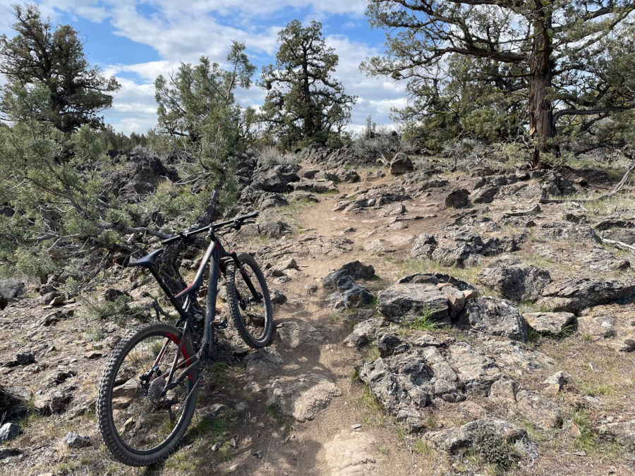
At the first junction, I turned onto Stinger West, a blue (intermediate) trail, and immediately encountered a rocky, technical section. I was able to roll over it with relative ease on my full-suspension bike. The area features many such sections, most of which are fairly easy to ride through. But I did decide to walk my bike through some more-challenging rocky areas.
I continued on to Stinger East and began making a climb along switchbacks on the west side of Cline Buttes.
The ascent was challenging but not overly difficult, and the view of the Cascades to the west was sublime. They dominated the horizon, including Tam McArthur Rim, the Three Sisters, Mount Washington, Three-Fingered Jack and Mount Jefferson.
Eventually, the trail looped to the north back toward the trailhead. I rode the east side of the network back, enjoying the descent along both technical and flowy sections.
The area is still relatively unknown; I encountered only two mountain bikers and two trail runners during the 12-mile ride, which included about 500 feet of climbing and took about 1 hour, 45 minutes.
The Cascade View Trailhead should serve to take some of the demand away from the nearby Maston Area off Cline Falls Highway, which has become an extremely popular winter and spring mountain biking spot.
Trails in the area should remain in decent condition with the recent stretch of cold weather and snow, but as summer approaches, they will likely become increasingly sandy.