BEND, Ore. — Some trails in Central Oregon never lose their luster no matter how many times you ride them.
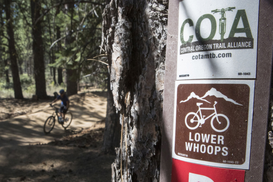
The Lower Whoops Trail is one such trail.
Tucked into the Phil’s Trail network, the downhill-only Lower Whoops Trail is located about five miles west of Bend. The trail is about two miles long and includes large tabletop jumps, smaller jumps and bermed corners.
As singletrack trails have expanded west of Bend during the past several years with many free-ride flavored trails in the Wanoga network, Whoops has remained a staple among the mountain-biking masses on the High Desert.
Earlier this year, Lower Whoops was closed for five days a week due to thinning operations in the area by the U.S. Forest Service, so it had been some time since I had ridden there.
Because Lower Whoops is only two miles long, I like to ride it as part of a longer loop. So I made a plan recently to start from the Cascade Lakes Welcome Station off Century Drive west of Bend and incorporate the Ticket to Ride, Voodoo and Pinedrops trails into the outing.
Ticket to Ride is a 6-mile loop rated as “easy” that can be accessed from the welcome station. I started out counterclockwise on the loop and turned onto the Voodoo Trail after a couple of miles. This trail led me downhill and I turned onto Ben’s Trail after a couple more miles.
A steady climb up Ben’s led me to Forest Road 300, the bottom of Lower Whoops. The area had changed dramatically since I was last there. The Forest Service’s project created much more open areas in what previously had been thick Ponderosa pine forest. The logging operations were designed to improve forest health and fire resiliency in that area of the Deschutes National Forest, according to the Forest Service.
To reach the top of Lower Whoops, mountain bikers have a couple of options. They can ride the Forest Service Road 310 uphill to junction 29, the top of Lower Whoops, or ride the singletrack Pinedrops Trail up to the top.
I opted for Pinedrops, and although it was a bit of a grueling climb, the trail made the uphill grind more enjoyable than taking the dusty dirt road.
Once I reached junction 29, I started down Lower Whoops, cruising through the bermed corners and catching a decent amount of air on the smaller jumps, but slowing on the taller tabletop jumps to avoid over-committing myself in the air.
The Central Oregon Trail Alliance — a volunteer-based group that helps develop, protect and enhance our local trails — has been improving the Whoops Trail for nearly 20 years. The area near Whoops was logged in the 1930s and ’40s, according to longtime COTA member Kent Howes.
The Whoops Trail was built in the late ’80s and early ’90s along these furrows, which were transformed into small jumps along the trail. The trail has evolved with the work of COTA ever since. Lower Whoops is chock-full of free-ride features but remains approachable for beginners while also providing enough jumping opportunities for more aggressive riders.
After riding Lower Whoops, I took Road 300 downhill and turned east onto Phil’s Trail. From there, I rode the Voodoo, Voodoo Child and Ticket to Ride (west portion) back to the Cascade Lakes Welcome Station.
It was a sort of double-loop ride that ended up being about 16 miles with about 1,000 feet of elevation gain. The ride was an intriguing mix of trails, highlighted by Whoops, which has stood the test of time.