BEND, Ore. — Even in the depths of a somewhat harsh winter, hikers in Central Oregon can find trails that remain relatively dry and snow free.
Areas east and north of Bend offer several ideal options for hikers now through spring.
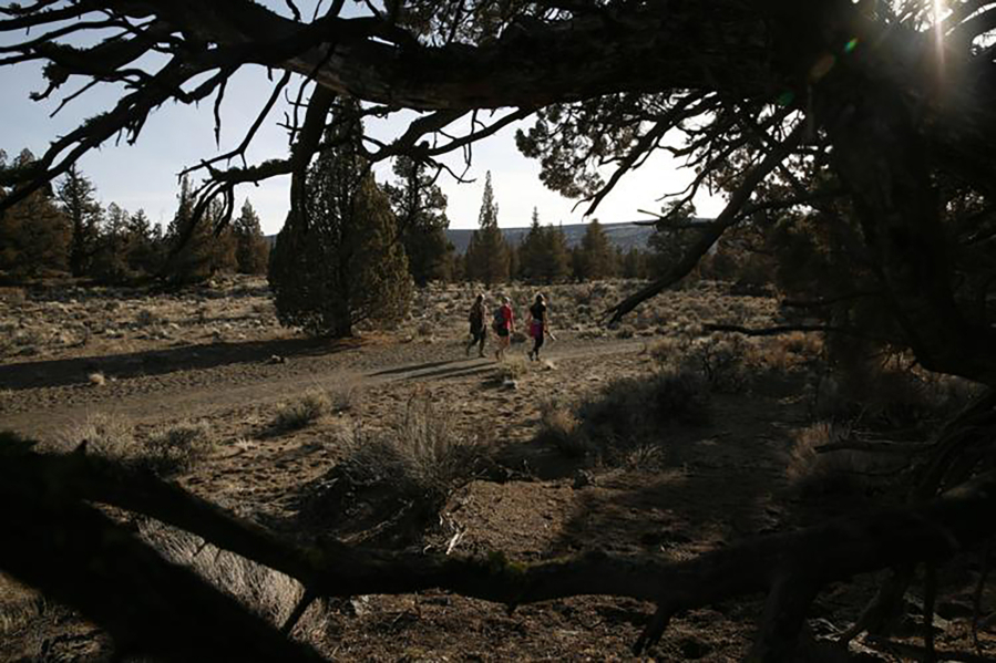
One such area is the Badlands, a 30,000-acre wilderness named for its barren desert landscape. Because it is dotted with twisted, old juniper trees and intricate rock formations in stark contrast to the spectacular mountain scenery found elsewhere in Central Oregon, the Badlands is not on the top of every hiker’s list.
I think the true gift of the Badlands lies not in the scenery or the terrain, but in the opportunity it offers to lose yourself in the quiet serenity of the high desert.
About 16 miles east of Bend is the Flatiron Rock Trailhead, directly off U.S. Highway 20. This trail is one of the most popular in the Badlands because of its accessibility and its intriguing rock shapes.
Most of the wilderness consists of the rugged Badlands volcano, which, according to the Bureau of Land Management, left behind thick basaltic lava flows.
Centuries of windblown volcanic ash and eroded lava formed the sand that covers the flat areas of the lava fields.
Walking the trail among junipers and sand, hikers can take the time to appreciate the detail of the gnarled juniper branches. Some of the juniper trees in the Badlands are more than 1,000 years old, according to the Oregon Natural Desert Association.
The Oregon Badlands Wilderness Act was signed into law in 2009, permanently protecting the Badlands.
The 3-mile trek to Flatiron Rock is a rambling stroll that can take about an hour.
Rising out of the sand in the middle of the Badlands, Flatiron Rock is an outcrop with rock walls that are lined by a few short trails. The rocks feature holes and gouges that were formed by ancient lava flows. Some of the rocks form jagged, strange arches at the top of the outcrop where sections of rock reach out to connect to one another.
On a clear day on top of Flatiron Rock, hikers can see northeast across the Badlands to the Ochoco Mountains and west to the snow-covered Cascade peaks.
A short loop around the top of Flatiron Rock allows hikers to view the various rock formations up close. The Bureau of Land Management website describes Flatiron Rock as an oblong-shaped moat offering a lunar-like hiking experience.
Past Flatiron Rock, the trail continues to the north boundary of the Oregon Badlands Wilderness.
Gray Butte
While Smith Rock State Park is one of the most popular areas for winter hiking in Central Oregon, nearby Gray Butte offers a climb to its summit and does not attract nearly as many visitors.
The drive from Bend north to Skull Hollow Campground just southeast of Gray Butte is about 45 minutes. The campground is a launching point for mountain bikers, horseback riders, hikers and trail runners. (Hikers looking to reach the summit of Gray Butte can start from Skull Hollow for a longer trek, or approach the climb from the north via the Gray Butte Trailhead.)
Along the trek from Skull Hollow, hikers reach an area known as “the saddle,” where the Cole Loop Trail connects with the Gray Butte Trail and the dirt road to the summit. This climb becomes increasingly steep.