CASCADE LOCKS, Ore. — If you’ve ever driven I-84 east from Multnomah Falls, you may have spotted bicycles pedaling a few feet off the road.
But motorists miss most of what those cyclists see, including a 1915 bridge and highway viaduct hidden in the woods.
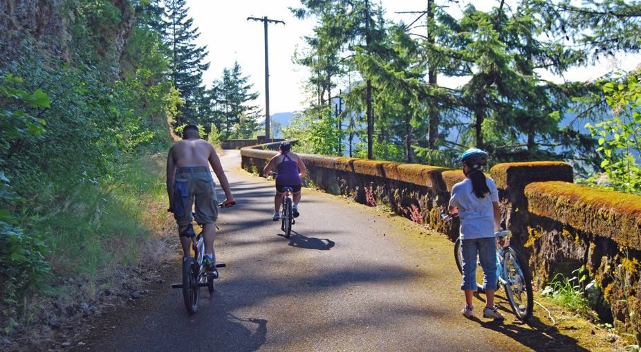
Oregon’s Historic Columbia River Highway State Trail meanders next to the freeway, providing glimpses of history along with a family-suitable excursion.
The winding highway linking Portland and The Dalles was built between 1913 and 1922.
Starting in the 1950s, the freeway was pushed through, obliterating parts of the older, narrower road.
Though motorists can still drive on the original highway in places, such as near Multnomah Falls, about half of the old route was abandoned and left to go wild.
But in the 1990s, Oregon’s parks and highway departments started resurrecting the abandoned pavement and viaducts for use by walkers and bicyclers.
Today, two segments are open.
The best place to start is the 4.6-mile route between Hood River and Mosier. It’s several hundred feet above the freeway and passes through two tunnels.
However, the 3.5-mile route between Tooth Rock and Cascade Locks has its appeal, too.
The Tooth Rock trail’s personality changes frequently. You’ll pedal though deep woods for a few minutes, only to coast down a hill and find yourself parallel to the freeway, separated from it by a sturdy concrete barrier.
The western end of the trail starts at the Tooth Rock Trailhead just off Exit 40, which is also the exit for Bonneville Dam. There’s no charge to park.
For the first few hundred yards, the bike trail doubles as an access road to a BPA transformer station, then gets narrower and starts to climb. After about half a mile, you reach the architectural high point of the trail, the Tooth Rock viaduct.
Road builders devised the viaduct to traverse a cliff rather than blast through the rock. Stop at a turnout built of the original stonework and gaze over Bonneville Dam.
The trail then descends to a decidedly non-original structure — a set of stairs three stories high, in two sections but still fairly steep. The stairs have troughs for bike tires— you reach over to push your bike on the way up, then roll your wheels on the way back down.
The bike lane then hugs the shoulder of a freeway exit ramp and skirts the Eagle Creek hatchery operated by the Oregon Department of Fish and Wildlife.
Visitors are welcome to ride around the tanks and watch the thousands of coho fingerlings forming fishy balls in the ponds.
The trail then heads away from the freeway and rises a few hundred feet to pretty little Ruckel Creek, where flat rocks provide a good place to stop and snack.
The path descends back downhill, and a tunnel provides a route under the freeway.
From there, it’s another half mile or so to the town of Cascade Locks, where the trail ends at a busy parking lot underneath the Bridge of the Gods across the Columbia River.
A much more pleasant place to pause is Cascade Locks Marine Park, which is a few minutes’ pedaling through town. The park has a grassy island next to the river, accessible by a foot/bike bridge.
A cafe next to the park serves food and drinks.
Back at the Tooth Rock trailhead, you can extend your trip by riding the opposite direction (west) for 1.3 miles to the Moffett Creek Bridge.
Though this section of trail stays close to the freeway and isn’t particularly scenic, the 1915 bridge is a must-see for architecture buffs.
Plaques here and elsewhere share the route’s history.
When new, the 170-foot span was an engineering marvel, the longest flat arch bridge in the country.
You can behold three generations of bridges: The 96-year-old bridge, the 1950s structure which carries I-84 westbound, and the handsome, stone-surfaced eastbound freeway bridge that was finished last year.
You can ride across the historic bridge and peer from the dizzying height before the trail ends in a thicket of brush, at least for now.
The Oregon Department of Transportation and other agencies have drawn up plans to open up another 1.6 miles of trail west to Warrendale, which would require a major structure next to the freeway.
Elsewhere, another 8.5 miles of trail construction has been planned, including a new Mitchell Point tunnel with windows through the rock, just like the original “Tunnel of Many Vistas” had.
By the time the viaduct and scenic wonder highway turns 100, the goal is to allow bicyclists to go all the way from Troutdale to Cascade Locks without braving the freeway.