As Vancouver is expected to waken Thursday to a blanket of low-elevation snow, forecasters warned area residents to be prepared for it to stick around for a while.
Cold temperatures are expected to remain in place into Saturday, with overnight lows dipping into the teens in Southwest Washington. That makes it more likely that today’s difficult commute could be duplicated on Friday, especially if melting snow freezes overnight.
o The Washington Department of Transportation advises motorists to check local conditions here, or call 511.
o Officials remind drivers to slow down, leave plenty of space between vehicles and give plenty of room to snowplows, whose blade is often wider than the lane it’s plowing.
“We’ll be left with a cold air mass Friday and Saturday,” said Tyree Wilde, warning coordination meteorologist for the National Weather Service in Portland.
State transportation crews are working 12-hour shifts around the clock, said Abbi Russell, spokeswoman for the Washington Department of Transportation in Vancouver. She said a total of eight trucks equipped with snowplows and a chemical de-icing agent are available to treat major highways in Clark and western Skamania counties, including Interstate 5, I-205 and state Highway 14.
Snowfall was expected after the evening commute on Wednesday, giving workers an opportunity to treat the roads unfettered by heavy congestion.
“If we get the snow overnight tonight, our crews can get out there and work on it when the traffic is light,” Russell said late Wednesday afternoon. “But it’s not an exact science, so we want drivers to prepare.”
School officials throughout Southwest Washington were planning early wake-up calls today.
“We’ll be up early, 3:30 to 4 a.m.,” said Gary Thomsen, transportation manager for Evergreen Public Schools in east Vancouver. “I’ll have people, including myself, drive the roads. We usually have to make decisions by shortly after 5 a.m. to get it out to the media.”
Superintendent John Deeder, who often drives the roads with Thomsen, ultimately makes the call whether or not to call off school for the day.
“He’ll want to know how the buses are faring, and we’ve got to always consider that we’ve got a lot of high school kids that drive themselves to school,” Thomsen said. “It’s kind of a no-win situation. You’ve got a certain amount of the population that want us to go no matter what, and others want to let everybody out of school with the first snowflake.”
Hockinson schools Superintendent Mike Grubbs can empathize.
“I’d much rather err on the side of being too quick to close it down, rather than not quick enough,” he said. “If I’m getting criticism of closing it down too late, then somebody’s been hurt.”
Grubbs oversees a district that ranges from the Cascade foothills to the county’s floor, so he’s become adept at understanding meteorological science and the vagaries of winter weather conditions in Western Washington. Accurately predicting low-elevation snow and ice is a notoriously iffy proposition, particularly in east Clark County, where warmer weather systems from the ocean sometimes collide with cool interior air blowing through the Columbia River Gorge.
By Wednesday afternoon, Grubbs said the forecast appeared as close to certain as it gets in these parts.
“I’m looking for a pretty significant event,” he said.
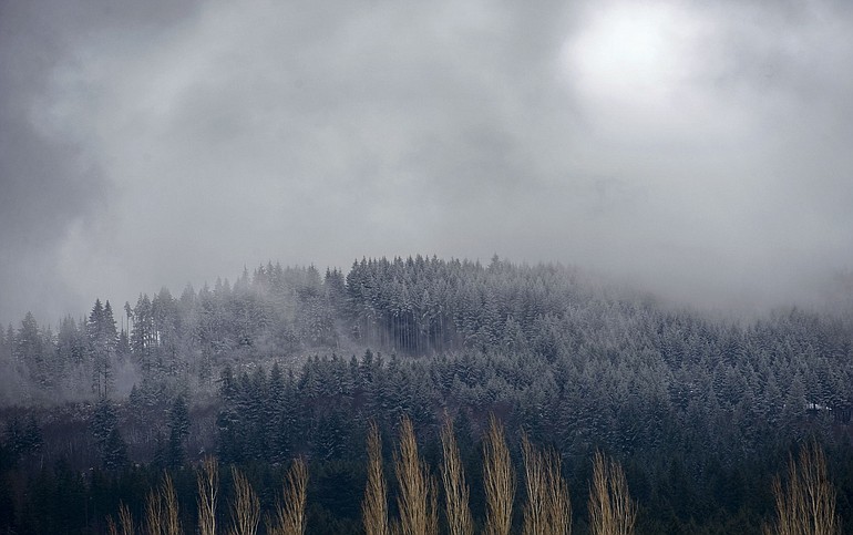
Forecasters anticipated 1 to 2 inches on Clark County’s floor Wednesday night and early today, followed by another inch or two generated by snow showers today. Up to 7 inches of snow is possible in the hills above 500 feet, according to the National Weather Service. Wilde, the weather service forecaster in Portland, said things should dry out by Friday and Saturday followed by gradual warming with a new shot of moisture on Sunday.
Beyond that, he said, the threat of localized flooding is a real possibility if the winter wonderland of today transitions into a dreaded rain-on-snow event by early next week.
“It’s always a concern,” Wilde said. “It’s always in the back of your mind.”
In the meantime, the storm should boost a mountain snowpack lagging slightly below average for the date, said Sheila Strachan, a hydrologist with the U.S. Natural Resources Conservation Service in Portland. The snow-water equivalent for the Columbia River basin as a whole stood at 90 percent of average for the date as of Wednesday, she said.
In the mountains, she said, ski areas are already reaping the benefits of the latest dumping.
“It’s light and fluffy and great for skiing,” Strachan said. “We got so much so quickly last week, that’s really good. The lower-elevation ski areas were desperately in need of a new dusting.”