Off Beat: Local mapmaker left his mark with fictitious roadways
By Tom Vogt, Columbian
Science, Military & History Reporter
Published: January 22, 2012, 4:00pm
Share:
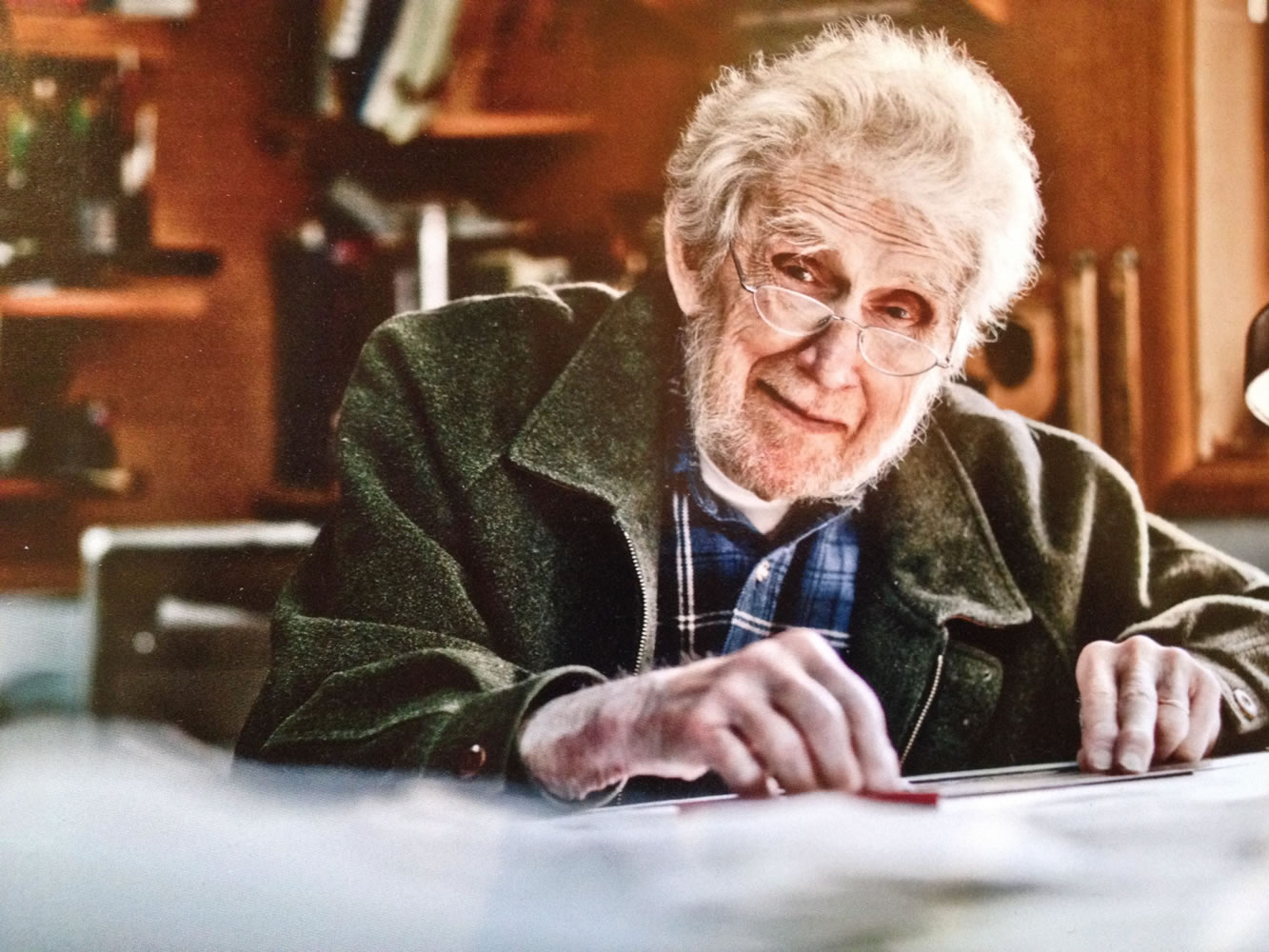
Philip Arnold spent decades as Vancouver mapmaker. He died Saturday, Jan. 14, at age 96.
After Phil Arnold’s death, his family noted how he gave Gov. Chris Gregoire a couple of customized maps featuring some roads that existed in name only: Gregoire Way and Chris Lane.
That presentation in 2005, right after his 90th birthday, wasn’t the first time Arnold charted his course with roads that didn’t really exist.
Some of it was a matter of intellectual property rights; but you can’t overlook how Arnold’s sense of humor would drive his sense of design. And when you find Overlook Drive on a vintage newsroom Arnold Atlas, you can see how it worked out. Just to the southwest of Overlook is a dotted line representing Philjr Road.
In the real world, however, Philjr isn’t a road: it’s the mapmaker’s son, Phil Jr.
“It’s an old-world copyright technique — creating and naming roads that really didn’t exist so he could track who was copying his map,” explained Janice Arnold, the daughter of Phil and Helen Arnold.
“Sometimes they were undeveloped roads that hadn’t been named yet, or he’d just put one in to show that the map was his,” Janice Arnold said after her father’s death on Jan. 14.
The “Mapman” didn’t put anybody in peril with his cartographic whimsies. The route representing Philjr Road is an extension of Alki Road, and the dotted line signifies a roadway that is private, unimproved or drivable only in good weather. And, it’s a dead end, so anybody planning to travel through better be riding a mule.
Apparently, the only person ever confused by the route was a Vancouver city administrator.
According to a story in The Columbian a few years ago, a land-use issue involved an area with the northern boundary of “Philjr Road.”
By way of Argentina
Son Dean’s name was scrambled to “Nead Road,” which was tagged to one of those dotted-line private roads near Norway Mountain, north of Washougal.
The name of the family’s Argentinian exchange student was inked onto a few maps for a while, until the unnamed road was officially named.
“When he had cataract surgery, the doctor was named Stout,” Janice Arnold recalled. “He put a Stout Eyeway on a map. You could see the grin on his face.”
Off Beat lets members of The Columbian news team step back from our newspaper beats to write the story behind the story, fill in the story or just tell a story.
Morning Briefing Newsletter
Get a rundown of the latest local and regional news every Mon-Fri morning.