KENNEWICK — If you love the Columbia River Gorge National Scenic Area for dramatic vistas, you’ll love Wallula Gap just as much.
The Wallula Gap isn’t nearly as well known as the designated national scenic area east of Washougal, but the gap that the Columbia River flows through just south of the Tri-Cities has its own quality of beauty, especially during spring when the grassy slopes show dome green and wildflowers are blooming
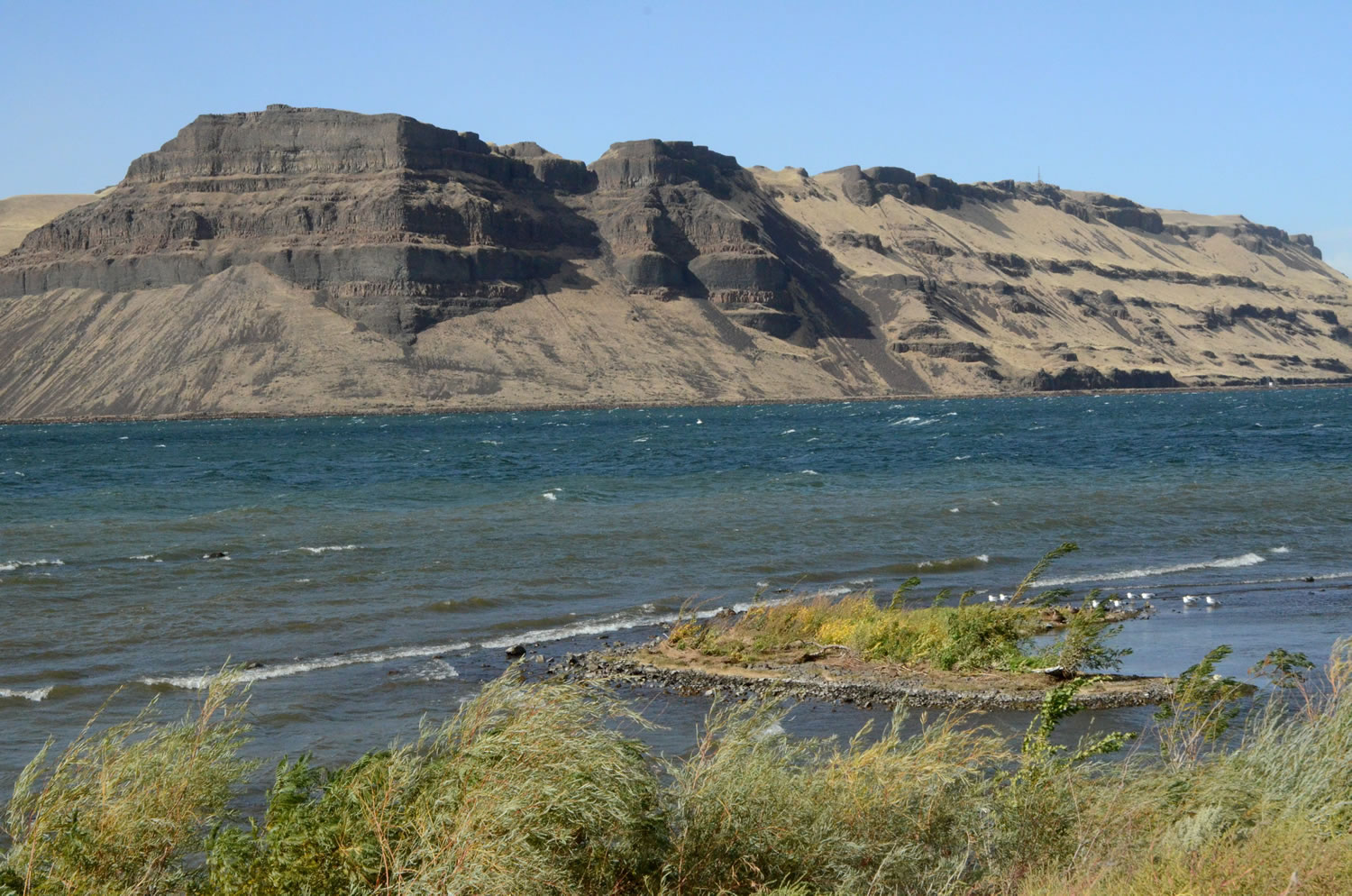
Wallula Gap is a recognized National Natural Landmark, same as Crown Point in the Columbia River Gorge east of Portland. The gap is a narrow constriction of the Columbia, just north of the Oregon border where the great river makes its last southern run, then swings west to complete its journey to the Pacific.
Find the gap by driving S.R. 397 southeast of Kennewick to Finley, a Benton County farm town just up the bench from the Columbia River.
From Finley, keep going southeast on county roads, staying as close as you can to the river. It’s less complicated to follow on the ground than to describe in words. Eventually, the road ends. Park, get out and walk south up to the clifftop for a view of the river from the top.
The public land is a mix of federal, state, county and municipal, but stay off the railroad tracks and don’t enter fenced private lands. This is open country, with no trails. While the cross-country walking can be easy, there are also some very steep slopes to avoid.
It’s open country and you can pick your own route. A description of the hike is on the website hiketricities.com. The twin rock formations, across the river from the top of the gap, are Two Sisters Rocks.
That’s Lake Wallula down below, the reservoir behind McNary Dam. When the ice age floods inundated this part of Washington, the waters backed up at the gap and flooded what became the Tri-Cities with 400 feet of water. Let’s hope it doesn’t happen again.
The gap is best visited in April and early May, when arrowleaf balsam root is blooming. Don’t wait until June, because I found the flowers well past their peak when I visited at that time. The views from atop the gap can be stunningly beautiful, no matter when you visit, but remember that this is a very windy spot.
There is no road that goes through the gap on the river’s west side, though the railroad that carries Amtrak from Portland to Spokane runs on that side. U.S. 730 and U.S. 12 run on the east side, which are the main route between Portland and Walla Walla. The gap starts just to the south from where the Walla Walla River enters the Columbia.