SEATTLE — A satellite tag attached to one endangered Puget Sound killer whale is yielding some valuable information about the migration of orcas in recent days.
NOAA Southern Resident Killer Whale Satellite Tagging: http://is.gd/ejK90i
Federal biologists tracking a 22-year-old whale, known as L-87, say he and others have moved moving extensively through the Salish Sea, circling an island in the northern Strait of Georgia and making appearances in Puget Sound and the central Strait of Juan de Fuca.
“It’s exciting this time of year because of what are we going to learn,” said Brad Hanson, a biologist with the National Oceanic and Atmospheric Administration in Seattle.
He said each year of satellite tagging is filling in more gaps about the winter movements of southern resident killer whales, while also raising new questions about why some travel as far south as Northern California and others may not.
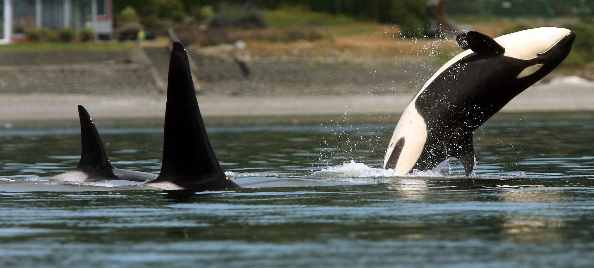
The endangered orcas — which hang out in three groups known as K, L and J — spend a bulk of the summer months in the inland waters of Washington, but scientists are hoping to learn more about where they winter and what they eat.
The satellite-linked tag on a whale on L-87 shows he has been covering about 75 to 100 miles a day since the device was attached on Dec. 26.
Whales tend to travel in the same family group, but L-87, who is named Onyx, is unusual because he has been hanging out another group, or the J pod.
Last year’s satellite tracking of K-25 revealed the orcas traveled long distances, making trips from this region to north of San Francisco before reversing course and heading back north. K-25 made three separate trips as far south as Point Reyes in Northern California, and each time turned around and headed back north.
Hanson’s not sure why. “I’m still scratching my head to understand what it is about these long movements that are important to the whales,” Hanson said.
Biologists know less about the winter migration of J pod than about the two others. Also, what the whales do may differ each year, and what one group of whales does may vary from another, Hanson said.
Tracking the animals in the winter would reveal their range and rate of travel, how far offshore they go and what they eat. The data could lead to designating new critical habitat areas for the whales.
The fish-eating whales were listed as endangered in 2005, and NOAA scientists are working to understand why the small population isn’t rebounding. They face potential threats from lack of prey, toxins and the effects of vessels and noise. The animals number about 81.
The J pod does not appear to travel very far south along the Washington coast nor do they go to Oregon or California like K and L pods, Hanson said.
Last March, with the help of the satellite tags, Hanson and others were able to intercept the whales off the coast of Southern Oregon on the NOAA research ship Bell M. Shimada. They were able to follow the whales as they foraged up the Oregon and Washington coasts.