BROOKINGS, Ore. — The one question I’ve been asked more times than any other revolves around this simple query: “What are the best easy hikes in Oregon?”
It’s not a simple question to answer because some people love mountains and others love coast; some want massive trees and others want high desert.
Plus, what’s easy for one person might not be for another, and the location of the best easy hikes are often spread far and wide across the state.
But if you asked me where the best collection of easy hikes could be found, the answer would have to be Samuel H. Boardman State Scenic Corridor, the most beautiful stretch of Oregon Coast that you’ve never heard of.
It’s a long drive from the Willamette Valley, located between Gold Beach and Brookings on the South Coast, but those who make the journey are rewarded by about 10 easy to very easy hiking options.
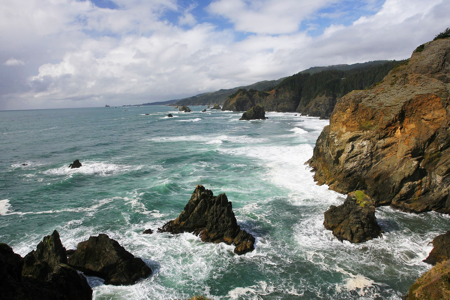
Places with names like Thunder Rock Cove, Secret Beach, Indian Sands and Cape Ferrelo are just a short stroll away at this 12-mile stretch of forested cliffs interspersed with beaches.
Even better than the easy hikes is the weather. This is the land of Oregon’s so-called Banana Belt or “Brookings Effect,” where temperatures occasionally rise much higher than the rest of the coast even in the depths of winter. Sunny, 70 degree days in February aren’t out of the question.
For those coming here for a multi-day vacation (really only way to do it considering the drive), you are also within striking distance of the ancient empire of old-growth redwoods. A short drive will bring you to the Oregon Redwoods and Jedediah Smith State Park.
Come for the stunning coast, stay for trees more than 300 feet tall.
If there is a problem with Boardman — which is named for Sam Boardman, the first director of the Oregon Parks and Recreation Commission (1929-1950) — it’s that there’s so many pullouts, picnic areas and short trails that it can feel overwhelming. Also, the area’s proximity to Highway 101, while it makes for easy access, can lessen the experience of hiking.
These are small gripes, though, because the scenery is utterly spectacular. Below I’ve listed a few of my favorite hikes and a few thoughts on getting there from the Willamette Valley.
Best Overall Hike (Easy to Moderate)
Even though Boardman can feel a bit chopped up, with so many access points and intersections with Highway 101, there are places where you can stay on the trail almost continuously without much interruption.
Such is the case with my favorite trek, a three-mile one-way slice (or six miles out-and-back) from Whaleshead Picnic Area to Thomas Creek Bridge.
The trail passes a multitude of ocean overlooks, crosses the eerie dunes of Indian Sands, and winds past wildflowers and a small waterfall before ending at Oregon’s tallest bridge.
The route begins at a post for the Coastal Trail near the entrance to Whaleshead Picnic Area.
The first 0.7-mile features two outstanding views — the first off Cape Ferrelo to the south and the next a cove to the north. Then the trail hits 101, following the guardrail briefly before heading up a dirt road and going back into the forest.
At mile 1.5 the trail reaches the strange, undulating dunes of the Indian Sands sitting above the ocean. What makes Indian Sands bizarre is that they are not on the beach but perched atop a cliff. The sand comes not from the ocean — as with other dunes along the coast — but from a sandstone seam in the rock strata that has devolved back into sand.
The coolest spot is a deep, narrow rock chasm with surging ocean at the bottom and the sand going right up to and over the cliff edges.
On the far side of the dunes, the edge drops off sharply into the ocean and a small trail tightropes along a cliff, though tunnels cut into the dense mat of coastal plants and nonstop views for the next 0.5 mile.
The trail ends at a viewpoint of Thomas Creek Bridge — at 345 feet, the tallest in Oregon. A spur that climbs to the parking area marks the route’s end.
Best Easy Hikes (north to south)
Arch Rock: Stroll down a short paved path to an overlook featuring a series of seastacks and islands being pummeled by ocean waves.
Secret Beach/ Thunder Rock Cove: From the small gravel parking area at milepost 345.3, you can enjoy an overlook into aptly name Thunder Rock Cove and look in winter and spring for gray whales. Follow a trail a quarter mile down to Secret Beach.
Natural Bridges: A short hike to an overlook of arched rocks being pummeled by the ocean.
China Beach: Black sand between the cliffs makes China Beach one of the most scenic spots on the Oregon Coast. Access can be had from North Island viewpoint (MP 347.5) or the north side of Thomas Creek Bridge (MP 347.8).
Indian Sands: If you’re not interested in the longer hike described in the first section of this story, you can take a very short trail directly down to the Indian Sands.
Whaleshead Beach: There are two access points for this iconic beach — a pullout for Whaleshead Beach and a trail down from the Whaleshead Picnic Area. Both are fairly steep but generally easy. (You can also reach the beach on a beautiful four-mile hike that begins at the Cape Ferrelo Trailhead and goes north along the bluff with many chances to drop down to hidden beaches.
Cape Ferrelo: A one-mile loop circles the top of this famous landmark with ocean views in every direction. A trail rounds the point of the cape, which during spring is covered in wildflowers and in spring and winter makes a perfect whale-watching spot. It’s known to photographers for its sunset views.
Lone Ranch: Not my favorite spot, but a fun little access point to a beach. To climb up Cape Ferrelo from Lone Ranch, cross over Lone Ranch creek and head up the grassy headland.
Others: There are plenty of other view points and short trails. Just drive and find your own adventure.