Cascades Volcano Observatory open house uses trash can, other tools to teach about eruptions such as Mount St. Helens'
By Patty Hastings, Columbian
Social Services, Demographics, Faith
Published: May 2, 2015, 5:00pm
Share:
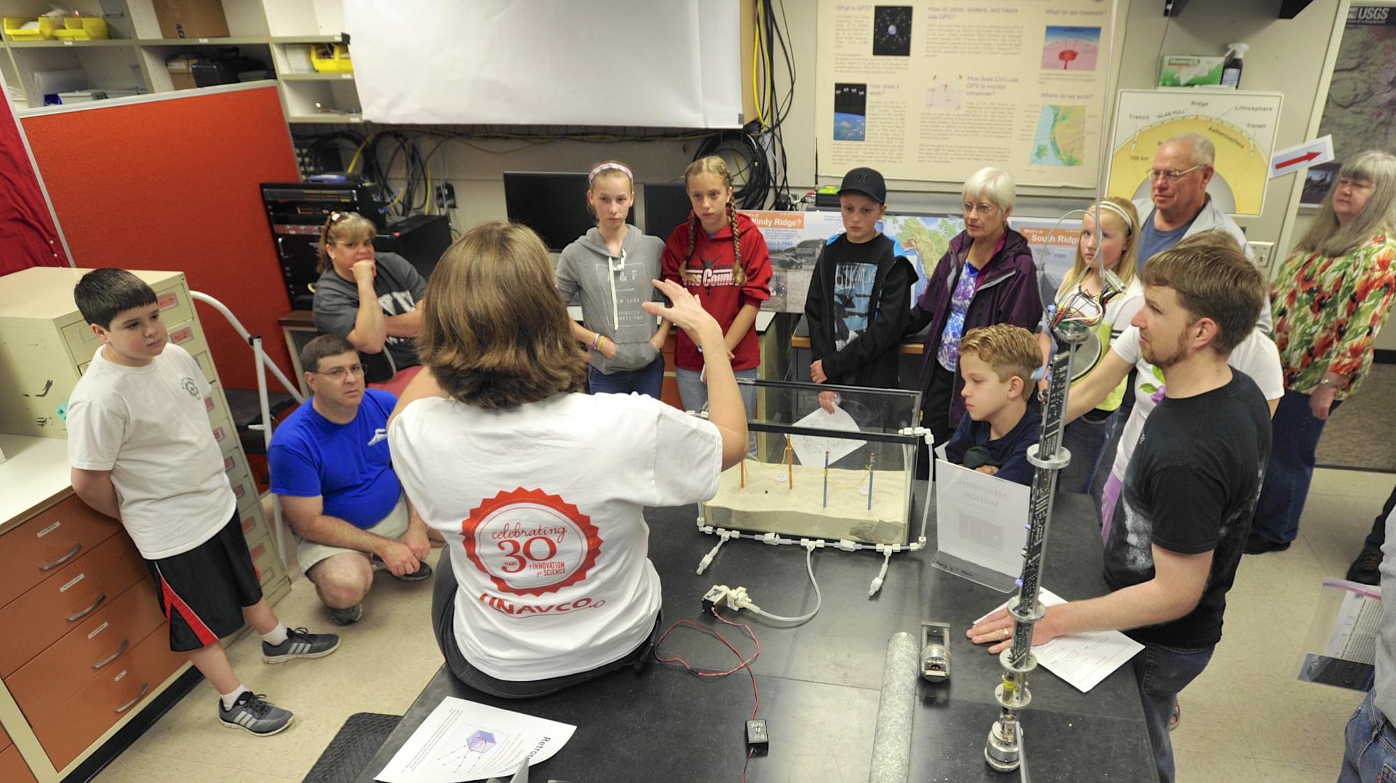
Outreach specialist Beth Bartel talks about how scientists measure the changing shape of a volcano during the U.S. Geological Survey's open house at the Cascades Volcano Observatory in east Vancouver.
“Trashcano?”
“Trashcano!”
“Which way to the trashcano?” visitors asked scientists as they walked through the U.S. Geological Survey’s Cascades Volcano Observatory in east Vancouver. During Saturday’s open house, it was clear which demo drew the most intrigue.
A sizable crowd gathered in the warehouse parking lot and watched as a volcanologist poured liquid nitrogen into a plastic soda bottle, screwed the cap on tight and set the bottle in a trash can of water. The liquid nitrogen, a gas, wants to expand but can’t inside the confines of the bottle.
“It’s the same principle that drives volcanic eruptions,” said volcanologist Alexa Van Eaton.
After a few seconds of anticipation … BOOM! Water and pink and red balloons shot out of the trash can.
A pair of children — eager to help with the experiment — traced a chalk outline showing how far the material dispersed. The pink balloons, filled with mostly air and water, represented lightweight pumice; the heavier red balloons filled with water represent the denser materials, known as lithics, that can shoot out of volcanoes during an eruption, said volcanologist Heather Wright.
After an eruption, volcanologists measure pumice layers to help determine how high and how far the eruption pushed materials. Debris reached Montana about 6½ hours after Mount St. Helens erupted in 1980, Wright said.
Jennifer Adams and her son sat in front to get a good view of the trashcano.
“We thought we’d check it out and geek out with the scientists,” Adams said. She was visiting Vancouver from out of town and took her 5-year-old son, who’s fascinated by volcanoes.
Learning how volcanoes work and identifying hazards is the crux of the volcano observatory, which monitors the Cascade Mountains as far north as Mount Baker near the Canadian border and as far south as Crater Lake in southern Oregon.
There hasn’t been an open house in five years, said spokeswoman Carolyn Driedger. One was scheduled for 2013 but didn’t happen due to budget restraints. Saturday gave researchers a chance to show off what they’ve been working on and the technology they use to learn more about the Cascades. It also happened to fall a couple weeks shy of May 18, the 35th anniversary of the 1980 Mount St. Helens eruption.
“As the memory of Mount St. Helens declines, we want to get the message across that this is an active volcano,” Driedger said.
Magma is rebuilding inside the mountain’s chamber, which is pushing the landscape upward and outward, she said.
“We have a very small but measurable change in elevation,” Driedger said. She saw the eruption in 1980 while driving to the mountain for work. “I remember what it was like. Society was not prepared for a volcanic eruption.”
John Ewert, the lead scientist at the volcano observatory, said that what scientists do doesn’t matter if the information doesn’t get out to the public. The Vancouver site also houses the Volcano Disaster Assistance Program, which responds to volcano crises around the world.
“Volcanoes, if we’re watching, give us ample warning,” Ewert said.
Technology used by researchers to measure activity has improved immensely since 1980.
Forward-looking infrared imaging systems, otherwise known as FLIR, show the temperature and structure of the lava that can’t be seen by the naked eye. The technology, which is hooked up to a helicopter, can scan the volcano and show where the lava is moving, said research geologist Jim Vallance.
That wasn’t available in 1980. But, it was around when there was activity inside Mount St. Helens between 2004 and 2008. During that time, magma gradually squeezed out of the top, kind of like toothpaste coming out of its container. FLIR allowed researchers to measure the lava building and moving inside the dome.
“It’s really getting a lot easier than it used to be,” Vallance said.
Morning Briefing Newsletter
Get a rundown of the latest local and regional news every Mon-Fri morning.
Support local journalism
Your tax-deductible donation to The Columbian’s Community Funded Journalism program will contribute to better local reporting on key issues, including homelessness, housing, transportation and the environment. Reporters will focus on narrative, investigative and data-driven storytelling.
Local journalism needs your help. It’s an essential part of a healthy community and a healthy democracy.