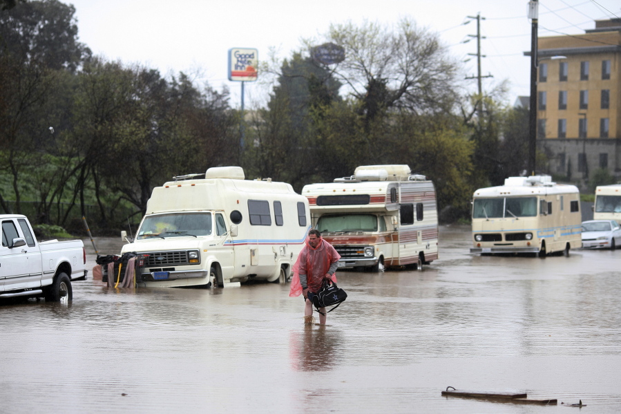
SAN FRANCISCO — Forecasters issued flash flood warnings Monday throughout the San Francisco Bay Area and elsewhere in Northern California as downpours swelled creeks and rivers in the already soggy region.
The National Weather Service said heavy rain could persist into the evening and was expected to cause flooding on the Carmel River in Monterey County and Coyote Creek in Santa Clara County.
In the San Joaquin Valley, residents were patrolling levees for signs of danger, reviewing evacuation plans and filling hundreds of sand bags as the San Joaquin River kept rising.
The weather service issued snow and wind advisories, including a flash flood warning for the Soberanes burn area in Monterey County. It said winds could reach 60 mph in the San Francisco Bay Area.
Santa Cruz County had seen 2.8 inches of rain in 24 hours and could see up to 8 inches before the storm passes today. Marin County got 2.3 inches of rain while close to an inch fell in San Francisco.
Forecasters said rainfall in San Francisco has already surpassed the normal annual amount for the water year that begins in October.
The city has logged 24.50 inches of rain since Oct. 1, said forecaster Bob Benjamin. The average rainfall for the year ending Sept. 30 is 23.65 inches.
A pre-evacuation advisory was issued for a community in Madera County after water discharges from Bass Lake were increased and threatened to swell rivers, officials said.
The Fresno Bee reported that the order was issued for several roads near downtown North Fork, about 10 miles from the lake.
The sheriff’s office said residents should be ready to leave quickly if conditions worsen.
In the mountains, the weather service forecast heavy snow in the Lake Tahoe area with a high avalanche danger until today in an area of the Sierra Nevada from Yuba Pass to Ebbetts Pass.
Forecasters say the winter storm could drop up to 5 feet of snow in areas above 7,500 feet while lower elevations could see between 8 and 24 inches of snow.
Forecasters advised motorists to avoid travel in the area through today.