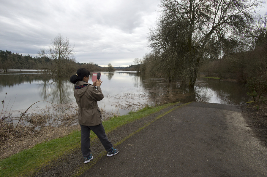
If you like walking through the Salmon Creek Greenway, consider this week a good opportunity to explore some new trails.
Parts of the trail near Northwest 36th Avenue are currently underwater, thanks to some minor flooding in the Columbia River that has backed up into Salmon Creek. While it can be discouraging to those wanting to get out on a sunny spring day, the situation is hardly unusual.
“It can happen several times a year, when we have conditions like we’re experiencing right now,” said Bill Bjerke, parks manager for Clark County.
Salmon Creek flows into Lake River, which flows into the Columbia. When the Columbia begins to flood its tributaries begin to choke. But Bjerke said the situation along the trail isn’t dangerous or damaging.
The water is slowly making its way through the area; in fact, the trail is designed to be submerged on occasion. But it is an inconvenience for those who like to walk, run or ride along it.
“It gets up to six inches (deep) possibly,” Bjerke said. “People turn back around so they don’t get their feet wet.”
There are no structures along the low portion of the trail, which stretches 3.2 miles from Klineline Pond west to Northwest 36th Avenue. The easternmost mile or more is still dry, as are the softball fields.
Other popular low-lying areas, including La Center Bottoms, Frenchman’s Bar and other parks along the Columbia, can be inundated when the river is running this high, Bjerke said.
The lowest parts of the Columbia River Waterfront Renaissance Trail are also underwater.
The National Weather Service has a flood warning in effect for the Columbia River in Southwest Washington. In Vancouver, the river is expected to hover in the minor flood stage between 16.3 and 18.85 feet through Saturday, and possibly longer.
Until the river subsides, information about some new paths is available by visiting the county parks website, www.clark.wa.gov/public-works/parks-and-trails.