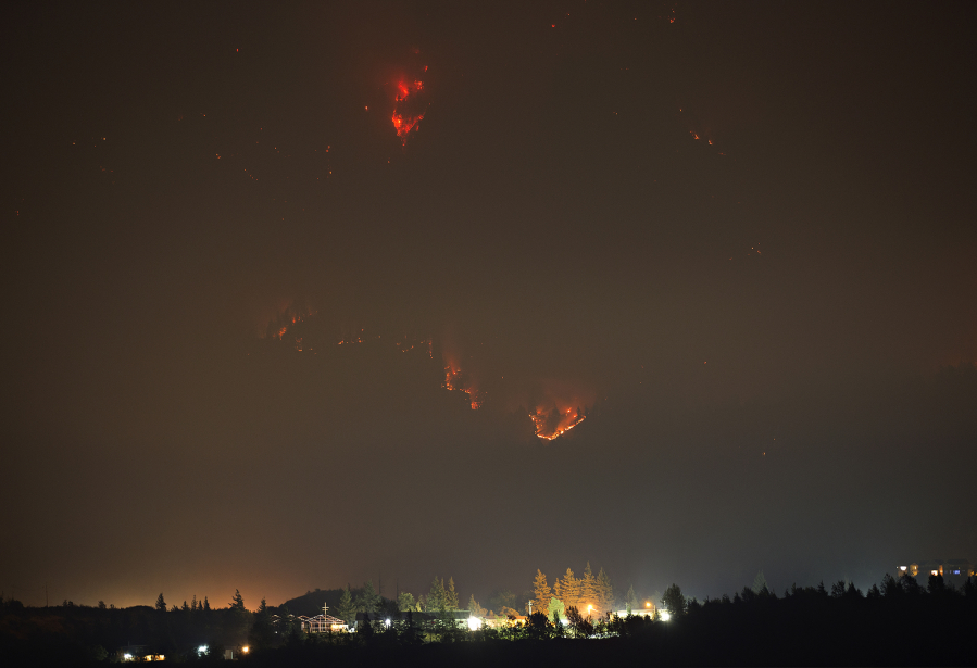
The Archer Mountain Fire in Skamania County grew to encompass roughly 209 acres as of Friday morning, but shifting winds pushed it away from nearby properties, and the weather has given fire crews a bit of an advantage.
The Skamania County Sheriff’s Office announced Friday that Deville Road West is at a Level 3 (go) evacuation level. However, it also announced further downgrades to its evacuation notifications for the entirety of Archer Mountain Road.
Archer Mountain Road to Deville Road, Franz Road, Smith-Cripe Road and are now at a Level 2 (be ready) evacuation level.
Mabee Mines Road and its tributaries are at a Level 1 (be alert).
Thus far, the fire is about 10 percent contained.
Thursday’s cool and humid conditions also bought crews time to reduce fuels along the fireline and extend it along the east and west side of the fire.
About 98 firefighters, nine engines and dozers are working in steep, rugged terrain to suppress the blaze.
The fire is burning on U.S. Forest Service and state Department of Natural Resources lands about 10 miles northwest of North Bonneville, north of state Highway 14. The goal for fire crews is to keep the fire east of Archer Creek, south of the Bonneville Power Administration transmission corridor, west of Duncan Creek and north of a pipeline that runs through the area.
Highway 14 remains closed to commercial trucks between mileposts 19 and 82. Interstate 84 remains closed on the Oregon side of the river.
The public is urged to avoid discretionary trips into the Columbia River Gorge so emergency officials can have optimum access. Those who do travel to the Gorge are urged to stop at designated areas only, not along highway shoulders.
The cause of the Archer Mountain Fire remains unclear. Officials believe it was ignited by an ember from the Eagle Creek Fire carried across the Columbia River very early Tuesday morning.
That fire was allegedly caused by a 15-year-old Vancouver boy on Sept. 2. Willamette Week reported Friday that Oregon State Police obtained video footage, shot by one of the boy’s friends, showing him throwing a smoke bomb into the brush from the Eagle Creek Trail.
Eagle Creek Fire
Firefighters have contained about 7 percent of the Eagle Creek Fire, which is burning on about 33,400 acres and is considered the top-priority wildfire in the nation.
Because of increased fire activity on the fire’s east side, the Hood River County Sheriff’s Office placed new Level 1 evacuation orders from Collins Road in Dee to I-84 on the north end as well as all areas west of Country Club south to Reed Road, running due south to Oregon state Highway 281, continuing along 281 to Milepost 12.5, then following the Middle Fork of the Hood River until it comes parallel with the south end of Collins Road.
The current level 2 evacuation area on the northeast half of Cascade Locks was extended east to Viento State Park, including Wyeth, Ore.
Elsewhere on the fire, cool weather, high humidity and a west wind slowed fire activity.
Relative humidity reached 100 percent Thursday night, and low clouds appeared in several areas around the fire.
However, night crews saw some fire growth on the ridge above Cascade Locks.
On Friday, fire crews focused on protecting structures on the western, eastern and southern flanks of the fire, especially near Bridge of the Gods and the Bull Run watershed.
More than 900 fire personnel are battling the blaze.
Gifford Pinchot fires
Two other fires burning in the Gifford Pinchot National Forest, the East Crater Fire and the Bear Creek Fire, were also slowed by the cooler conditions.
Crews made some headway on the Bear Creek Fire on Thursday by completing an initial fire line and laying hoses around it.
As of Friday afternoon, the fire hadn’t grown beyond 35 acres. In the coming days, crews will further improve the fireline and begin perimeter mop-up.
It’s burning in a steep landscape 3 miles northeast of Carson. Although it’s a small fire, it’s a high priority for the Forest Service because of its proximity to the community’s water supply.
The East Crater Fire grew slowly over the last couple of days and is estimated at 467 acres. Some areas are actively burning while others have little to no intensity. Over the next few days, crews will be working to prepare nearby roads as firelines to minimize the fire’s spread beyond the wilderness.
That fire was started by a hiker on Sept. 3. The Indian Heaven Wilderness, nearby campsites and part of the Pacific Crest Trail are closed due to the fire.