<img height="1" width="1" style="display:none" src="https://www.facebook.com/tr?id=192888919167017&amp;ev=PageView&amp;noscript=1">
Friday,  April 26 , 2024

Linkedin Pinterest
News / Clark County News

Region’s snowpack 101% of normal after recent storms

By Dameon Pesanti, Columbian staff writer
Published: March 3, 2018, 5:07pm
3 Photos
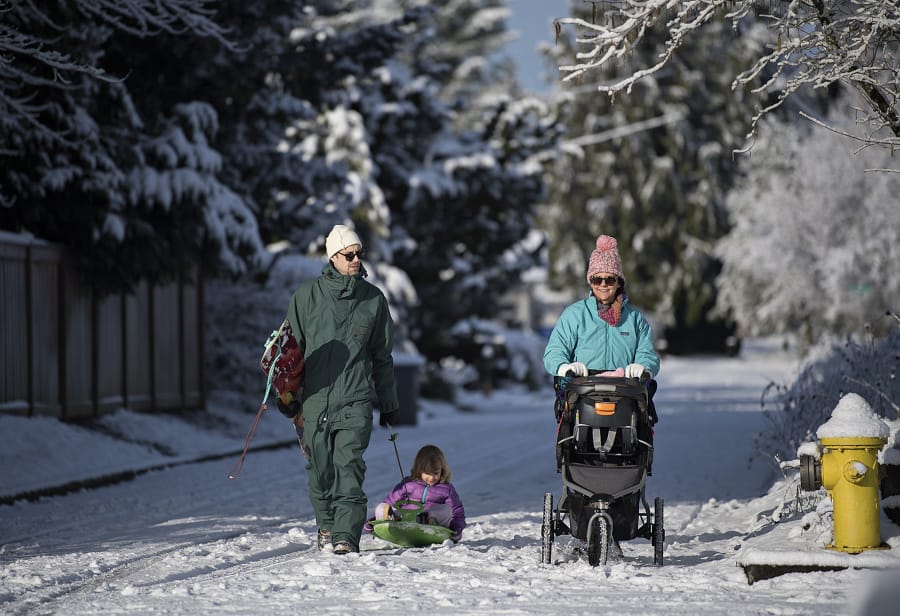
Tai Ledah, from left, heads out Feb. 21 with his daughter, Naomi, his wife, Anne, and their baby, Ebony, on their way to Franklin Elementary School in Vancouver for a morning of fun in the snow.
Tai Ledah, from left, heads out Feb. 21 with his daughter, Naomi, his wife, Anne, and their baby, Ebony, on their way to Franklin Elementary School in Vancouver for a morning of fun in the snow. amanda cowan/The Columbian Photo Gallery

In terms of accumulation, this winter got off to a clunky start in Southwest Washington, but the big storms that clobbered the Pacific Northwest around Presidents Day and through the rest of last month substantially boosted the region’s snowpack and brought a bit of relief to those thinking about this summer’s water supply.

At the beginning of this winter, precipitation levels were near normal, but a few particularly balmy stretches caused snowpack levels at higher elevations to lag behind. In mid-January the Lower Columbia Basin’s snowpack was just 70 percent of average. A few storms boosted that to 87 percent in mid-February. When Winter Storm Oliver hit the nation late last month, it brought to the Pacific Northwest some much-needed snow in a brief period of time.

As of March 2, the region’s snowpack was 101 percent of normal.

“We got the nice couple systems that passed through,” said David Bishop, a meteorologist at the National Weather Service.

Over the past week, Mount Hood gained a little over 7 inches of snow water equivalent on the Oregon side of the Columbia River, which is included in the Lower Columbia Basin. In terms of snow depth, the mountain gained 25 inches of snow between Feb. 23 and Feb. 25. As of Friday, the mountain had 116 inches of snow.

Down at lower elevations, February is the snowiest month in the Portland metro area, typically receiving just over 2 inches of snow for the month. By March, the area’s snow accumulation drops to two-tenths of an inch.

But are we done with snow in Vancouver and Portland this winter?

“That’s a hard one to say,” Bishop said. “The definite thing we can say is the closer we get into March, the less and less likely we are to get snow at the low elevations.”

However, snow continues to fall into the mountains until typically around the beginning of April, he added.

The official start to spring is only about three weeks away, but the National Oceanic and Atmospheric Administration is predicting wetter and cooler than average weather conditions for the next month.

Whatever extra snow falls in the mountains in the next few weeks will benefit the region later in the year. The Pacific Northwest relies on a good snowpack to keep streams running at healthy levels for migratory fish and to feed rivers and reservoirs, which the region depends on during the dry summers months.

Loading...
Columbian staff writer