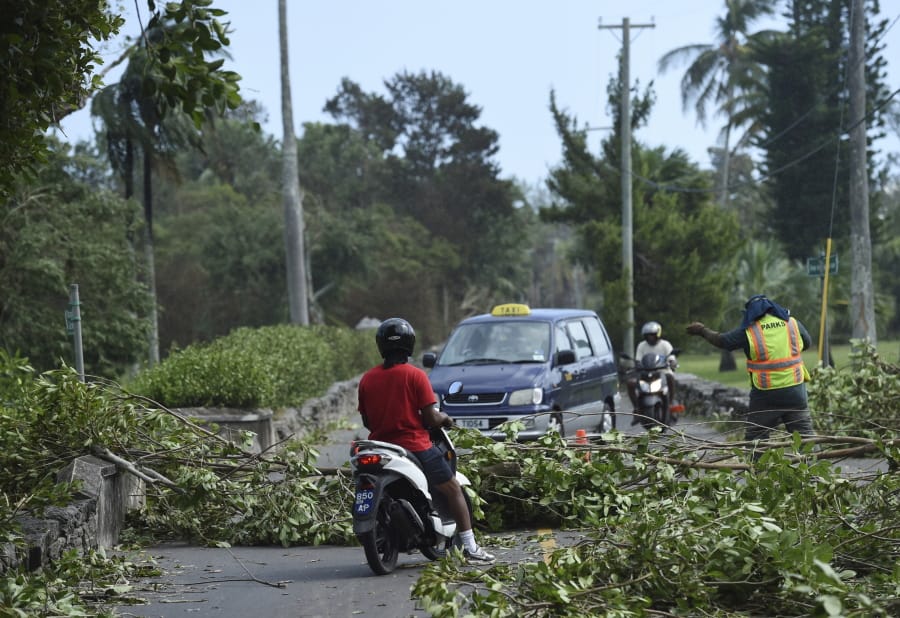
MIAMI (AP) — Hurricane Humberto blew off rooftops, toppled trees and knocked out power as it blew past the British Atlantic island of Bermuda. But officials said Thursday that the Category 3 storm caused no reported deaths.
“We’ve made it through and everyone is safe,” Premier David Burt said. “That’s what is most important.”
Security Minister Wayne Caines said power had been restored to most customers by midday Thursday and emergency crews were clearing roads of power lines damaged by the hurricane, which had winds of about 120 mph at its nearest approach to the island Wednesday night.
Caines said government offices would reopen today, though schools would remain closed.
“The country is getting back on its feet and the good news is there was no loss of life,” he said.
The U.S. National Hurricane Center said Humberto would still kick up high surf in Bermuda and along the U.S. East Coast.
The storm had maximum sustained winds of 105 mph late Thursday afternoon, with tropical storm-force winds extending outward for 380 miles, covering a huge swath of ocean.
The storm was centered about 550 miles northeast of Bermuda and moving to the northeast at a brisk 24 mph.
Meanwhile, a brush with land near Puerto Vallarta knocked newly formed Hurricane Lorena back down to tropical storm force, though forecasters said it would soon become a hurricane again on a track that would carry it close to the Los Cabos resorts at the tip of the Baja California Peninsula by midday today.
The storm’s center came onshore in darkness in the western state of Colima, whipping palm trees about with its strong winds and lashing the area with sheets of rain.
Lorena flooded streets, washed out roads and touched off minor slides in 10 municipalities. Dozens of trees were downed, and there were power outages in some areas.
Water topped the banks of an arroyo and swamped some homes in the port city of Manzanillo, where 21 people sought refuge at a temporary shelter at a school, state Gov. Jose Ignacio Peralta said Thursday.
At an afternoon news conference, Peralta said nearly 8 inches of rain had fallen in a little under 24 hours, and more than 7,400 acres of crops such as bananas and papayas were damaged statewide.
But there were no deaths or significant damage to infrastructure, he said.
“There are no losses of human lives to lament,” Peralta said.
Lorena had maximum sustained winds of 70 mph Thursday evening and it was centered about 185 miles east-southeast of Cabo San Lucas. It was moving to the northwest at 12 mph.
Forecasters said the storm could bring 5 to 10 inches of rain to parts of the region.
Mexican officials voiced concern that some parts of southern Mexico, which have seen a lack of rainfall, could suffer dangerous flash floods and landslides unleashed by torrential rain.
Authorities in Los Cabos said schools would be closed today.
Another tropical storm, Mario, was also moving north across the Pacific several hundred miles farther out to sea. It was located about 400 miles south of the southern tip of the Baja California Peninsula and had sustained winds of 60 mph.
It wasn’t expected to hit land, however.
In Texas and Louisiana, the remains of Tropical Depression Imelda kept bringing rains and flooding. Forecasters warned that Imelda could drop up to 35 inches of rain in some areas of Texas through today.
In the Texas town of Winnie, about 60 miles east of Houston, a hospital was evacuated and water was inundating several homes and businesses.
Elsewhere in the Atlantic region, Jerry strengthened into a hurricane on a track that would carry it near the northern Leeward Islands today and north of Puerto Rico on Saturday.
It had maximum sustained winds of 90 mph Thursday evening and was centered about 435 miles east of the northern Leeward Islands.
It was moving to the west-northwest at 17 mph.


