BEND, Ore. — Cycling, in general, has surged in popularity as more and more folks seek to get outside and away from others during the coronavirus pandemic.
And gravel riding has ridden that wave, as road cyclists look to avoid cars and mountain bikers look to avoid the trappings of trailheads and the sometimes close quarters of singletrack.
“Our web traffic has skyrocketed since this pandemic started,” says Bend’s Linda English, who founded the gravel riding website dirtyfreehub.com with her husband, Kevin. “It’s insane how many people are looking for routes. What we’re really excited about is helping push people a lot farther out and away from everybody else. Let’s not all just start at Phil’s Trailhead. It’s so great to just get away from it all.”
Gravel routes typically include a mix of paved roads and dirt/gravel forest roads. Dirty Freehub features several gravel routes in and around Central Oregon, most of them about 30 to 40 miles with climbs of 2,000 to 4,000 feet of elevation gain. The routes all allow for proper social distancing.
But during midsummer it can be hard to beat the heat, the sand, and the potential water shortage that can make gravel cycling a challenge.
English recommends routes near Detroit Lake, Camp Sherman, Oakridge and the Ochocos that typically offer lots of canopy for shade, water options, and less sand than other dirt roads in Central Oregon.
“Right now, out at Phil’s Trail and Skyline Forest, it’s just like three inches of sand,” English says. “It’s not that great. There’s a route between Prineville and Mitchell, it’s in the forest. The roads are a little rougher, but it’s not dusty and it’s got a lot of canopy to it.”
English says she carries a hydration pack as well as two water bottles on her bike. Many gravel routes are quite remote, so planning ahead with proper water, food and navigation is crucial.
Both Linda and Kevin English carry Garmin inReach devices that allow them to communicate via satellite messaging with each other and in case they need to call for help or 911.
They also carry Wahoo navigation devices that help them follow their intended route.
“It’s essentially a black line that shows exactly where my route is going,” Linda says. “It starts beeping at me as soon as I’m off course. It allows you to download and use our routes. I can’t even tell you how many times I recommend that to people. That’s probably the crux for gravel cycling, is navigation. Because we get up to places, and there’s no road signs out there. And there’s usually no people.”
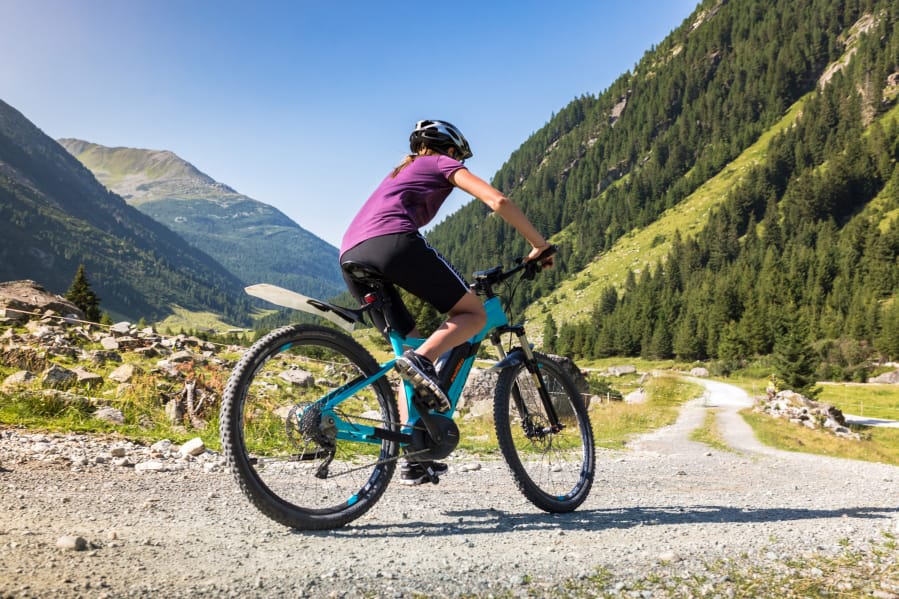
Many dedicated gravel riders own bikes that are actually built for the discipline essentially road bikes designed to tackle a variety of surfaces and carry additional gear. But many gravel routes can be ridden on a mountain bike.
No matter what type of bike a gravel rider uses, selecting summer routes is all about avoiding moon dust, staying close to a river or lake, riding at higher elevations and enjoying good tree cover.
Here are a few ideal summertime options from Dirty Freehub:
Big Red
Named for Oregon’s largest ponderosa tree in La Pine State Park, this route follows the Deschutes and Fall rivers through the park and passes by Big Red.
The relatively easy 17-mile route includes 500 feet of elevation gain and stays mostly shaded along smooth, packed-down dirt roads. Big Red is 70% gravel/dirt roads/singletrack and 30% paved road.
The route starts about 30 miles south of Bend at the Big River boat launch.
Motown
This 41-mile mix of gravel and paved roads includes 3,900 feet of climbing and starts at Santiam Flats campground near Detroit Lake. It offers lots of canopy and a swimming hole at the finish.
After a long climb, riders can enjoy views of Mount Jefferson and Mount Hood.
A long, steep downhill along gravel turns back into paved road as riders cruise along the shores of Detroit Lake.
“This route is tremendous during the summer because most of the ride you are well protected from the sun,” English says.
The difficulty of the route is considered intermediate, as riders climb 2,600 feet in 9 miles.
Gravel Cracker 60
This 58-mile route starts at Creekside Park in Sisters and includes 2,800 feet of climbing. It features Round Lake, Head of the Metolius, and two places with drinking water.
“The Sisters/Camp Sherman area is one of the most diverse and scenic areas to ride in Central Oregon,” English says. “This ride is a true favorite.”
The ride includes views of the Three Sisters mountains and a wooded traverse of the shoulder of Black Butte. There is also a climb to Round Lake and a singletrack loop around Suttle Lake.
The intermediate/advanced route is a mix of gravel roads and singletrack.
For more detailed information on gravel routes, including online maps, visit dirtyfreehub.com.